Calvary, Georgia
| Calvary, Georgia | |
|---|---|
| Census-designated place | |
 Calvary  Calvary | |
| Coordinates: 30°43′36″N 84°20′58″W / 30.72667°N 84.34944°WCoordinates: 30°43′36″N 84°20′58″W / 30.72667°N 84.34944°W | |
| Country | United States |
| State | Georgia |
| County | Grady |
| Area | |
| • Total | 1.57 sq mi (4.07 km2) |
| • Land | 1.54 sq mi (3.98 km2) |
| • Water | 0.03 sq mi (0.09 km2) |
| Elevation | 260 ft (80 m) |
| Population (2010) | |
| • Total | 161 |
| • Density | 105/sq mi (40.4/km2) |
| Time zone | Eastern (EST) (UTC-5) |
| • Summer (DST) | EDT (UTC-4) |
| ZIP code | 39829 |
| Area code(s) | 229 |
| FIPS code | 13-12484[1] |
| GNIS feature ID | 0354940[2] |
Calvary is a census-designated place and unincorporated community in Grady County, Georgia, United States.[2] As of the 2010 census its population was 161.[1] It is located along Georgia State Route 111, 15 miles (24 km) southwest of Cairo, the Grady County seat. Tallahassee, Florida, is 23 miles (37 km) to the south.
It is primarily farming land, and the massive drought in the Southeastern United States has decimated crops, venturing half a crop yield from 2000.
History
Calvary has always been a small unincorporated community, with population never exceeding over 250 people at one given time. It is home to a branch of the Lions Club, which handles the necessary preparations for Mule Day, an annual festival to celebrate how mules shaped the Southern United States. Arts, crafts, and all types of traditional Southern food can be found on the first Saturday in November. Before 2000, the average attendance of the festival ranged from 70,000 to 90,000 people. However, in the recent economic downturn, the attendance levels have dropped to approximately 20,000 to 40,000 people, most being local residents from neighboring counties.
References
- 1 2 "Geographic Identifiers: 2010 Demographic Profile Data (G001): Calvary CDP, Georgia". American Factfinder. U.S. Census Bureau. Retrieved November 23, 2016.
- 1 2 U.S. Geological Survey Geographic Names Information System: Calvary, Georgia
Municipalities and communities of Grady County, Georgia, United States | ||
|---|---|---|
| Cities | 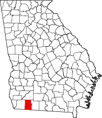 | |
| CDP | ||
| Unincorporated community | ||