Cairo, Georgia
| Cairo, Georgia | |
|---|---|
| City | |
|
Cairo City Hall | |
| Nickname(s): "Georgia's Hospitality City" | |
 Location in Grady County and the state of Georgia | |
| Coordinates: 30°53′N 84°13′W / 30.883°N 84.217°WCoordinates: 30°53′N 84°13′W / 30.883°N 84.217°W | |
| Country | United States |
| State | Georgia |
| County | Grady |
| Area | |
| • Total | 9.8 sq mi (25.4 km2) |
| • Land | 9.7 sq mi (25.1 km2) |
| • Water | 0.1 sq mi (0.3 km2) |
| Elevation | 243 ft (74 m) |
| Population (2010) | |
| • Total | 9,607 |
| • Density | 992/sq mi (382.9/km2) |
| Time zone | Eastern (EST) (UTC-5) |
| • Summer (DST) | EDT (UTC-4) |
| ZIP codes | 31728, 39827, 39828 |
| Area code(s) | 229 |
| FIPS code | 13-12400[1] |
| GNIS feature ID | 0354934[2] |
| Website |
www |

Cairo ![]() i/ˈkeɪ.roʊ/[3] is a city in Grady County, Georgia, United States. As of the 2010 census, the city had a population of 9,607.[4] The city is the county seat of Grady County.[5]
i/ˈkeɪ.roʊ/[3] is a city in Grady County, Georgia, United States. As of the 2010 census, the city had a population of 9,607.[4] The city is the county seat of Grady County.[5]
History
Cairo was founded in 1835. It was incorporated as a town in 1870 and as a city in 1906. In 1905, Cairo was designated seat of the newly formed Grady County.[6] The city was named after Cairo, the capital of Egypt.[7]
Syrup City
Although Cairo is nicknamed the "Syrup City", it has no relationship with the Karo brand of corn syrup, which is pronounced like the city's name. Rather, Cairo earned its nickname by producing cane syrup from the early 1900s through the late 1990s. Of the several companies that produced cane syrup, Roddenbery's was the best known. Roddenbery's later became better known for its pickles and the world's largest outdoor brine yard. However, the company was sold to Dean Foods in 1993 and the local factory shut down.
Reflecting its "syrup" heritage, the Cairo High School football team is nicknamed the Syrupmakers, and the school mascot is the agriculturally based sugar cane farmer/syrupmaker similar to the Cornhusker and Boilermaker. According to local tradition, this began during a rainy football game, when the players wore donated ponchos with "Roddenbery Syrup" printed on them. The most widely accepted tradition and the one with the most supportive evidence claims that a newspaper reporter referred to the Cairo Tigers in print as "the syrupmakers from Cairo".
The school's female athletic teams are named "Syrup Maids", often shortened to "Maids", while the male athletes are often dubbed "Makers". In 1986 ESPN chose "Syrupmakers" as the No. 1 nickname for a high school sports team. In 2009, ESPN's Sports Center selected the Syrupmakers as their number one mascot in the high school heritage category.
Recreation and entertainment
Cairo is close to great hunting, fishing, and points of historical interest. The local industrial base continues to grow with manufacturing, service, and healthcare companies anchoring a strong economy.
The area is home to several local festivals, including Calvary's Mule Day, Whigham's Rattlesnake Roundup, Cairo's own Antique Car Rally, and several competitive recreational programs. The Antique Car Rally features a wide range of cars, and includes many activities: a poker run, a parade, and even a street dance. It usually takes place on the second weekend of May. Sponsored by Mr. Chick, it is an annual event that attracts many people to the southwest corner of Georgia.
Education
Grady County Schools serves the city. Elementary schools in Grady include Shiver School, Eastside Elementary, Northside Elementary, Southside Elementary, and Whigham School. All residents are zoned to Washington Middle School and Cairo High School. Students living further out in the county are sent to Shiver School K-8, or either Whigham School [8]
The South West Georgia Tech campus is in Cairo, main campus in Thomasville, Georgia.
Geography
Cairo is located in central Grady County at 30°53′N 84°13′W / 30.883°N 84.217°W (30.8778, -84.2089).[9] U.S. Route 84 (38th Boulevard) passes through the northern part of the city, leading east 14 miles (23 km) to Thomasville and west 24 miles (39 km) to Bainbridge. Valdosta is 59 miles (95 km) to the east, and Dothan, Alabama, is 79 miles (127 km) to the west on US 84. Georgia State Route 93 passes through the center of Cairo as Broad Street and Fifth Street; it leads north 19 miles (31 km) to Pelham and south 12 miles (19 km) to U.S. Route 319 north of the Florida border. Tallahassee, Florida, is 33 miles (53 km) to the south.
According to the United States Census Bureau, Cairo has a total area of 9.8 square miles (25.4 km2), of which 9.7 square miles (25.1 km2) is land and 0.1 square miles (0.3 km2), or 1.38%, is water.[10]
Climate
The climate in this area is characterized by relatively high temperatures and evenly distributed precipitation throughout the year. According to the Köppen Climate Classification system, Cairo has a humid subtropical climate, abbreviated "Cfa" on climate maps.[11]
| Climate data for Cairo, Georgia | |||||||||||||
|---|---|---|---|---|---|---|---|---|---|---|---|---|---|
| Month | Jan | Feb | Mar | Apr | May | Jun | Jul | Aug | Sep | Oct | Nov | Dec | Year |
| Average high °F (°C) | 64 (18) |
66 (19) |
73 (23) |
80 (27) |
86 (30) |
90 (32) |
91 (33) |
91 (33) |
87 (31) |
81 (27) |
71 (22) |
65 (18) |
79 (26) |
| Average low °F (°C) | 42 (6) |
42 (6) |
48 (9) |
55 (13) |
62 (17) |
68 (20) |
70 (21) |
70 (21) |
67 (19) |
57 (14) |
46 (8) |
42 (6) |
56 (13) |
| Average precipitation inches (mm) | 3.9 (99) |
4.1 (104) |
5.3 (135) |
3.9 (99) |
3.4 (86) |
5.5 (140) |
6.4 (163) |
5.6 (142) |
4.4 (112) |
2.5 (64) |
2.6 (66) |
3.5 (89) |
51.2 (1,300) |
| Source: Weatherbase [12] | |||||||||||||
Demographics
| Historical population | |||
|---|---|---|---|
| Census | Pop. | %± | |
| 1880 | 275 | — | |
| 1890 | 521 | 89.5% | |
| 1900 | 690 | 32.4% | |
| 1910 | 1,505 | 118.1% | |
| 1920 | 1,908 | 26.8% | |
| 1930 | 3,169 | 66.1% | |
| 1940 | 4,653 | 46.8% | |
| 1950 | 5,577 | 19.9% | |
| 1960 | 7,427 | 33.2% | |
| 1970 | 8,061 | 8.5% | |
| 1980 | 8,777 | 8.9% | |
| 1990 | 9,035 | 2.9% | |
| 2000 | 9,239 | 2.3% | |
| 2010 | 9,607 | 4.0% | |
| Est. 2015 | 9,752 | [13] | 1.5% |
As of the census[1] of 2000, there were 9,239 people, 3,465 households, and 2,456 families residing in the city. The population density was 992.0 people per square mile (383.2/km²). There were 3,898 housing units at an average density of 418.5 per square mile (161.7/km²). The racial makeup of the city was 51.30% African American, 43.99% White, 0.42% Native American, 0.57% Asian, 0.02% Pacific Islander, 2.80% from other races, and 0.89% from two or more races. Hispanic or Latino of any race were 5.05% of the population.
There were 3,465 households out of which 34.0% had children under the age of 18 living with them, 41.4% were married couples living together, 24.7% had a female householder with no husband present, and 29.1% were non-families. 25.4% of all households were made up of individuals and 13.5% had someone living alone who was 65 years of age or older. The average household size was 2.64 and the average family size was 3.14.
In the city the population was spread out with 29.1% under the age of 18, 9.4% from 18 to 24, 27.4% from 25 to 44, 20.7% from 45 to 64, and 13.5% who were 65 years of age or older. The median age was 34 years. For every 100 females there were 83.4 males. For every 100 females age 18 and over, there were 77.6 males.
The median income for a household in the city was $23,054, and the median income for a family was $30,352. Males had a median income of $29,063 versus $20,542 for females. The per capita income for the city was $13,759. About 24.4% of families and 30.0% of the population were below the poverty line, including 41.2% of those under age 18 and 23.4% of those age 65 or over.
Notable people
- Jake Bundrick, drummer for the pop/rock band Mayday Parade
- Teresa Edwards, former professional basketball player and an Olympic gold medalist
- Willie Harris, outfielder and second baseman in Major League Baseball from 2001 through 2012, member of the 2005 World Champion Chicago White Sox
- John Monds, 2010 Libertarian gubernatorial candidate for the state of Georgia
- David Ponder, former defensive tackle for the Dallas Cowboys
- Ernest Riles, shortstop and third baseman in Major League Baseball from 1985 through 199
- Jackie Robinson, Baseball Hall of Famer; first person to break the color barrier in Major League Baseball; born in Cairo
- Matthew "Mack" Robinson, Olympic silver medalist, older brother of Jackie Robinson
- Daryle Singletary, country music singer
- George Thornewell Smith, Georgia politician
- Bill Stanfill, former All-Pro National Football League defensive end
- Mickey Thomas, lead singer of Jefferson Starship
- Bobby Walden, former punter for the Pittsburgh Steelers and Minnesota Vikings
- J. J. Wilcox, 3rd round pick in 2013 NFL draft (80th overall), safety for the Dallas Cowboys
- Arthur L. Williams Jr., founder of Primerica Financial Services
- Curley Williams, country music singer and songwriter; born near Cairo in Grady County
References
- 1 2 "American FactFinder". United States Census Bureau. Archived from the original on 2013-09-11. Retrieved 2008-01-31.
- ↑ "US Board on Geographic Names". United States Geological Survey. 2007-10-25. Retrieved 2008-01-31.
- ↑ Named for Cairo, Egypt, but pronounced differently
- ↑ http://quickfacts.census.gov/qfd/states/13/1312400.html
- ↑ "Find a County". National Association of Counties. Archived from the original on 2011-05-31. Retrieved 2011-06-07.
- ↑ Hellmann, Paul T. (May 13, 2013). Historical Gazetteer of the United States. Routledge. p. 222. Retrieved 30 November 2013.
- ↑ Logue, Victoria; Logue, Frank (1997). Touring the Backroads of North and South Georgia. John F. Blair, Publisher. p. 412. ISBN 978-0-89587-171-8.
- ↑ "Schools." Grady County Schools. Retrieved on April 9, 2009.
- ↑ "US Gazetteer files: 2010, 2000, and 1990". United States Census Bureau. 2011-02-12. Retrieved 2011-04-23.
- ↑ "Geographic Identifiers: 2010 Demographic Profile Data (G001): Cairo city, Georgia". American Factfinder. U.S. Census Bureau. Retrieved November 23, 2016.
- ↑ Climate Summary for Cairo, Georgia
- ↑ "Weatherbase.com". Weatherbase. 2013. Retrieved on September 28, 2013.
- ↑ "Annual Estimates of the Resident Population for Incorporated Places: April 1, 2010 to July 1, 2015". Retrieved July 2, 2016.
- ↑ "Census of Population and Housing". Census.gov. Archived from the original on April 22, 2013. Retrieved June 4, 2015.
External links
Municipalities and communities of Grady County, Georgia, United States | ||
|---|---|---|
| Cities | 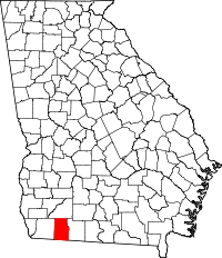 | |
| CDP | ||
| Unincorporated community | ||