Butte Creek Ecological Reserve
| Butte Creek Ecological Preserve | |
|---|---|
|
IUCN category Ia (strict nature reserve) | |
|
Lower Butte Creek | |
 US state of California | |
| Location | Butte County, eastern Sacramento Valley |
| Nearest city | Chico, California |
| Coordinates | 40°05′16″N 121°24′57″W / 40.08778°N 121.41583°W[1]Coordinates: 40°05′16″N 121°24′57″W / 40.08778°N 121.41583°W[2] |
| Area | 378 acres (0.591 sq mi) |
| Governing body | California Department of Fish and Game / California State University, Chico |
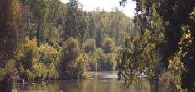
The Butte Creek Ecological Preserve is a nature preserve of 378 acres (1.53 km2) located east of Chico along Butte Creek in northern California. It consists of three semi-contiguous units: Honey Run Unit, Canyon Unit and Virgin Valley Unit. It is jointly managed by the California Department of Fish and Game and California State University, Chico. The reserve's namesake, Butte Creek, has over 20 miles (32 km) of spawning habitat for the spring-run Chinook salmon, fall-run Chinook salmon and steelhead trout.
The California Department of Fish and Game considers the Butte Creek Ecological Preserve valuable in terms of providing wildlife habitat and protection of critical shaded riverine and aquatic resources.[3]
The Butte Creek population of spring-run Chinook salmon is one of the few remaining self-sustaining populations in the Central Valley and is listed as threatened under both the state and federal endangered species acts.[4] The reserve protects habitat for other species such as bald eagle, Swainson's hawk, beaver and the western pond turtle.
At the headwaters of Butte Creek is a separate nature reserve called the Butte Creek House Ecological Reserve managed by the California Department of Fish and Game (CDFG).
Reserve units detail
Butte Creek Canyon Unit
This unit is located two miles (3 km) southeast of the City of Chico and is 255 acres (1.03 km2) in size. It is managed by CDFG. This unit has a high amount of non-native grasses (over 40 per cent) and several sensitive or rare plants, including California black walnut (Juglans hindsii) and shield-bracted monkey flower (Mimulus glaucescens).
Virgin Valley Unit
This unit is 30 acres (120,000 m2) in size and is also managed by CDFG. It is one half mile downstream from the Butte Creek canyon mouth on an alluvial apron. This unit contains forests of valley oak (Quercus lobata) growing on streamside terraces and on the alluvial aggregate.
Honey Run Unit
Managed by Chico State University Research Foundation in cooperation with other agencies and is located within the Butte Creek canyon proper. It is 93 acres (380,000 m2) in size.
The area of Butte Creek had been used in dredge mining in the 1800s, and mining for sand and gravel from the 1950s to the 1970s. In 1980, a cluster development project of 75 condominiums was approved for the site by the Butte County Planning Commission and the Board of Supervisors. The project was stopped by concerned local citizens with a successful ballot initiative that overturned the Butte County decision.[5]
The flood of 1986, which caused more than $13 million damage in Butte County, washed out the two bridge crossings on Butte Creek and helped start the preservation sequence of events. The bridges connected to the haul road that went from the gravel mining sites to Baldwin Construction's plant. Soon after the historic flood, the mining company sold its properties, with some parcels being bought by the California Department of Fish and Game, and one parcel (the Honey Run unit) being bought by John McAmis.[6] McAmis contracted for a subdivision of single family homes, which was voted down by the Planning Commission, but a subsequent development plan was submitted and approved. After construction began on the property, local concerns were again raised which eventually led to McAmis willingly selling the property to Chico State University, Research Foundation.[5]
In 1998, CSU, Chico Research Foundation bought the 93-acre (380,000 m2) parcel from McAmis with funds from CSU's Office of Watershed Projects, Butte Creek Conservancy, National Fish and Wildlife Foundation, Wildlife Conservation Board and US Fish and Wildlife Service.[7]
Butte Creek House Ecological Reserve
The Butte Creek House Ecological Reserve is located at the headwaters of Butte Creek. It is 110 acres (0.45 km2) of wetland meadow and forest near the base of Snow Mountain. The site was purchased in 1986 to preserve and restore the area as a part of the Federal Energy Regulatory Commission (FERC) Project 803, the De Sable-Centerville Hydroelectric Project.[8] This reserve is located near montane chaparral, a type of plant community that includes greenleaf and pinemat manzanitas (Arctostaphylos patula, A. nevadensis), bitter cherry (Prunus emarginata) and bush chinquapin (Chrysolepis sempervirens) that grow at elevations from 2,000 feet (610 m) up to 9,000 feet (2,700 m). Forested areas include pure stands of lodgepole pine (Pinus contorta) and red fir (Abies magnifica).[9]
Restoration
The restoration efforts of the Butte Creek watershed by environmental groups, together with private landowners and state and federal agencies is showing results. "The restoration there I think has clearly had a measurable response," said Rob Titus, a senior Department of Fish and Game environmental scientist.[10]
The fish count of Chinook salmon in 1987 was 14. The number counted in 1998 was 20,000.[10]
During the period 1994 through 1997, several agricultural structures were removed, fish screens were installed and a new fish ladder was also installed. In addition, a minimum streamflow rate of 40 cubic feet per second (1.1 m3/s) is maintained during the summer months.[11]
"The spring run in Butte Creek is doing exceptionally well. "For the fish, it's a success story...", according to the California Department of Fish and Game's Harry Morse.[10]
Other restoration work has been the removal of invasive plant species including star thistle, scotch broom and Himalayan blackberry. Non-native plants can displace the native species, which may decrease biodiversity and cause a loss of habitat that provide nest sites and food sources. The riparian or streamside plant areas along Butte Creek are the most vulnerable to invasive non-native plants.[11]
See also
List of California Department of Fish and Game protected areas
Floods in the United States: 1901-2000#Decade of the 1980s
Notes
- ↑ Coords are for Butte Creek House ER
- ↑ Coords are for Butte Creek House ER
- ↑ Butte Creek Revegetation and Restoration Assessment Project-CSU, Chico Research Foundation/Watershed Projects, CSU, Chico (Butte CrER.PDF) pp 1-2
- ↑ Ecosystem Restoration: Spring-run Chinook Salmon in Butte Creek p.1
- 1 2 Management Plan p.5
- ↑ Nature Trail brochure p.3
- ↑ "Grand Opening of the Honey Run Unit Butte Creek Ecological Preserve" Nov. 3, 1999 CSU, Chico News
- ↑ Existing Conditions Report, Ch. 11-Existing Resource Protection Measures, Butte Creek House Restoration Project p. 14
- ↑ Existing Conditions Report, Ch. 6- Ecology pp 5-6
- 1 2 3 "Salmon Resurgence in Butte County" by Peter Fimrite, San Francisco Chronicle, May 26, 2008.
- 1 2 Butte Creek Revegetation and Restoration Assessmant Project p.3
References
External links
| Athletics | |
|---|---|
| Facilities | |
| Organizations | |
| Academics | |
| Media | |
| Related | |
| |