Bushnell, South Dakota
| Bushnell, South Dakota | |
|---|---|
| Town | |
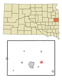 Location in Brookings County and the state of South Dakota | |
| Coordinates: 44°19′38″N 96°38′42″W / 44.32722°N 96.64500°WCoordinates: 44°19′38″N 96°38′42″W / 44.32722°N 96.64500°W | |
| Country | United States |
| State | South Dakota |
| County | Brookings |
| Incorporated | 1915[1] |
| Area[2] | |
| • Total | 0.71 sq mi (1.84 km2) |
| • Land | 0.71 sq mi (1.84 km2) |
| • Water | 0 sq mi (0 km2) |
| Elevation | 1,690 ft (515 m) |
| Population (2010)[3] | |
| • Total | 65 |
| • Estimate (2012[4]) | 65 |
| • Density | 91.5/sq mi (35.3/km2) |
| Time zone | Central (CST) (UTC-6) |
| • Summer (DST) | CDT (UTC-5) |
| ZIP code | 57276 |
| Area code(s) | 605 |
| FIPS code | 46-08820[5] |
| GNIS feature ID | 1254173[6] |
Bushnell is a town in Brookings County, South Dakota, United States. The population was 65 at the 2010 census.
History
Bushnell was laid out in 1904 and named for Frank Bushnell, the original owner of the site.[7]
Geography
Bushnell is located at 44°19′38″N 96°38′42″W / 44.327310°N 96.644935°W.[8]
According to the United States Census Bureau, the town has a total area of 0.71 square miles (1.84 km2), all of it land.[2]
Demographics
| Historical population | |||
|---|---|---|---|
| Census | Pop. | %± | |
| 1920 | 150 | — | |
| 1930 | 134 | −10.7% | |
| 1940 | 134 | 0.0% | |
| 1950 | 96 | −28.4% | |
| 1960 | 92 | −4.2% | |
| 1970 | 65 | −29.3% | |
| 1980 | 76 | 16.9% | |
| 1990 | 81 | 6.6% | |
| 2000 | 75 | −7.4% | |
| 2010 | 65 | −13.3% | |
| Est. 2015 | 65 | [9] | 0.0% |
2010 census
As of the census[3] of 2010, there were 65 people, 28 households, and 18 families residing in the town. The population density was 91.5 inhabitants per square mile (35.3/km2). There were 32 housing units at an average density of 45.1 per square mile (17.4/km2). The racial makeup of the town was 90.8% White, 7.7% Native American, and 1.5% from two or more races.
There were 28 households of which 35.7% had children under the age of 18 living with them, 53.6% were married couples living together, 7.1% had a female householder with no husband present, 3.6% had a male householder with no wife present, and 35.7% were non-families. 28.6% of all households were made up of individuals and 10.7% had someone living alone who was 65 years of age or older. The average household size was 2.32 and the average family size was 2.89.
The median age in the town was 43.6 years. 23.1% of residents were under the age of 18; 3% were between the ages of 18 and 24; 30.8% were from 25 to 44; 30.9% were from 45 to 64; and 12.3% were 65 years of age or older. The gender makeup of the town was 52.3% male and 47.7% female.
2000 census
As of the census[5] of 2000, there were 75 people, 32 households, and 20 families residing in the town. The population density was 105.6 people per square mile (40.8/km2). There were 34 housing units at an average density of 47.9 per square mile (18.5/km2). The racial makeup of the town was 82.67% White, 12.00% Native American, 1.33% Asian, and 4.00% from two or more races. Hispanic or Latino of any race were 1.33% of the population.
There were 32 households out of which 28.1% had children under the age of 18 living with them, 59.4% were married couples living together, 3.1% had a female householder with no husband present, and 34.4% were non-families. 34.4% of all households were made up of individuals and 6.3% had someone living alone who was 65 years of age or older. The average household size was 2.34 and the average family size was 2.95.
In the town the population was spread out with 25.3% under the age of 18, 6.7% from 18 to 24, 34.7% from 25 to 44, 25.3% from 45 to 64, and 8.0% who were 65 years of age or older. The median age was 35 years. For every 100 females there were 114.3 males. For every 100 females age 18 and over, there were 115.4 males.
The median income for a household in the town was $45,625, and the median income for a family was $50,833. Males had a median income of $28,333 versus $24,375 for females. The per capita income for the town was $15,619. There were no families and 8.7% of the population living below the poverty line, including no under eighteens and none of those over 64.
References
- ↑ "SD Towns" (PDF). South Dakota State Historical Society. Archived from the original (PDF) on 2010-02-10. Retrieved 2010-02-11.
- 1 2 "US Gazetteer files 2010". United States Census Bureau. Archived from the original on 2012-01-24. Retrieved 2012-06-21.
- 1 2 "American FactFinder". United States Census Bureau. Retrieved 2012-06-21.
- ↑ "Population Estimates". United States Census Bureau. Archived from the original on 2013-06-17. Retrieved 2013-05-29.
- 1 2 "American FactFinder". United States Census Bureau. Archived from the original on 2013-09-11. Retrieved 2008-01-31.
- ↑ "US Board on Geographic Names". United States Geological Survey. 2007-10-25. Retrieved 2008-01-31.
- ↑ Federal Writers' Project (1940). South Dakota place-names, v.1-3. University of South Dakota. p. 29.
- ↑ "US Gazetteer files: 2010, 2000, and 1990". United States Census Bureau. 2011-02-12. Retrieved 2011-04-23.
- ↑ "Annual Estimates of the Resident Population for Incorporated Places: April 1, 2010 to July 1, 2015". Retrieved July 2, 2016.
- ↑ "Census of Population and Housing". Census.gov. Archived from the original on May 11, 2015. Retrieved June 4, 2015.
Municipalities and communities of Brookings County, South Dakota, United States | ||
|---|---|---|
| Cities | 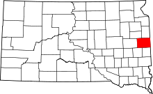 | |
| Towns | ||
| CDP | ||
| Other unincorporated communities | ||
| Townships |
| |
| Footnotes | ‡This populated place also has portions in an adjacent county or counties | |