Burwood, New South Wales
| Burwood Sydney, New South Wales | |||||||||||||
|---|---|---|---|---|---|---|---|---|---|---|---|---|---|
 Burwood Road. The brick tower is part of Burwood Post Office (designed by government architect Walter Liberty Vernon). | |||||||||||||
| Population | 12,466 (2011 census)[1] | ||||||||||||
| Established | 1814 | ||||||||||||
| Postcode(s) | 2134 | ||||||||||||
| Location | 11 km (7 mi) west of Sydney CBD | ||||||||||||
| LGA(s) | Burwood Council | ||||||||||||
| State electorate(s) | Strathfield | ||||||||||||
| Federal Division(s) | Reid, Watson | ||||||||||||
| |||||||||||||
Burwood is a suburb in the Inner West[2] of Sydney, in the state of New South Wales, Australia. It is 12 kilometres west of the Sydney central business district and is the administrative centre for the local government area of Burwood Council.
Burwood Heights is a separate suburb to the south. The Appian Way is a street in Burwood, known for its architecturally designed Federation-style homes.
History
Archaeological evidence indicates people were living in the Sydney area for at least 11,000 years. This long association had led to a harmonious relationship between the indigenous inhabitants and their environment, which was interrupted by the arrival of the British in 1788. The European desire to cultivate the land aided and abetted by a smallpox epidemic that forced the local people, the Wangal clan, away from their source of food and their spiritual connection with the land.[3]

Captain Thomas Rowley (1748–1806) received a grant of 260 acres (110 ha) in 1799, and called his property Burwood Farm after Burwood Park, England. Following more land grants, his estate increased to 750 acres (300 ha). The grant stretched from Parramatta Road to where Nicholson Street and The Boulevarde are today and eastwards where to Croydon railway station is now. This is where he ran merino sheep on the property.

The first house, Burwood Villa, was built in the area in 1814, the same year that a stagecoach began running between Sydney and Parramatta. Burwood became a staging post along the road and the beginnings of a settlement started to develop. One of its most prominent early residents was Dr. John Dulhunty, a former naval surgeon who was appointed the Superintendent of Police for the Colony of New South Wales after his arrival in Sydney from England in 1826. Dr. Dulhunty became famous in the colony for fighting a gang of bushrangers that attacked his residence, Burwood House. He died suddenly in the house in 1828 but his son, Robert Dulhunty, went on to become the founder of the New South Wales regional city of Dubbo.
Subdivisions in the Burwood area in the 1830s propelled the growth of a village and by 1855, when the railway line opened, Burwood was one of the initial six stops on the Sydney-to-Parramatta route. The railway led to a huge growth in population. In 1874, the area became a municipality.[4]
Commercial area
Burwood has a mixture of residential, commercial, and light industrial developments. The main shopping strip runs along Burwood Road, beside Burwood railway station. Westfield Burwood is a large regional shopping centre, north of the railway line, on Burwood Road opposite Burwood Park. Burwood Plaza is a smaller shopping centre on Railway Parade, south of the railway line.
High rise residential and commercial buildings are also found in surrounding streets and along the railway line. Commercial and light industrial developments are located along Parramatta Road.
Transport
Burwood railway station is on the North Shore, Northern & Western and Airport, Inner West & South lines of the Sydney Trains network.
Trams to Mortlake and Cabarita once travelled down Burwood Road; trams ceased in August 1948.
Sydney Buses provide many bus services to Burwood, from Hurstville, Rockdale, Bondi Junction, Strathfield, Homebush, Campsie, Ryde as well as many other locations across Sydney. Sydney Buses has two terminuses, Burwood station and Westfield Burwood. Sydney Buses' Burwood Bus Depot is located on the corner of Shaftesbury and Parramatta Roads.
Landmarks

Burwood features many fine examples of architecture from the Victorian and Federation styles. St Paul's Anglican Church on Burwood Road was designed by colonial architect Edmund Blacket and built in 1871. Sir Donald Bradman and Lady Bradman, Jessie Menzies were married here in 1932. It is heritage-listed in the NSW State Heritage Register and in the Register of the National Estate.[5] Nearby Woodstock in Church Street was built in the early 1870s by tobacco manufacturer Edwin Penfold. In the 1940s, it was taken over by the army, later becoming Broughton Migrant Hostel, before being bought by the council in 1974 for use as a community centre. Radio station 2RDJ-FM has been broadcasting from Woodstock since November 1983. Further south on Burwood Road is The Priory, built in 1877 by local councillor Mowbray Forrest, and Gayton, built in 1888 by NSW parliamentarian Richard Jones. The heritage'-listed St Nectarios Greek Orthodox Church in Railway Parade was formerly a Methodist church and was built in 1879.
Running between Burwood Road and Liverpool Road is The Appian Way, a model housing estate conceived by George Hoskins at the turn of the century. The street has been described as one of the finest streets of Federation houses in Australia and is state heritage-listed. In the centre of the Appian Way is a communal reserve which was converted into a lawn tennis club.[6]
Heritage

The following buildings are on the Register of the National Estate or the NSW Heritage Register[7]
- Congregational Church, Burwood Road[8]
- Post Office, Burwood Road[9]
- St Paul's Anglican Church, Burwood Road[5]
- St Cloud, Burwood Road[10]
- Gayton, Burwood Road[11]
- The Priory (1877), Burwood Road[12]
- Deolee, Burwood Road[13]
- Methodist Ladies College, Rowley Street[14]
- Woodstock, Church Street[15]
- St Nectarios Greek Orthodox Church, Railway Parade[16]
Burwood Park

Burwood Park was established by the local council in 1882 on land formerly known as Edrop's Paddock. The original design of the park was based on the Union Jack flag, although it was later modified to allow a cricket oval to be established at the western edge of the park. Other features of Burwood Park include memorials to soldiers who died in World War I and Sandakan, a rotunda, a playground, a lake and an obelisk commemorating the site of Burwood Villa, the area's first house. It is also the location for Carols in the Park each Christmas. Burwood Park is located on Burwood Road opposite Westfield Burwood
Demographics
According to the 2011 census of Population, there were 12,466 residents in Burwood. In Burwood, 30.4% of people were born in Australia. The most common other countries of birth were China (excludes SARs and Taiwan) 26.5%, India 4.6% and Korea, Republic of (South) 4.0%. 25.5% of people only spoke English at home. Other languages spoken at home included Mandarin 22.5%, Cantonese 13.1% and Korean 4.3%. The most common responses in the 2011 Census for religion in Burwood were No Religion 29.6%, Catholic 21.4%, Buddhism 10.5%, Hinduism 6.9% and Anglican 4.5%.[1]
Residents
The following were either born or have lived in the suburb of Burwood
- Arthur Cuthbertson – Ice hockey player, born in Burwood
- Eleanor Dark – novelist, born in Burwood
- Clare Dennis – swimmer, born in Burwood
- Sir Norman McAlister Gregg – ophthalmologist, born in Burwood
- Norman Hetherington – cartoonist, grew up at 35 Meryla Street Burwood
- Miriam Hyde – composer and pianist, born and lived in Burwood
- Robert Kaleski – writer, environmentalist, and dog breeder influential, born in Burwood
- Arthur Renwick – physician, philanthropist and politician
- Rita Mabbett – cellist, lived in George Street Burwood
- William McMahon – Prime Minister, lived in Burwood
- William MacDonald – serial killer, lived in a store in Burwood
- Earle Page – Prime Minister, lived in Burwood
- George Reid – Prime Minister, lived in Burwood
- Doug Sutherland – former lord mayor of Sydney
- Angus and Malcolm Young – musicians, grew up in Burwood
- Charles Smith Wilkinson – spent his last days in Burwood
- John Manning Ward – historian and vice chancellor, born in Burwood
Sister cities
Burwood currently have five sister cities:[17]
-
 Tianjin, China
 -
 Calabria, Italy
 -
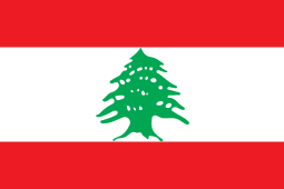 Imar, Lebanon
 -
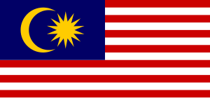 Sandakan, Malaysia
 -
 Utica, New York, United States of America
 -
 Geumcheon, South Korea
Gallery
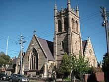 St Paul's Anglican Church, Burwood Road
 Deolee (c.1891), Burwood Road
Southern_Cross_Catholic_Vocational_College_Burwood.jpg) Southern Cross Catholic Vocational College, Comer Street
Southern Cross Catholic Vocational College, Comer StreetBurwood_Hotel.jpg) Burwood Hotel, Burwood Road
Burwood Hotel, Burwood Road St Nectarios Greek Orthodox Church, Railway Parade
References
- 1 2 Australian Bureau of Statistics (31 October 2012). "Burwood (State Suburb)". 2011 Census QuickStats. Retrieved 21 September 2014.
- ↑ Australian Suburb Guide: Sydney Inner West Archived 26 December 2012 at the Wayback Machine. Retrieved 7 August 2013.
- ↑ "Local History". Burwood Council. Archived from the original on 22 July 2008. Retrieved 18 April 2009.
- ↑ Pollon, F. (1990.) The Book of Sydney Suburbs, Angus & Robertson Publishers, Sydney, p.41
- 1 2 State Heritage Register
- ↑ "Burwood Heritage Trail". Burwood Council. Archived from the original on 22 July 2008. Retrieved 18 April 2009.
- ↑ The Heritage of Australia, Macmillan Company, 1981, pp. 2 – 14
- ↑ State Heritage Register
- ↑ State Heritage Register
- ↑ State Heritage Register
- ↑ State Heritage Register
- ↑ State Heritage Register
- ↑ State Heritage Register
- ↑ State Heritage Register
- ↑ State Heritage Register
- ↑ State Heritage Register
- ↑ "Sister and Friendship Cities". Burwood Council. 17 August 2012. Archived from the original on 27 March 2014. Retrieved 9 March 2015.
Coordinates: 33°52′38″S 151°06′18″E / 33.8772°S 151.1049°E
![]() Media related to Category:Burwood, New South Wales at Wikimedia Commons
Media related to Category:Burwood, New South Wales at Wikimedia Commons