Burlington, Indiana
| Burlington, Indiana | |
|---|---|
| Town | |
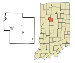 Location in the state of Indiana | |
| Coordinates: 40°28′50″N 86°23′40″W / 40.48056°N 86.39444°WCoordinates: 40°28′50″N 86°23′40″W / 40.48056°N 86.39444°W | |
| Country | United States |
| State | Indiana |
| County | Carroll |
| Township | Burlington |
| Founded | 1828 |
| Incorporated | 1967 |
| Area[1] | |
| • Total | 0.60 sq mi (1.55 km2) |
| • Land | 0.60 sq mi (1.55 km2) |
| • Water | 0 sq mi (0 km2) |
| Elevation | 784 ft (239 m) |
| Population (2010)[2] | |
| • Total | 603 |
| • Estimate (2012[3]) | 601 |
| • Density | 1,005.0/sq mi (388.0/km2) |
| Time zone | EST (UTC−5) |
| • Summer (DST) | EST (UTC−5) |
| ZIP code | 46915 |
| Area code(s) | 765 |
| FIPS code | 18-09244[4] |
| GNIS feature ID | 0431841[5] |
Burlington is a town in Burlington Township, Carroll County, Indiana, United States. The population was 603 at the 2010 census. It is part of the Lafayette, Indiana Metropolitan Statistical Area. Although it is commonly more linked to Kokomo, Indiana with Indiana State Road 22 connecting the two cities, the state road's western terminus is in Burlington.
History
Burlington was laid out in 1828 by David Stipp[6] and incorporated in 1967. It is named for Wyandot Chief Burlington.[7]
Geography
Burlington is located at 40°28′50″N 86°23′40″W / 40.48056°N 86.39444°W (40.480564, -86.394470).[8]
According to the 2010 census, Burlington has a total area of 0.6 square miles (1.55 km2), all land.[1]
Demographics
| Historical population | |||
|---|---|---|---|
| Census | Pop. | %± | |
| 1850 | 164 | — | |
| 1970 | 685 | — | |
| 1980 | 680 | −0.7% | |
| 1990 | 568 | −16.5% | |
| 2000 | 444 | −21.8% | |
| 2010 | 603 | 35.8% | |
| Est. 2015 | 596 | [9] | −1.2% |
2010 census
As of the census[2] of 2010, there were 603 people, 258 households, and 173 families residing in the town. The population density was 1,005.0 inhabitants per square mile (388.0/km2). There were 286 housing units at an average density of 476.7 per square mile (184.1/km2). The racial makeup of the town was 98.8% White, 0.5% African American, 0.2% Asian, and 0.5% from two or more races. Hispanic or Latino of any race were 2.0% of the population.
There were 258 households of which 31.0% had children under the age of 18 living with them, 54.7% were married couples living together, 10.1% had a female householder with no husband present, 2.3% had a male householder with no wife present, and 32.9% were non-families. 28.3% of all households were made up of individuals and 13.9% had someone living alone who was 65 years of age or older. The average household size was 2.34 and the average family size was 2.81.
The median age in the town was 40.6 years. 23.5% of residents were under the age of 18; 6.5% were between the ages of 18 and 24; 24.9% were from 25 to 44; 23.4% were from 45 to 64; and 21.7% were 65 years of age or older. The gender makeup of the town was 45.8% male and 54.2% female.
2000 census
As of the census[4] of 2000, there were 444 people, 207 households, and 127 families residing in the town. The population density was 820.0 people per square mile (317.5/km²). There were 217 housing units at an average density of 400.7 per square mile (155.2/km²). The racial makeup of the town was 99.10% White, 0.23% African American, 0.23% from other races, and 0.45% from two or more races. Hispanic or Latino of any race were 0.68% of the population.
There were 207 households out of which 22.2% had children under the age of 18 living with them, 48.3% were married couples living together, 9.7% had a female householder with no husband present, and 38.6% were non-families. 34.3% of all households were made up of individuals and 20.8% had someone living alone who was 65 years of age or older. The average household size was 2.14 and the average family size was 2.71.
In the town the population was spread out with 19.6% under the age of 18, 7.2% from 18 to 24, 29.5% from 25 to 44, 21.8% from 45 to 64, and 21.8% who were 65 years of age or older. The median age was 41 years. For every 100 females there were 92.2 males. For every 100 females age 18 and over, there were 86.9 males.
The median income for a household in the town was $38,472, and the median income for a family was $52,917. Males had a median income of $35,000 versus $17,917 for females. The per capita income for the town was $22,482. About 3.3% of families and 5.5% of the population were below the poverty line, including 2.7% of those under age 18 and 10.0% of those age 65 or over.
References
- 1 2 "G001 - Geographic Identifiers - 2010 Census Summary File 1". United States Census Bureau. Retrieved 2015-07-13.
- 1 2 "American FactFinder". United States Census Bureau. Retrieved 2012-12-11.
- ↑ "Population Estimates". United States Census Bureau. Archived from the original on 2013-06-17. Retrieved 2013-06-25.
- 1 2 "American FactFinder". United States Census Bureau. Archived from the original on 2013-09-11. Retrieved 2008-01-31.
- ↑ "US Board on Geographic Names". United States Geological Survey. 2007-10-25. Retrieved 2008-01-31.
- ↑ "History". Town of Burlington, Indiana. Retrieved 2 June 2014.
- ↑ Allison, Harold (1986). The Tragic Saga of the Indiana Indians. Paducah, Kentucky: Graphic Design of Indiana. p. 301. ISBN 0-938021-07-9.
- ↑ "US Gazetteer files: 2010, 2000, and 1990". United States Census Bureau. 2011-02-12. Retrieved 2011-04-23.
- ↑ "Annual Estimates of the Resident Population for Incorporated Places: April 1, 2010 to July 1, 2015". Retrieved July 2, 2016.
- ↑ "Census of Population and Housing". Census.gov. Archived from the original on May 11, 2015. Retrieved June 4, 2015.
Municipalities and communities of Carroll County, Indiana, United States | ||
|---|---|---|
| City | ||
| Towns | ||
| Townships | ||
| Unincorporated communities |
| |