Burevestnik Airport
| Burevestnik | |||||||||||
|---|---|---|---|---|---|---|---|---|---|---|---|
 | |||||||||||
| IATA: BVV – ICAO: UHSB | |||||||||||
| Summary | |||||||||||
| Airport type | Military | ||||||||||
| Operator | Russian Air Force | ||||||||||
| Location | Burevestnik | ||||||||||
| Elevation AMSL | 24 m / 79 ft | ||||||||||
| Coordinates | 44°55′12″N 147°37′18″E / 44.92000°N 147.62167°ECoordinates: 44°55′12″N 147°37′18″E / 44.92000°N 147.62167°E | ||||||||||
| Map | |||||||||||
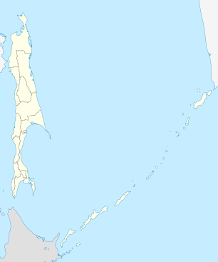 BVV Location of airport in Sakhalin Oblast | |||||||||||
| Runways | |||||||||||
| |||||||||||
Burevestnik (also Iturup; Japanese: 天寧飛行場, Tennei-hikōjyō) (IATA: BVV, ICAO: UHSB) is a military air base on Iturup Island, Russia, establishing the nation's presence on the disputed South Kuril Islands with the largest airfield in the region. It is also the former Soviet Union's most remote interceptor base, home of 387 IAP (387th Interceptor Aviation Regiment). During the 1970s it flew MiG-21bis and upgraded to MiG-23 jets in 1983.[1] Burevestnik's communications and logistics were tied to Yuzhno-Sakhalinsk and supplies were flown in weekly on An-12 aircraft.
The 41st Fighter Aviation Regiment PVO, flying MiG-23MLs (1983–90) and MiG-23MLDs (1990-1994), operated from the base from April 1983 to May 1994, under the control of 40 IAD (1983–86), 24 Air Defence Division (1986–90) and then finally 72nd Air Defence Corps (1990–94).[2]
Burevestnik's close proximity to Japan's highly populated Hokkaidō Island, by only 190 km, and to major aviation corridors kept the base in a state of constant alert. In 1968, an American Douglas DC-8 was forced to land here after straying off course in the Seaboard World Airlines Flight 253 incident. In April 1983, Burevestnik's MiG-21s were alerted due to a close approach of American F-14 aircraft but did not take off due to bad weather.
As of 2008, a Digital Globe high resolution satellite image accessible through Google Earth showed no evidence of interceptor or other fixed-wing aircraft on the base, other than one non-swept wing transport aircraft occupying the otherwise empty aircraft parking areas. The images also show an old parallel runway about 1 km northeast of the main concrete runway, measuring approximately 1200 m long and 70 m wide.[3]
On 17 September 2014, new Iturup Airport[4] was opened 7 km (4.3 mi) northeast of the town of Kurilsk.[5] After that Burevestnik Airport remains as a military base and a reserve airfield for Iturup.[6]
Airlines and destinations
There is no longer any passenger traffic scheduled after Aurora moved its Yuzhno-Sakhalinsk route to newly opened Iturup Airport.[7]
References
- ↑ Central Intelligence Agency (1985). Soviet Military Forces in the Far East: National Intelligence Estimate 11-14/40-81, TOP SECRET, declassified 1999. Central Intelligence Agency.
- ↑ Michael Holm, 41st Fighter Aviation Regiment PVO, accessed 2016.
- ↑ "+44° 55' 12", +147° 37' 18"" (image). Google Earth. Retrieved 2008-01-12.
- ↑ "Russia opens new airport on Japan-claimed Etorofu Island off Hokkaido". Japan Times. 18 September 2014.
- ↑ "AIP Russian Federation - UHSI KURILSK/Iturup" (PDF) (in Russian and English). Federal State Unitary Enterprise Centre of Aeronautical Information. 11 December 2014. Retrieved 20 November 2015.
- ↑ "New airport on Kuril Iturup Island receives first flight". rbth.com. 22 September 2014. Retrieved 20 November 2015.
- ↑ "Aurora - on-line timetable" (in Russian). flyaurora.ru. Retrieved 20 November 2015.