Bryan, Ohio
| Bryan, Ohio | |
|---|---|
| City | |
|
Eastern side of the courthouse square | |
| Nickname(s): The Fountain City | |
 Location of Bryan, Ohio | |
 Location of Bryan in Williams County | |
| Coordinates: 41°28′22″N 84°33′7″W / 41.47278°N 84.55194°WCoordinates: 41°28′22″N 84°33′7″W / 41.47278°N 84.55194°W | |
| Country | United States |
| State | Ohio |
| County | Williams |
| Government | |
| • Mayor | Douglas Johnson |
| Area[1] | |
| • Total | 5.56 sq mi (14.40 km2) |
| • Land | 5.53 sq mi (14.32 km2) |
| • Water | 0.03 sq mi (0.08 km2) |
| Elevation[2] | 768 ft (234 m) |
| Population (2010)[3] | |
| • Total | 8,545 |
| • Estimate (2012[4]) | 8,514 |
| • Density | 1,545.2/sq mi (596.6/km2) |
| Time zone | Eastern (EST) (UTC-5) |
| • Summer (DST) | EDT (UTC-4) |
| ZIP code | 43506 |
| Area code(s) | 419 |
| FIPS code | 39-09792[5] |
| GNIS feature ID | 1048561[2] |
| Website | http://www.cityofbryan.com/ |

Bryan is a city in and the county seat of Williams County, Ohio, United States,[6] in the state's northwestern corner. The population was 8,545 at the 2010 census.
History
Bryan was platted in 1840 by John A. Bryan, and named for him.[7] It was incorporated as a village in 1841, and reincorporated as a city in 1941.
Williams County were originally part of Defiance County, with Defiance as the county seat.[8] The area was later split into Williams and Defiance counties. Bryan was named the seat for the new county,[7] but not without conflict; the village of Montpelier was considered a more centralized location. The people of Montpelier petitioned the state legislature, but in the end Bryan was named county seat because of its greater industrial and commercial importance and because of its higher population. To this day, many people still argue about the state's decision and a rivalry of sorts remains between the two communities.
A strip of Williams County north of Bryan was originally part of a conflict, the Toledo War, between Ohio and Michigan. Both states claimed the land, the Toledo Strip, which was named for the port city of Toledo at its eastern end. The conflict was eventually resolved in favor of Ohio, with Michigan being compensated with what is now the western Upper Peninsula.
The Williams County Courthouse downtown was completed in 1891. It is the third courthouse to occupy the property.[7]

Bryan, Ohio, The East Side, 1910 or before
Geography
Bryan is located at 41°28′22″N 84°33′7″W / 41.47278°N 84.55194°W (41.472692, -84.551928).[9]
According to the United States Census Bureau, the city has a total area of 5.56 square miles (14.40 km2), of which 5.53 square miles (14.32 km2) is land and 0.03 square miles (0.08 km2) is water.[1]
Demographics
| Historical population | |||
|---|---|---|---|
| Census | Pop. | %± | |
| 1860 | 1,064 | — | |
| 1870 | 2,284 | 114.7% | |
| 1880 | 2,952 | 29.2% | |
| 1890 | 3,068 | 3.9% | |
| 1900 | 3,131 | 2.1% | |
| 1910 | 3,641 | 16.3% | |
| 1920 | 4,252 | 16.8% | |
| 1930 | 4,689 | 10.3% | |
| 1940 | 5,404 | 15.2% | |
| 1950 | 6,365 | 17.8% | |
| 1960 | 7,361 | 15.6% | |
| 1970 | 7,008 | −4.8% | |
| 1980 | 7,880 | 12.4% | |
| 1990 | 8,348 | 5.9% | |
| 2000 | 8,333 | −0.2% | |
| 2010 | 8,545 | 2.5% | |
| Est. 2015 | 8,436 | [10] | −1.3% |
| Sources:[11][12] [13][14][15][16][5][17] | |||
2010 census
As of the census of 2010, there were 8,545 people, 3,761 households, and 2,214 families residing in the city. The population density was 1,545.2 inhabitants per square mile (596.6/km2). There were 4,087 housing units at an average density of 739.1 per square mile (285.4/km2). The racial makeup of the city was 94.3% White, 0.6% African American, 0.2% Native American, 0.9% Asian, 0.1% Pacific Islander, 2.1% from other races, and 2.0% from two or more races. Hispanic or Latino of any race were 5.1% of the population.[3]
There were 3,761 households of which 29.4% had children under the age of 18 living with them, 40.8% were married couples living together, 12.7% had a female householder with no husband present, 5.4% had a male householder with no wife present, and 41.1% were non-families. 34.9% of all households were made up of individuals and 14.1% had someone living alone who was 65 years of age or older. The average household size was 2.24 and the average family size was 2.86.[3]
The median age in the city was 39.7 years. 23.6% of residents were under the age of 18; 8.1% were between the ages of 18 and 24; 24.8% were from 25 to 44; 26.7% were from 45 to 64; and 16.8% were 65 years of age or older. The gender makeup of the city was 47.5% male and 52.5% female.[3]
2000 census
As of the census[5] of 2000, there were 8,333 people, 3,528 households, and 2,155 families residing in the city. The population density was 1,821.7 people per square mile (704.0/km²). There were 3,733 housing units at an average density of 816.1 per square mile (315.4/km²). The racial makeup of the city was 96.23% White, 0.31% African American, 0.23% Native American, 0.71% Asian, 1.40% from other races, and 1.12% from two or more races. Hispanic or Latino of any race were 3.73% of the population.
There were 3,528 households out of which 29.7% had children under the age of 18 living with them, 45.7% were married couples living together, 11.4% had a female householder with no husband present, and 38.9% were non-families. 32.9% of all households were made up of individuals and 13.7% had someone living alone who was 65 years of age or older. The average household size was 2.31 and the average family size was 2.94.
In the city the population was spread out with 24.8% under the age of 18, 8.4% from 18 to 24, 28.7% from 25 to 44, 22.0% from 45 to 64, and 16.1% who were 65 years of age or older. The median age was 37 years. For every 100 females there were 90.6 males. For every 100 females age 18 and over, there were 84.2 males.
The median income for a household in the city was $36,978, and the median income for a family was $45,965. Males had a median income of $34,641 versus $22,434 for females. The per capita income for the city was $20,069. About 3.9% of families and 6.0% of the population were below the poverty line, including 5.1% of those under age 18 and 5.9% of those age 65 or over.
Economy
Bryan's manufacturers include a diversity of items. However, it is best known for two very famous products made by companies headquartered in the city—Dum Dum suckers made by Spangler Candy Company (as well as much of the world's candy cane production) and the Etch A Sketch (now manufactured in China) made by Ohio Art Company. The city is also home to Titan Tire Corporation, makers of Goodyear- and Titan-brand off-road tires. In 2005 a Sun Pharmaceutical plant specializing in making generic medications, opened in the city.[18] The plant was sold to Nostrum Laboratories in December 2015.[19]
WQCT-AM, which plays oldies, WBNO-FM, which plays classic hits, and WLZZ-FM in nearby Montpelier, which plays country music, are the local commercial radio stations. Other radio stations licensed to Bryan are WGBE-FM, a simulcast of classical music/National Public Radio station WGTE-FM in Toledo, and WKJH-LP, a low-powered non-commercial station playing Southern Gospel music.
Transportation
Bryan is served by Amtrak's Lake Shore Limited service at an unmanned station along the former New York Central line. The city is served by U.S. Route 6 (US 6), US 127, State Route 2 (SR 2), SR 15, and SR 34. SR 15 connects to the Ohio Turnpike, which passes to the north of Bryan. Williams County Airport is the nearest general aviation airport.
Notable people
- Dr. Margaret Goodell - renowned stem cell scientist and professor at Baylor College of Medicine
- Bob Hartman - guitarist and founder of the pioneer Christian Rock Band Petra[20]
- Frank A. Hooker - Chief Justice of the Michigan Supreme Court; he practiced law briefly in Bryan[21]
- Sam Hornish Jr. - 2006 Indianapolis 500 winner.
- William Isaac - chairman of the Federal Deposit Insurance Corporation from 1981 to 1985 and frequent commentator on financial regulatory matters[22][23]
- J.O. Kinnaman - biblical scholar and archaeologist
- Horace Prettyman, the first Ohioan to play football for the University of Michigan
- Matt Wisler, Major League Baseball pitcher for the Atlanta Braves.
References
- 1 2 "US Gazetteer files 2010". United States Census Bureau. Archived from the original on 2012-07-14. Retrieved 2013-01-06.
- 1 2 "US Board on Geographic Names". United States Geological Survey. 2007-10-25. Retrieved 2008-01-31.
- 1 2 3 4 "American FactFinder". United States Census Bureau. Retrieved 2013-01-06.
- ↑ "Population Estimates". United States Census Bureau. Archived from the original on 2013-06-17. Retrieved 2013-06-17.
- 1 2 3 "American FactFinder". United States Census Bureau. Archived from the original on 2013-09-11. Retrieved 2008-01-31.
- ↑ "Find a County". National Association of Counties. Archived from the original on 2011-05-31. Retrieved 2011-06-07.
- 1 2 3 "Archived copy". Archived from the original on 2014-02-22. Retrieved 2015-11-03.
- ↑ http://www.ohiohistorycentral.org/entry.php?rec=1901
- ↑ "US Gazetteer files: 2010, 2000, and 1990". United States Census Bureau. 2011-02-12. Retrieved 2011-04-23.
- ↑ "Annual Estimates of the Resident Population for Incorporated Places: April 1, 2010 to July 1, 2015". Retrieved July 2, 2016.
- ↑ "Population of Civil Divisions Less than Counties" (PDF). Statistics of the Population of the United States at the Tenth Census. U.S. Census Bureau. Retrieved 28 November 2013.
- ↑ "Population of Civil Divisions Less than Counties" (PDF). Statistics of the Population of the United States at the Tenth Census. U.S. Census Bureau. Retrieved 28 November 2013.
- ↑ "Population: Ohio" (PDF). 1910 U.S. Census. U.S. Census Bureau. Retrieved 28 November 2013.
- ↑ "Population: Ohio" (PDF). 1930 US Census. U.S. Census Bureau. Retrieved 28 November 2013.
- ↑ "Number of Inhabitants: Ohio" (PDF). 18th Census of the United States. U.S. Census Bureau. Retrieved 22 November 2013.
- ↑ "Ohio: Population and Housing Unit Counts" (PDF). U.S. Census Bureau. Retrieved 22 November 2013.
- ↑ "Incorporated Places and Minor Civil Divisions Datasets: Subcounty Population Estimates: April 1, 2010 to July 1, 2012". U.S. Census Bureau. Archived from the original on 17 June 2013. Retrieved 25 November 2013.
- ↑ "Sun Pharmaceutical Industries Ltd.". Financial Times.
- ↑ Template:Vite web
- ↑ "About Bob Hartman". House of Bob. Retrieved January 12, 2013.
- ↑ 'Judge Hooker Passes Away Unexpectedly,' Escanaba Daily Press, July 12, 1911
- ↑ http://www.toledoblade.com/Nation/2008/10/02/Bryan-native-pivotal-to-rejection-by-House.html
- ↑ http://www.williamisaac.com/published-works/address-by-william-m-isaac-bryan-area-foundation-bryan-ohio-june-24-2011/
External links
Municipalities and communities of Williams County, Ohio, United States | ||
|---|---|---|
| City | 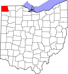 | |
| Villages | ||
| Townships | ||
| CDPs | ||
| Unincorporated communities | ||
| Ghost town | ||