Braxton, Mississippi
| Braxton, Mississippi | |
|---|---|
| Village | |
 Location of Braxton, Mississippi | |
 Braxton, Mississippi Location in the United States | |
| Coordinates: 32°1′26″N 89°58′14″W / 32.02389°N 89.97056°WCoordinates: 32°1′26″N 89°58′14″W / 32.02389°N 89.97056°W | |
| Country | United States |
| State | Mississippi |
| County | Simpson |
| Area | |
| • Total | 0.6 sq mi (1.5 km2) |
| • Land | 0.6 sq mi (1.5 km2) |
| • Water | 0.0 sq mi (0.0 km2) |
| Elevation | 354 ft (108 m) |
| Population (2000) | |
| • Total | 181 |
| • Density | 304.0/sq mi (117.4/km2) |
| Time zone | Central (CST) (UTC-6) |
| • Summer (DST) | CDT (UTC-5) |
| ZIP code | 39044 |
| Area code(s) | 601 |
| FIPS code | 28-08460 |
| GNIS feature ID | 0667533 |
Braxton is a village in Simpson County, Mississippi, United States. The village's population was 181 at the 2000 census. It is part of the Jackson, Mississippi Metropolitan Statistical Area. Its zip code is 39044.
History
The town of Braxton was named after Ira Braxton Standifer, the son of a physician.[1] The population of Braxton as of 2015 was 181.
Geography
Braxton is located at 32°1′26″N 89°58′14″W / 32.02389°N 89.97056°W (32.023985, -89.970679).[2] According to the United States Census Bureau, the village has a total area of 0.6 square miles (1.6 km2), all of it land.
Demographics
| Historical population | |||
|---|---|---|---|
| Census | Pop. | %± | |
| 1910 | 286 | — | |
| 1920 | 237 | −17.1% | |
| 1930 | 222 | −6.3% | |
| 1940 | 220 | −0.9% | |
| 1950 | 206 | −6.4% | |
| 1960 | 191 | −7.3% | |
| 1970 | 180 | −5.8% | |
| 1980 | 172 | −4.4% | |
| 1990 | 141 | −18.0% | |
| 2000 | 181 | 28.4% | |
| 2010 | 183 | 1.1% | |
| Est. 2015 | 181 | [3] | −1.1% |
As of the census[5] of 2000, there were 181 people, 74 households, and 44 families residing in the village. The population density was 304.0 people per square mile (116.5/km²). There were 86 housing units at an average density of 144.5 per square mile (55.3/km²). The racial makeup of the village was 96.13% White, 3.31% African American and 0.55% Native American.
There were 74 households out of which 27.0% had children under the age of 18 living with them, 48.6% were married couples living together, 9.5% had a female householder with no husband present, and 39.2% were non-families. 35.1% of all households were made up of individuals and 18.9% had someone living alone who was 65 years of age or older. The average household size was 2.45 and the average family size was 3.09.
In the village the population was spread out with 27.1% under the age of 18, 5.5% from 18 to 24, 29.3% from 25 to 44, 23.2% from 45 to 64, and 14.9% who were 65 years of age or older. The median age was 36 years. For every 100 females there were 86.6 males. For every 100 females age 18 and over, there were 80.8 males.
The median income for a household in the village was $26,250, and the median income for a family was $43,036. Males had a median income of $37,500 versus $12,500 for females. The per capita income for the village was $14,527. About 11.6% of families and 17.0% of the population were below the poverty line, including 4.5% of those under the age of eighteen and 29.3% of those sixty five or over.
Education
The Village of Braxton is served by the Simpson County School District.
References
- ↑ http://www.discoversimpsoncounty.com/index.php/history_heritage. Missing or empty
|title=(help); External link in|website=(help); - ↑ "US Gazetteer files: 2010, 2000, and 1990". United States Census Bureau. 2011-02-12. Retrieved 2011-04-23.
- ↑ "Annual Estimates of the Resident Population for Incorporated Places: April 1, 2010 to July 1, 2015". Retrieved July 2, 2016.
- ↑ "Census of Population and Housing". Census.gov. Archived from the original on May 11, 2015. Retrieved June 4, 2015.
- ↑ "American FactFinder". United States Census Bureau. Archived from the original on 2013-09-11. Retrieved 2008-01-31.
Municipalities and communities of Simpson County, Mississippi, United States | ||
|---|---|---|
| Cities | 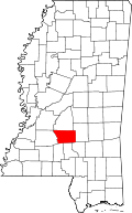 | |
| Town | ||
| Village | ||
| Unincorporated communities | ||