Boyce, Louisiana
| Boyce, Louisiana | |
| Town | |
| Country | United States |
|---|---|
| State | Louisiana |
| Parish | Rapides |
| Elevation | 85 ft (25.9 m) |
| Coordinates | 31°23′12″N 92°40′14″W / 31.38667°N 92.67056°WCoordinates: 31°23′12″N 92°40′14″W / 31.38667°N 92.67056°W |
| Area | 0.6 sq mi (1.6 km2) |
| - land | 0.5 sq mi (1 km2) |
| - water | 0.1 sq mi (0 km2), 16.67% |
| Population | 1,190 (2000) |
| Density | 2,239.5/sq mi (864.7/km2) |
| Timezone | CST (UTC-6) |
| - summer (DST) | CDT (UTC-5) |
| Area code | 318 |
 Location of Boyce in Louisiana
| |
 Location of Louisiana in the United States
| |
Boyce is a town in northern Rapides Parish, Louisiana, United States. It is part of the Alexandria, Louisiana Metropolitan Statistical Area. The population was 1,190 at the 2000 census. The community is nearly 75 percent African American.
History
Originally called Cotile Landing, the name was changed to Boyce in 1880, when the Texas and Pacific Railroad made Boyce its terminal point. The town was named for Judge Henry Boyce, who owned the land on which the town was located. Being of Irish descent, Boyce, and/or his son Henry Archinard Boyce, gave all the streets Irish names as he did his own plantation, Ulster, which was immediately adjacent to the town along Bayou Jeunes des Gens (Jean de Jean). The original incorporation date is not on file.
Geography
Boyce is located at 31°23′12″N 92°40′14″W / 31.38667°N 92.67056°W (31.386778, -92.670577).[1]
According to the United States Census Bureau, the town has a total area of 0.6 square miles (1.6 km2), of which 0.5 square miles (1.3 km2) is land and 0.1 square miles (0.26 km2) (8.62%) is water.
A number of small bayous, such as Bayou Jean de Jean and Bayou Helen, are located just outside the town.
An island in the Red River North of the town was created with the straightening of the portion of the river next to the Town by the Army Corps of Engineers. The owners of the Island named it St. Alfred Island, after Alfred Boyce Wettermark, 1916-2010
Demographics
| Historical population | |||
|---|---|---|---|
| Census | Pop. | %± | |
| 1890 | 301 | — | |
| 1900 | 832 | 176.4% | |
| 1910 | 865 | 4.0% | |
| 1920 | 1,060 | 22.5% | |
| 1930 | 820 | −22.6% | |
| 1940 | 732 | −10.7% | |
| 1950 | 981 | 34.0% | |
| 1960 | 1,094 | 11.5% | |
| 1970 | 1,240 | 13.3% | |
| 1980 | 1,198 | −3.4% | |
| 1990 | 1,361 | 13.6% | |
| 2000 | 1,190 | −12.6% | |
| 2010 | 1,004 | −15.6% | |
| Est. 2015 | 979 | [2] | −2.5% |
As of the census[4] of 2000, there were 1,190 people, 426 households, and 310 families residing in the town. The population density was 2,239.5 people per square mile (866.9/km²). There were 485 housing units at an average density of 912.7 per square mile (353.3/km²). The racial makeup of the town was 23.19% White, 74.37% African American, 0.08% Native American, 0.42% Asian, 0.25% from other races, and 1.68% from two or more races. Hispanic or Latino of any race were 0.67% of the population.
There were 426 households out of which 40.4% had children under the age of 18 living with them, 35.0% were married couples living together, 35.0% had a female householder with no husband present, and 27.2% were non-families. 23.2% of all households were made up of individuals and 11.5% had someone living alone who was 65 years of age or older. The average household size was 2.79 and the average family size was 3.32.
In the town the population was spread out with 34.8% under the age of 18, 11.8% from 18 to 24, 23.3% from 25 to 44, 18.1% from 45 to 64, and 12.1% who were 65 years of age or older. The median age was 29 years. For every 100 females there were 77.1 males. For every 100 females age 18 and over, there were 67.2 males.
The median income for a household in the town was $17,727, and the median income for a family was $20,000. Males had a median income of $24,000 versus $13,600 for females. The per capita income for the town was $9,616. About 37.9% of families and 40.7% of the population were below the poverty line, including 52.3% of those under age 18 and 27.1% of those age 65 or over.
Education
Boyce is served by Northwood High School, which opened in 1988, as a new consolidation of the old Boyce Junior High School and the former A. (Alfred) Wettermark High School.
Notable people
- Henry Boyce, a United States federal judge and member of the Louisiana state legislature. The town of Boyce, Louisiana, adjacent to his plantation Ulster, was named for him.
- Lloyd George Teekell, a state representative from Rapides Parish from 1953 to 1960 and a judge of the 9th Judicial District Court from 1979 to 1990, operated a ranch near Boyce.
- Julius Patrick, served as Mayor of Boyce for twenty-eight consecutive years (1978-2006).
- Jim Willis (baseball), a resident of Boyce and a former pitcher in Major League Baseball who played from 1953 through 1954 for the Chicago Cubs.
References
- ↑ "US Gazetteer files: 2010, 2000, and 1990". United States Census Bureau. 2011-02-12. Retrieved 2011-04-23.
- ↑ "Annual Estimates of the Resident Population for Incorporated Places: April 1, 2010 to July 1, 2015". Retrieved July 2, 2016.
- ↑ "Census of Population and Housing". Census.gov. Archived from the original on May 11, 2015. Retrieved June 4, 2015.
- ↑ "American FactFinder". United States Census Bureau. Archived from the original on 2013-09-11. Retrieved 2008-01-31.
Municipalities and communities of Rapides Parish, Louisiana, United States | ||
|---|---|---|
| Cities | 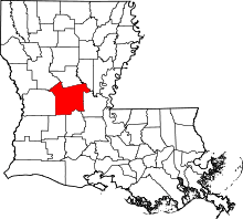 | |
| Towns | ||
| Villages | ||
| CDP | ||
| Other unincorporated communities | ||