Bowerston, Ohio
| Bowerston, Ohio | |
|---|---|
| Village | |
 Location of Bowerston, Ohio | |
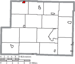 Location of Bowerston in Harrison County | |
| Coordinates: 40°25′37″N 81°11′15″W / 40.42694°N 81.18750°WCoordinates: 40°25′37″N 81°11′15″W / 40.42694°N 81.18750°W | |
| Country | United States |
| State | Ohio |
| County | Harrison |
| Area[1] | |
| • Total | 0.51 sq mi (1.32 km2) |
| • Land | 0.51 sq mi (1.32 km2) |
| • Water | 0 sq mi (0 km2) |
| Elevation[2] | 951 ft (290 m) |
| Population (2010)[3] | |
| • Total | 398 |
| • Estimate (2012[4]) | 397 |
| • Density | 780.4/sq mi (301.3/km2) |
| Time zone | Eastern (EST) (UTC-5) |
| • Summer (DST) | EDT (UTC-4) |
| ZIP code | 44695 |
| Area code(s) | 740 |
| FIPS code | 39-07916[5] |
| GNIS feature ID | 1048536[2] |
Bowerston is a village in Harrison County, Ohio, United States. The population was 398 at the 2010 census.
History
The village of Bowerston was settled in the early 19th century by Barnhard Bower and his brother John. When they first moved to the area, two mills were already built on the south side of Conotton Creek. One mill was a sawmill, the other a gristmill, and in 1804, the Bower brothers began to rebuild the mills. In 1816, the settlement called Bower's Mills was laid out and later it was called Bowersville and finally Bowerston. Bowerston was platted by David Bower, Henry Hoover, and Nathaniel Bower on August 21, 1851 and was filed in court August 2, 1852.[6] The village was incorporated April 2, 1883.
Geography
Bowerston is located at 40°25′37″N 81°11′15″W / 40.42694°N 81.18750°W (40.426806, -81.187523).[7]
According to the United States Census Bureau, the village has a total area of 0.51 square miles (1.32 km2), all land.[1]
Demographics
| Historical population | |||
|---|---|---|---|
| Census | Pop. | %± | |
| 1880 | 320 | — | |
| 1900 | 526 | — | |
| 1910 | 514 | −2.3% | |
| 1920 | 500 | −2.7% | |
| 1930 | 440 | −12.0% | |
| 1940 | 447 | 1.6% | |
| 1950 | 522 | 16.8% | |
| 1960 | 463 | −11.3% | |
| 1970 | 479 | 3.5% | |
| 1980 | 487 | 1.7% | |
| 1990 | 343 | −29.6% | |
| 2000 | 414 | 20.7% | |
| 2010 | 398 | −3.9% | |
| Est. 2015 | 393 | [8] | −1.3% |
2010 census
As of the census[3] of 2010, there were 398 people, 156 households, and 92 families residing in the village. The population density was 780.4 inhabitants per square mile (301.3/km2). There were 179 housing units at an average density of 351.0 per square mile (135.5/km2). The racial makeup of the village was 98.7% White, 0.8% African American, 0.3% Native American, and 0.3% from two or more races.
There were 156 households of which 30.8% had children under the age of 18 living with them, 42.9% were married couples living together, 9.0% had a female householder with no husband present, 7.1% had a male householder with no wife present, and 41.0% were non-families. 37.8% of all households were made up of individuals and 17.3% had someone living alone who was 65 years of age or older. The average household size was 2.26 and the average family size was 2.99.
The median age in the village was 41.1 years. 22.6% of residents were under the age of 18; 4.5% were between the ages of 18 and 24; 28.9% were from 25 to 44; 23.1% were from 45 to 64; and 20.9% were 65 years of age or older. The gender makeup of the village was 45.0% male and 55.0% female.
2000 census
As of the census[5] of 2000, there were 414 people, 145 households, and 100 families residing in the village. The population density was 816.9 people per square mile (313.4/km²). There were 165 housing units at an average density of 325.6 per square mile (124.9/km²). The racial makeup of the village was 100.00% White.
There were 145 households out of which 35.2% had children under the age of 18 living with them, 53.1% were married couples living together, 12.4% had a female householder with no husband present, and 31.0% were non-families. 27.6% of all households were made up of individuals and 11.7% had someone living alone who was 65 years of age or older. The average household size was 2.50 and the average family size was 3.06.
In the village the population was spread out with 24.2% under the age of 18, 9.2% from 18 to 24, 23.9% from 25 to 44, 19.8% from 45 to 64, and 22.9% who were 65 years of age or older. The median age was 39 years. For every 100 females there were 84.8 males. For every 100 females age 18 and over, there were 80.5 males.
The median income for a household in the village was $35,000, and the median income for a family was $42,083. Males had a median income of $28,036 versus $16,932 for females. The per capita income for the village was $15,267. About 1.9% of families and 6.5% of the population were below the poverty line, including 5.3% of those under age 18 and 12.2% of those age 65 or over.
Education
Public education in the village of Bowerston is provided by the Conotton Valley Union Local School District. Campuses serving the village include Bowerston Elementary School (Grades K-6) and Conotton Valley High School (Grades 7-12).
Conotton Creek Trail

Bowerston is the beginning of the multi-use rails-to-trails path, the Conotton Creek Trail, along Conotton Creek. The trail is 11.4 miles (18.3 kilometers) long. It starts at the eastern end of Bowerston, at the southeast end of Erie Street. It is paved and suitable for bicycling, roller blading, wheel chairing and walking.
References
- 1 2 "US Gazetteer files 2010". United States Census Bureau. Archived from the original on 2012-01-24. Retrieved 2013-01-06.
- 1 2 "US Board on Geographic Names". United States Geological Survey. 2007-10-25. Retrieved 2008-01-31.
- 1 2 "American FactFinder". United States Census Bureau. Retrieved 2013-01-06.
- ↑ "Population Estimates". United States Census Bureau. Archived from the original on 2013-06-17. Retrieved 2013-06-17.
- 1 2 "American FactFinder". United States Census Bureau. Archived from the original on 2013-09-11. Retrieved 2008-01-31.
- ↑ Hanna, Charles Augustus (1900). Historical Collections of Harrison County, in the State of Ohio. p. 114.
- ↑ "US Gazetteer files: 2010, 2000, and 1990". United States Census Bureau. 2011-02-12. Retrieved 2011-04-23.
- ↑ "Annual Estimates of the Resident Population for Incorporated Places: April 1, 2010 to July 1, 2015". Retrieved July 2, 2016.
- ↑ "Census of Population and Housing". Census.gov. Archived from the original on May 11, 2015. Retrieved June 4, 2015.
External links
| Wikimedia Commons has media related to Bowerston, Ohio. |
Municipalities and communities of Harrison County, Ohio, United States | ||
|---|---|---|
| Villages | 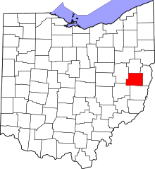 | |
| Townships | ||
| CDP | ||
| Unincorporated communities | ||
| Ghost towns | ||
| Footnotes | ‡This populated place also has portions in an adjacent county or counties | |