Bourbon Township, Marshall County, Indiana
| Bourbon Township | |
|---|---|
| Township | |
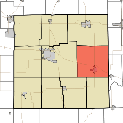 Location in Marshall County | |
| Coordinates: 41°19′42″N 86°07′34″W / 41.32833°N 86.12611°WCoordinates: 41°19′42″N 86°07′34″W / 41.32833°N 86.12611°W | |
| Country |
|
| State |
|
| County | Marshall |
| Government | |
| • Type | Indiana township |
| Area | |
| • Total | 49.67 sq mi (128.6 km2) |
| • Land | 49.62 sq mi (128.5 km2) |
| • Water | 0.05 sq mi (0.1 km2) 0.10% |
| Elevation | 827 ft (252 m) |
| Population (2010) | |
| • Total | 3,152 |
| • Density | 63.5/sq mi (24.5/km2) |
| ZIP codes | 46501, 46504, 46506, 46524, 46563 |
| GNIS feature ID | 0453132 |
Bourbon Township is one of ten townships in Marshall County, Indiana, USA. As of the 2010 census, its population was 3,152 and it contained 1,232 housing units.[1]
History
Bourbon Township was organized in 1840. It was likely named after Bourbon County, Kentucky, the native home of some of the early settlers.[2]
Geography
According to the 2010 census, the township has a total area of 49.67 square miles (128.6 km2), of which 49.62 square miles (128.5 km2) (or 99.90%) is land and 0.05 square miles (0.13 km2) (or 0.10%) is water.[1]
Cities, towns, villages
Cemeteries
The township contains these three cemeteries: Odd Fellows, Parks Memorial and Sandridge.
Major highways
School districts
- Triton School Corporation
Political districts
- Indiana's 2nd congressional district
- State House District 23
- State Senate District 9
References
- "Bourbon Township, Marshall County, Indiana". Geographic Names Information System. United States Geological Survey. Retrieved 2009-09-29.
- United States Census Bureau 2008 TIGER/Line Shapefiles
- IndianaMap
- 1 2 "Population, Housing Units, Area, and Density: 2010 - County -- County Subdivision and Place -- 2010 Census Summary File 1". United States Census. Retrieved 2013-05-10.
- ↑ McDonald, Daniel (1908). A Twentieth Century History of Marshall County, Indiana, Volume 1. Lewis Publishing Company. p. 86.
External links
- Indiana Township Association
- United Township Association of Indiana
- City-Data.com page for Bourbon Township
 |
German Township | Scott Township, Kosciusko County | | |
| Center Township | |
Etna Township, Kosciusko County | ||
| ||||
| | ||||
| Walnut Township | Tippecanoe Township |
Municipalities and communities of Marshall County, Indiana, United States | ||
|---|---|---|
| City | ||
| Towns | ||
| Townships | ||
| CDP | ||
| Unincorporated communities | ||
| Footnotes | ‡This populated place also has portions in an adjacent county or counties | |
This article is issued from Wikipedia - version of the 11/6/2016. The text is available under the Creative Commons Attribution/Share Alike but additional terms may apply for the media files.