Bourbon Township, Douglas County, Illinois
| Bourbon Township | |
|---|---|
| Township | |
 Location in Douglas County | |
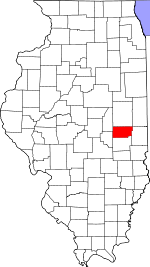 Douglas County's location in Illinois | |
| Coordinates: 39°42′11″N 88°24′51″W / 39.70306°N 88.41417°WCoordinates: 39°42′11″N 88°24′51″W / 39.70306°N 88.41417°W | |
| Country |
|
| State |
|
| County | Douglas |
| Established | November 5, 1867 |
| Area | |
| • Total | 43.1 sq mi (112 km2) |
| • Land | 43.08 sq mi (111.6 km2) |
| • Water | 0.02 sq mi (0.05 km2) 0.05% |
| Elevation | 666 ft (203 m) |
| Population (2010) | |
| • Total | 4,124 |
| • Density | 95.7/sq mi (36.9/km2) |
| Time zone | CST (UTC-6) |
| • Summer (DST) | CDT (UTC-5) |
| ZIP codes | 61910, 61911, 61953 |
| GNIS feature ID | 0428695 |
Bourbon Township is one of nine townships in Douglas County, Illinois, USA. As of the 2010 census, its population was 4,124 and it contained 1,352 housing units.[1]
Geography
According to the 2010 census, the township has a total area of 43.1 square miles (112 km2), of which 43.08 square miles (111.6 km2) (or 99.95%) is land and 0.02 square miles (0.052 km2) (or 0.05%) is water.[1]
Cities, towns, villages
- Arthur (eastern portion)
Unincorporated towns
- Bourbon at 39°44′44″N 88°22′44″W / 39.745588°N 88.378941°W
- Chesterville at 39°42′12″N 88°23′28″W / 39.703366°N 88.391163°W
Extinct towns
(These towns are listed as "historical" by the USGS.)
Cemeteries
The township contains these six cemeteries: Bourbon, Campbell, Fillmore, Miller, Yoder and Yoder.
Major highways
School districts
- Arcola Consolidated Unit School District 306
- Arthur Community Unit School District 305
Political districts
- State House District 110
- State Senate District 55
References
- "Bourbon Township, Douglas County, Illinois". Geographic Names Information System. United States Geological Survey. Retrieved 2010-01-17.
- United States Census Bureau 2009 TIGER/Line Shapefiles
- United States National Atlas
- 1 2 "Population, Housing Units, Area, and Density: 2010 - County -- County Subdivision and Place -- 2010 Census Summary File 1". United States Census. Retrieved 2013-05-28.
External links

Municipalities and communities of Douglas County, Illinois, United States | ||
|---|---|---|
| Cities | ||
| Villages | ||
| Townships | ||
| Unincorporated communities | ||
| Ghost town | ||
| Footnotes | ‡This populated place also has portions in an adjacent county or counties | |
This article is issued from Wikipedia - version of the 11/6/2016. The text is available under the Creative Commons Attribution/Share Alike but additional terms may apply for the media files.