Borkou Region
Coordinates: 17°55′00″N 19°07′00″E / 17.9167°N 19.1167°E
| Borkou | |
|---|---|
| Region | |
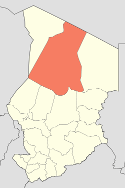 Map of Chad showing Borkou region | |
| Country | Chad |
| Departments | 2 |
| Sub-prefectures | 4 |
| Region | 2008 |
| Regional capital | Faya-Largeau |
| Government | |
| • Governor | Erdibou Ramadan (2008) |
| Population (2009) | |
| • Total | 107,251 |
The Borkou region is a region of Chad which was created in 2008 from the Borkou department of the former Borkou-Ennedi-Tibesti region the inhabited by Gouran Anakaza ethnic group of northern Chad.[1] Its capital is Faya-Largeau.
Per the census of 2009, the population of the region was 97,251, 46.60 per cent females. The number of households was 16,191: 10,584 in rural areas and 5,607 in urban areas. The number of nomads in the region was 8,221, 2.10 per cent of the population. The sex ratio was 114.00 females for every hundred males.
Demographics
Per the census of 2009, the population of the region was 97,251, 46.60 per cent female. The average size of household as of 2009 is 6.00: 6.00 in rural households and 5.80 in urban areas. The total number of households was 16,191: 10,584 in rural areas and 5,607 in urban areas. The number of nomads in the region was 8,221, 2.10 per cent of the population. The were 96,459 people residing in private households. There were 47,285 above 18 years of ages: 24,775 male and 22,510 female. The sex ratio was 114.00 females for every hundred males. There were 89,030 sedantary staff, 0.80 of the total population.[2] Batha is one of the 23 regions of Chad and has the Head Post Office of the region is located in the capital. As of 2015, internet and telephone were limited and post was the primary mode of communication.[3]
Geography
Borkou is traversed by the northeasterly line of equal latitude and longitude. Chad has a general elevation of 240 m (790 ft) in Lake Chad Depression towards Guera massif located at an elevation of 1,800 m (5,900 ft) and eastwards towards mountaineous Saharan region of 3,350 m (10,990 ft). The only rivers in the country of importance are Chari and Logone, flowing into Lake Chad. The region receives an annual rainfall of 250 mm (9.8 in) to 500 mm (20 in) and has Savannah woodland region. There are open grasslands and it is predominantly covered with pastures. There is limited amount of groundnut and local grains. During the drought of 1970s and 1980s, the region was heavily affected and the number of cattle herds has reduced. The northern most zone of the region has sparse rainfall and desert vegetation. The northern regions of the country is believed to have significant amount of Uranium deposits.[4]
Administration
Chad became independent in 1961 from the French Colonial Empire. On account of ensuing political instability and local civil wars, it continued as a one party democary till 1991, while other parties were also allowed. All the powers rested centrally with the President.[5] As a part of decentralization in February 2003, the country is administratively split into regions, departments, municipalities and rural communities. The prefectures which were originally 14 in number were re-designated in 17 regions. The regions are administered by Governors appointed by the President. The Prefects, who originally held the responsibility of the 14 prefects, still retained the titles and were responsible for the administration of smaller departments in each region. The members of local assemblies are elected every six years, while the executive organs are elected every three years.[6] As of 2016, there are totally 23 regions in Chad, which are divided based on population and administrative convenience. The Borkou region is divided into two departments, namely, Borkou (capital Faya-Largeau) and Borkou Yala (capital Kirdimi ).[7]
References
- ↑ "Ordonnance n° 002/PR/08 portant restructuration de certaines" (in French). collectivités territoriales décentralisées. Retrieved 20 November 2016.
- ↑ "Census of Chad". National Institute of Statistical, Economic and Demographic Studies, Chad. 2009. Retrieved 17 November 2016.
- ↑ Falola, Toyin; Jean-Jacques, Daniel (2015). Africa: An Encyclopedia of Culture and Society [3 volumes]: An Encyclopedia of Culture and Society. ABC-CLIO. p. 251. ISBN 9781598846669.
- ↑ Hilling, David (2004). "Chad - Physical and Social Geography". Africa South of the Sahara 2004. Psychology Press. p. 218. ISBN 9781857431834.
- ↑ "Chad profile - Timeline". BBC. 2 August 2016. Retrieved 20 November 2016.
- ↑ Republic of Chad Public Administration and Country profile (PDF) (Report). Department of Economic and Social Affairs (DESA), United Nations. 2004. p. 9. Retrieved 17 November 2016.
- ↑ Chad district map (PDF) (Report). Department of Field Support,Cartographic Section, United Nations. Retrieved 20 November 2016.
External links
| ||