Kanem Region
Coordinates: 14°07′10″N 15°18′48″E / 14.1194°N 15.3133°E
| Kanem | |
|---|---|
| Region | |
 | |
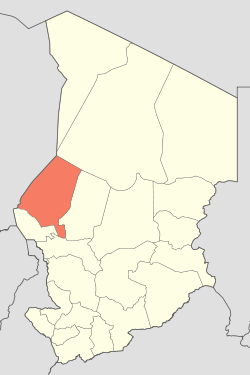 Map of Chad showing Kanem. | |
| Country | Chad |
| Departments | 3 |
| Sub-prefectures | 10 |
| Regional capital | Mao |
| Government | |
| • Governor | N'Gamaï Djari (2008) |
| Population (2009) | |
| • Total | 354,603 |
Kanem is one of the 23 regions of Chad. It was created in 2002 from the former Prefecture of Kanem. It is named after the famous Kanem Empire, which was centered in this vicinity. The region's capital is Mao. In 2008, a portion of the Kanem region (the Bahr el Gazel Department) was split off to become the new Bahr el Gazel Region.
Per the census of 2009, the total population in the region was 354,603, 51.40 per cent females. The total number of households was 78,145: it was 70,779 in rural areas and 7,366 in urban areas. The number of nomads in the region was 10,056, 2.60 per cent of the total population.
Geography
Kanem is traversed by the northeasterly line of equal latitude and longitude. Chad has a general elevation of 240 m (790 ft) in Lake Chad Depression towards Guera massif located at an elevation of 1,800 m (5,900 ft) and eastwards towards mountaineous Saharan region of 3,350 m (10,990 ft). The only rivers in the country of importance are Chari and Logone, flowing into Lake Chad. The region receives an annual rainfall of 744 mm (29.3 in) and has vegetational zones. The region is the principal agricultural segment in the whole country, producing cotton and groundnut, the two main cashcrops of the country. There are a variety of local crops like rice are also grown in the region.[1]
Demographics
Per the census of 2009, the population in the region was 354,603, 51.40 per cent female. The average size of household was 4.50: 4.50 in rural households and 4.90 in urban areas. The number of households was 78,145: 70,779 in rural areas and 7,366 in urban areas. The number of nomads in the region was 10,056, 2.60 per cent of the population. There were 354,007 people residing in private households. There were 157,264 over 18 years of age: 70,134 male and 87,130 female. The sex ratio was 94.00 females for every hundred males. There were 344,547 sedentary staff, 3.20 of the population. The principal ethnico-linguistic groups are the Daza (48.25%), the Kanembu people (40.54%) and Baggara Arabs (4,97%).[2] Kanem is one of the 23 regions of Chad and has the Head Post Office of the region is located in the capital. As of 2015, internet and telephone were limited and post was the primary mode of communication.[3]
Administration
Since 2008, the region of Kanem is divided in three departments, namely, Kanem (capital Mao), Nord Kanem (capital of Nokou) and Wadi Bissam (capital of Mondo). Chad became independent in 1961 from the French Colonial Empire. On account of ensuing political instability and local civil wars, it continued as a one party democracy till 1991, while other parties were also allowed. All the powers rested centrally with the President.[4] As a part of decentralization in February 2003, the country is administratively split into regions, departments, municipalities and rural communities. The prefectures which were originally 14 in number were re-designated in 17 regions. The regions are administered by Governors appointed by the President. The Prefects, who originally held the responsibility of the 14 prefects, still retained the titles and were responsible for the administration of smaller departments in each region. The members of local assemblies are elected every six years, while the executive organs are elected every three years.[5] As of 2016, there are totally 23 regions in Chad, which are divided based on population and administrative convenience.[6]
References
- ↑ Hilling, David (2004). "Chad - Physical and Social Geography". Africa South of the Sahara 2004. Psychology Press. p. 218. ISBN 9781857431834.
- ↑ "Census of Chad". National Institute of Statistical, Economic and Demographic Studies, Chad. 2009. Retrieved 17 November 2016.
- ↑ Falola, Toyin; Jean-Jacques, Daniel (2015). Africa: An Encyclopedia of Culture and Society [3 volumes]: An Encyclopedia of Culture and Society. ABC-CLIO. p. 251. ISBN 9781598846669.
- ↑ "Chad profile - Timeline". BBC. 2 August 2016. Retrieved 20 November 2016.
- ↑ Republic of Chad Public Administration and Country profile (PDF) (Report). Department of Economic and Social Affairs (DESA), United Nations. 2004. p. 9. Retrieved 17 November 2016.
- ↑ Chad district map (PDF) (Report). Department of Field Support,Cartographic Section, United Nations. Retrieved 20 November 2016.
See also
External links
| Wikimedia Commons has media related to Kanem Region. |
| ||