Bogra
| Bogra ,Bangladesh বগুড়া Bogura. | |
|---|---|
|
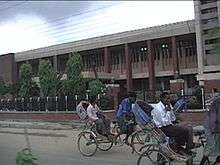
Bogra Sathmatha (Heart of Bogra) | |
| Nickname(s): Bogra | |
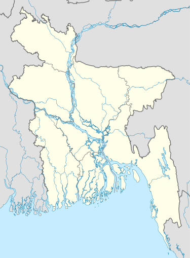 Bogra ,Bangladesh Location in Bangladesh | |
| Coordinates: 24°51′N 89°22′E / 24.850°N 89.367°E | |
| Country |
|
| Division | Rajshahi Division |
| District | Bogra District |
| Area | |
| • Total | 10.37 sq mi (26.86 km2) |
| Elevation | 70 ft (20 m) |
| Population (2011) | |
| • Total | 266,930 |
| Time zone | Bangladesh Time (UTC+6) |
| Postal code | 5800 |
| Calling code | 051 |
| Website |
www |

Bogra (Bengali: বগুড়া) is a city located in the Bogra District, Rajshahi Division, Bangladesh, and acts as the major commerce hub in the = Bogra District. Described by some as the nerve centre of Northern Bangladesh, Bogra is a bridge between the Rajshahi Division and Rangpur Division. The city area of Borga is approximately 26.86 km2 (10.37 sq mi), consists of 21 wards, and the has a population of around 266,930 people. Currently the Mayor of the municipality is Adv. Mahabubar Rahman.
History
Supposedly the oldest city of Bengal in the Great Emperor Ashoka's India, Emperor Ashoka conquered the Bengal (Bongo) and founded Borgra, previously called Pundra Bardhan. Possibly confirming this origin story, an ancient engraved stone believed to be of Gupta era was discovered on a pond bank near Sura Masjid at Ghoraghat Upazila in Dinajpur in October 2008.
During the Bangladesh War of Independence, the area witnessed the Battle of Bogra a fierce battle between the guerrilla units of the BDF under Sector 7 which defeated the Pakistan Army.
Geography

First formed in 1821, the administrative district of Bogra contains an area of 1,359 sq mi (3,520 km2).
The principal rivers in the district are formed by the different channels of the Brahmaputra, which river here bears the local names of the Konai, the Daokoba and the Jamuna, the last forming a portion of the eastern boundary of the district. The Brahmaputra and its channels, together with three minor streams, the Bangali, Karatoya and Atrai, allow for significant facilities for the usage of commerce.
In 1911 the Karatoya (which flows from north to south), divided the district into two portions, the eastern tract consisting of rich alluvial soil, subject to fertilizing inundations and yielding heavy crops of coarse rice, oil-seeds and jute, while the soil of the high-lying western portion of the district allow for growing rice.[1]
Economy
Since 2009 with the advancment of urban planning, there has been a significant development in the infrastructure of Borgra including, restructured and widened town roads, improved telecommunications, and the instillation of underground gas connections.
Additionally, red chili production in Bogra has become a major local industry, with companies such as Square, Acme, BD Food collecting red chili from as many as 12 centers withinBogra.[2]
Often called the "Town of Banks", Bogra is the is the location of numerous online banking facilities, credit card, debit card, and money gram companies. Banking in Bogra has significantly expanded with the branch of government banks such as the Bangladesh Bank (Central Bank), Sonali Bank, Rupali Bank, Janata Bank, Rajshahi Krishi Unnayan Bank, Bangladesh Development Bank Ltd., Uttara Bank Ltd, Agrani Bank, as well as a number of private and specialized banks including, Pubali Bank, National Bank, IFIC bank Ltd., Citi Bank Ltd., and others.

Additionally, Bogra is the home of IT, software, technology, and computer services companies,[3] and in 2008 the French Grameen Group and Groupe Danone entered into a joint venture named Grameen Danone in Bogra.[4]
Statistically, Bogra's workforce is divided between jobs in agriculture (29.95%), agricultural manufacturing (12.53%), general commerce (18.11%), customer service (15.62%), transportation (6.66%), wage labor (2.2%), and other industries (14.93%).[5]
Tourism

Borga is home to Mahasthangarh, the earliest urban archaeological site so far discovered in Bangladesh, as well as the village Mahasthan in Shibganj thana of Bogra District, which contains the remains of Pundranagara (or Paundravardhanapura), an ancient city in the territory of Pundravardhana.[6][7][8] This place is considered to be sacred by Buddhists, Muslims and Hindus alike.[9]
Also popular among tourists to Bogra is: the "Behular Bashor Ghar" which is very near to Mahasthangar, Nawab Palace (called Neelkuthi during the British period), Kherua Mosque (Sherpur Upazila), Bara Mosque, Mazar of Shah Sultan Balkhi, Mazar of Panchpir, Gokul Medh, palace of Parshuram, Basu Bihara, Palli Unnayan Academy, Saudia City Park, Bhimer Jangle, museum of Nawab Bari Palace, Wonderland Shishupark (children park), Shanewaz Shishubagan, Woodburn Park, Dreshtinandan Park, Bijayangan (war of liberation museum) and the Jaina Temple.
Notable residents
- Akhteruzzaman Elias (1943–1997), Novelist and short story writer
- Gaziul Haque (1929–2009), Language movement veteran
- Hero Alom, Model, Businessman
- Khademul Bashar (1935–1976), Bir Uttam, Sector Commander of Liberation War & former Chief of Bangladesh Air Force.
- Muhammad Ali Bogra (1909–1963), Notable diplomat, former Prime Minister of Pakistan (from 1953–1955)
- Mushfiqur Rahim, Famous Cricketer, Bangladesh Cricket Team
- Ziaur Rahman, Freedom Fighter, Social Worker, Former President of Bangladesh
See also
- Bogra Sadar Upazila, a sub-district (upzalia) of Bogra.
Notes
- ↑ Chisholm 1911, p. 121.
- ↑ "Turnover goes up to Tk 100cr from Tk 5cr in just 5 years". The Daly Star. Retrieved 6 December 2009.
- ↑ Bogra Database, retrieved 7 December 2009, Bogra.info
- ↑ "French minister backs social business". The Daily Star. Retrieved 6 December 2009.
- ↑ Chawdhury, Shagata (2012). "Bogra Sadar Upazila". In Islam, Sirajul; Jamal, Ahmed A. Banglapedia: National Encyclopedia of Bangladesh (Second ed.). Asiatic Society of Bangladesh.
- ↑ Hossain, Md. Mosharraf, Mahasthan: Anecdote to History, 2006, Preface, Dibyaprakash, 38/2 ka Bangla Bazar, Dhaka, ISBN 9844832454
- ↑ Brochure: Mahasthan – the earliest city-site of Bangladesh, published by the Department of Archaeology, Ministry of Cultural Affairs, Government of the People’s Republic of Bangladesh, 2003
- ↑ Majumdar, Dr. R.C., History of Ancient Bengal, First published 1971, Reprint 2005, p. 10, Tulshi Prakashani, Kolkata, ISBN 81-89118-01-3.
- ↑ Khan, Ayub (2012). "Goku Medh". In Islam, Sirajul; Jamal, Ahmed A. Banglapedia: National Encyclopedia of Bangladesh (Second ed.). Asiatic Society of Bangladesh.
References
-
 This article incorporates text from a publication now in the public domain: Chisholm, Hugh, ed. (1911). "Bogra". Encyclopædia Britannica. 4 (11th ed.). Cambridge University Press. p. 121.
External links
| Wikimedia Commons has media related to Bogra. |
Coordinates: 24°51′N 89°22′E / 24.850°N 89.367°E