Tangail
| Tangail টাঙ্গাইল | |
|---|---|
| City of Culture | |
|
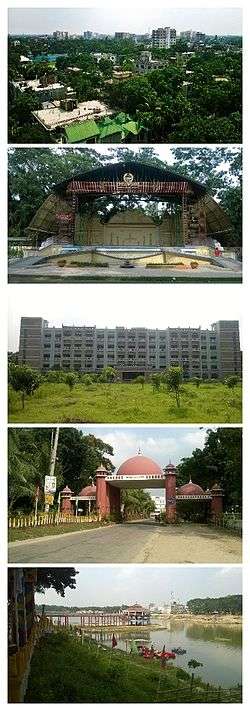
From top to bottom: 1. The City Skyline from "Suparibagan"; 2. The Open Stage of Tangail Poura Uddan; 3. Tangail District Court Building; 4. The city gate called "Shamsul Huq Toron"; 5. DC Lake at District Headquarters | |
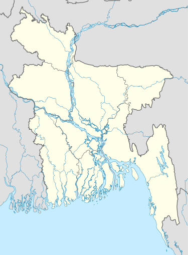 Tangail Location of Tangail in Bangladesh | |
| Coordinates: 24°15′52″N 89°55′05″E / 24.264423°N 89.918140°ECoordinates: 24°15′52″N 89°55′05″E / 24.264423°N 89.918140°E | |
| Country |
|
| Division | Dhaka Division |
| District | Tangail District |
| Upazila | Tangail Sadar Upazila-Part, Delduar Upazila-Part |
| Incorporated | 1887 |
| Government | |
| • Type | Pourashava |
| • First Mayor | Shashi Shekhar Dutt |
| • Present Mayor | Md.Jamilur Rahman Miron (Bangladesh Awami League) |
| Area | |
| • Total | 35.22 km2 (13.60 sq mi) |
| Elevation | 14 m (46 ft) |
| Population (2015) | |
| • Total |
|
| Time zone | BST (UTC+6) |
| Postal codes | 1900, 1901, 1902 |
| Area code(s) | 0921 |
| Website | Tangail Pourashava Website |
| [1] | |
Tangail (Bengali: টাঙ্গাইল, [ʈaŋgail]) is a city of Tangail District in the central region of Bangladesh 98 km north-west of Dhaka, the capital. It is one of the important cities of Central Bangladesh and main urban area of Tangail District. The city is on the bank of Louhajang River.[2]
Etymology
During early 19th century, horse carts were the main transportation medium for carrying goods and passengers in the present city area. A long line of horse carts used to stand at that time. There is a common belief that the name Tangail has been originated from the word tanga meaning horse carts.
History
Tangail was a popular local business centre since early 19th century. But the name came on focus when the headquarter of a subdivision of the Greater Mymensingh District was shifted in 1860 from Atia to there due to its fertility and high elevation near Louhajong River. At the same time, The subdivision was named as Tangail.
The Municipal Corporation or pourashava was established on 1 July 1887. During its establishment the town was composed of five wards.
| Ward No. | Area |
|---|---|
| 1 | Tangail Kanda Para, Par Dighulia, Akur Takur Para |
| 2 | Korer Betka, Mirer Betka, Nondir Betka, Sabalia, Dorun, Ashekpur, Nagor Jalfai, Boali |
| 3 | Garai, Berai, Kazipur, Bachrakandi, Potol, Bajitpur, Berabuchna, Valluk kandi |
| 4 | Kagmari, Sontosh, Aloa, Boitta, Patuli, Ekrampur |
| 5 | Kalipur, Dighulia, Sakrail, Kaiyamara, Beradoma, Basha, Khanpur |
| 13 | Purbo Adalot para |
Afterwards, the pourashava was reshaped into four wards:
- Ward no. 1 as 'Central'
- Ward no. 2 as 'Betka'
- Ward no. 3 as 'Dighulia'
- Ward no. 4 as 'Santosh'
Iin 1988 it was subdivided into six wards:
- Ward no. 1 as 'Central'
- Ward no. 2 as 'Betka'
- Ward no. 3 as 'Dighulia'
- Ward no. 4 as 'Santosh'
- Ward no. 5 as 'Zila Sadar'
- Ward no. 6 as 'Kazipur'
After decisions for a few years, in 1999 the town was subdivided into 18 wards and gained its present shape.
The first election of the town was held in November 1887. In that election eight ward commissioners from four wards were elected by direct vote of the citizens of the town. On the other hand, the then Subdivision Commissioner of Tangail, Shashi Shekhar Dutt, was appointed as the first administrator of Tangail municipality. There was no pakka street in this town then. No lamp post could be seen in the roads. In the 1890s the town was lacking safe water supply, too. The regional zamindars and subdivision board came forward and helped financially to dig ponds, lakes and canals. Those sources served the local people with a safe water supply.
In early 1900s, the pourashava authority lit the roads for the first time by kerosene lambs. The pourashava gradually became populated in the first half of the 20th century. At that time, many tube wells were set up in the town. The main way of transportation was horse cars in the town. People used cattle for transportation, too.
The people of Tangail used to visit Kolkata through Charabari by launch and Dhaka through Mymensingh. In the early 1930s, electricity line was first provided in the town. The rickshaws started to roll in town's streets. In the 1960s, pakka roads were constructed in the town. In the meantime, Tangail was directly connected to Dhaka by road. Many bridges and culverts were constructed to develop the area. The town got water by pipelines at that time.
In 1985 Tangail municipality was promoted to 'B Class' from 'C Class'. In 1989 the pourashava was promoted to 'A Class'. In 1990s, The town was financed by Asian Development Bank and Government of Bangladesh to develop water supply, sanitation, wastewater drainage, bus terminal, supermarkets and other infrastructure.[3]
Sports
Cricket is the most popular sport in Tangail. Football and kabaddi are also popular. All important sports events of the city are held in Tangail Stadium which is beside Bhashani hall and Tangail Eid-gah. The stadium has hosted national events. It was the home venue of Bangladesh Football Premier League club Team BJMC. It was converted into a cricket stadium in 2015. First Division Cricket is regularly hosted in this venue.
Administration
The total area of Tangail city is 35.22 km2. The government of Bangladesh has planned to expand the city. After expansion it will have a proposed area of 81.75 km2.[4] The city consists of 18 wards and 64 mahallas until 2016.
| Ward No. | Region | Households | Population (2011) |
|---|---|---|---|
| 1 | Akur Takur Para-north, Dewla, District hq | 2070 | 10388 |
| 2 | Enayetpur | 2142 | 8760 |
| 3 | West Akur Takur Para, North Kagmara, South Kagmara | 3205 | 13903 |
| 4 | Bepari Para, Fakir Para, Bera Doma, Dighulia, Char Dighulia | 2119 | 9208 |
| 5 | Kalipur, Lakshimpur, Sarutia, Shakrail | 1614 | 7235 |
| 6 | College Para, Paradise Para, Par Dighulia-part | 1569 | 6712 |
| 7 | Baluk Kandi, Bagbari, Patuli Bhabani Bagbari, Uttar Santosh-part, Santosh Palpara | 1674 | 7325 |
| 8 | Aloa Bhabani Pahim, Aloa Pahim, Dakshin Santosh-part | 1797 | 8026 |
| 9 | Aloa Baratia, Aloa Paikasta, Aloa Tarini, Baluk Kandi-part, Char Patuli, Purba Aloa, Aloa Bhabani | 1888 | 8575 |
| 10 | Bajitpur, Berai, Basrakandi, Kazipur, Patal | 1458 | 6189 |
| 11 | Berabuchna, Kachua Para,Kanda Para | 1929 | 7536 |
| 12 | Adi Tangail, Bepari Para, Bil Para | 1628 | 7160 |
| 13 | Tangail Mahalla, Chayanir Bazar, Pachanir Bazar, Thana Para, Uttar Thana Para | 1792 | 7572 |
| 14 | Purba Adalat Para, Adalat Para, Biswas Betka-part S.W corn, Shaha Para | 2790 | 11786 |
| 15 | Ashekpur, Biswas Betka-part | 2745 | 12118 |
| 16 | Akur Takur Para-part, Par Dighulia-part | 2459 | 10670 |
| 17 | Kumudini College Para, Munshi Para, Registry Para, Biswas Betka-west | 2128 | 11081 |
| 18 | Kodalia, Sabalia | 2600 | 13168[5] |
Karatia is the suburb of Tangail.
Transport
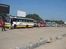
It takes approximately 1 hour and 55 minutes to reach Tangail from Dhaka city, via Kaliakair and Tongi. The distance is around 98 km. From Mohakhali (মহাখালী) bus terminal, several buses run to this city. Among them Nirala, Dhaleshwari, Jhatika and High Choice are notable.
Several trains are available from Dhaka to Tangail. Among them the most popular is "Sirajganj Express". Other notable intercity trains that stop in Tangail railway station are Padma Express, Ekota Express, Nilsagor Express, Silk City Express, Sundarban Express, Drutojan Express, Rangpur Express etc. Some local trains stop in the station, too. Those are Rajshahi Express, Rajshahi Mail, Rangpur Express, Fast Passenger, etc.[6]
Traditional foods
Parks
- Tangail Poura Uddan
- Soul Park
- DC Lake
Education
The literacy rate of the city area is 71.8%.
There are eight notable high schools in the city:
- Bindu Basini Govt. Boys' High School (established in 1880 by zamindar of Santosh of the famous Roy Chowdhury family)
- Bindu Basini Govt. Girls' High School (established in 1882 by zamindar of Santosh of the famous Roy Chowdhury family)
- Shibnath High School
- Vivekananda High School
- Police Lines High School
- Zila Sadar Girls' High School
- Santosh Jannabi Govt. High School
- P.T.I. High School
There are several colleges in the city.
- Major General Mahmudul Hassan College
- Kumudini College
- Mawlana Mohammad Ali Govt. College
- Govt. Sheikh Fazilatunnesa Mujib Mohila College
- Vivekananda College
- Police Lines College
Furthermore, Sheikh Hasina Medical College and Tangail Polytechnic Institute[7] are located here. There is a technological university named Mawlana Bhashani Science and Technology University[8] in Santosh, Tangail.
Religion
The majority of Tangail city's people are Muslims (88.2%) like most other parts of Bangladesh. Other religious groups include Hindus (11.7%), Christians (.08%) and Buddhists (0.02%).
Notable residents
- Maulana Abdul Hamid Khan Bhashani, Islamic scholar, political leader, ex-president of the Awami League
- Shamsul Huq, first general secretary of the Awami League
- Abu Sayeed Chowdhury, second president of Bangladesh
- SM Aslam Talukder aka Manna, film actor and producer
- Principal Ibrahim Kha, founder principal of Karotia College and writer.(voapur)
- Principal Mehrab Ali Chowdhury, first dabol MA (English and history) principal Goripur college (Mymanshing), writer. (Karotia Dapnajor)
See also
References
- ↑ "Population Census 2011: National Volume-3: Urban Area Report" (PDF). Bangladesh Bureau of Statistics. p. 8. Retrieved 31 January 2016.
- ↑ "land grabbers choke Tangail's louhajong river". The Daily Star Bangladesh. 30 June 2015. Retrieved 13 February 2016.
- ↑ http://tangailpourashava.gov.bd/page/article/10
- ↑ http://tangailpourashava.gov.bd/page/article/90
- ↑ "Tangail Pourashava C01 P-97,98,99". Bangladesh Bureau of Statistics. 16 June 2011. Retrieved 11 January 2016.
- ↑ "Train schedule of Tangail station". Bangladesh Railway. 1 June 2001.
- ↑ "Tangail Polytechnic Institute". 13 February 2016.
- ↑ "Mawlana Bhasani Science & Technology University". 13 February 2016.
- ↑ "Bangladesh Bureau of Statistics Region Census 2011". Bangladesh Bureau of Statistics. Retrieved 20 September 2014.