Blackcomb Peak
- This article describes the geographical feature Blackcomb Peak, for the ski resort see Whistler Blackcomb.
| Blackcomb Peak | |
|---|---|
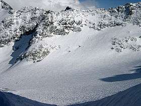 View of Blackcomb Glacier from the "Blowhole" entrance to Blackcomb Glacier Provincial Park. Spearhead Mtn in foreground, Phalanx Mtn on left | |
| Highest point | |
| Elevation | 2,436 m (7,992 ft) [1] |
| Prominence | 86 m (282 ft) [1] |
| Coordinates | 50°04′53″N 122°52′15″W / 50.08139°N 122.87083°WCoordinates: 50°04′53″N 122°52′15″W / 50.08139°N 122.87083°W [1] |
| Geography | |
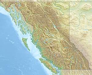 Blackcomb Peak Location in British Columbia | |
| Location | British Columbia, Canada |
| Parent range | Fitzsimmons Range |
| Topo map | NTC 92J/02 |
| Climbing | |
| First ascent | 1923 Phyllis Munday, Don Munday[1] |
| Easiest route | class 3 |
Blackcomb Peak is a mountain located east of Whistler, British Columbia and forms the boundary between the Whistler Blackcomb ski resort and Garibaldi Provincial Park. Like Whistler Mountain, it is located on the edge of Garibaldi Provincial Park and the ski lifts are often used to access the park, particularly for the Spearhead Traverse.
Several skiing runs are established on the mountain, with Whistler Village at the base of the mountain on the side facing Whistler Mountain, and Blackcomb Village on the face opposite. The 2010 Winter Olympics sliding sports took place on its slopes, with the Whistler Sliding Centre located on it.
-
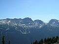
Blackcomb, with the 7th Heaven ski run, after the ski season
-

Blackcomb in 2007, ski run featured

References
- 1 2 3 4 "Blackcomb Peak". Bivouac.com. Retrieved 2007-02-18.