Cypress Provincial Park
| Cypress Provincial Park | |
|---|---|
|
IUCN category II (national park) | |
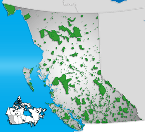
 Location of Cypress Provincial Park in British Columbia | |
| Location | British Columbia, Canada |
| Nearest city | Vancouver |
| Coordinates | 49°23′30″N 123°12′45″W / 49.39167°N 123.21250°WCoordinates: 49°23′30″N 123°12′45″W / 49.39167°N 123.21250°W |
| Area | 30.12 km² |
| Established |
1975 (provincial park) 1982 (Howe Sound added) |
| Governing body | BC Parks |
Cypress Provincial Park is a Provincial Park on the North Shore of Metro Vancouver, British Columbia. The park has two sections: a 21 km² southern section which is accessible by road, and a 9 km² northern section which is only accessible by hiking trails. Most of the park is in West Vancouver.
The southern section of Cypress Provincial Park contains a ski area (Cypress Mountain) that is operated under a Park Use Permit by a private company called Cypress Bowl Recreations Ltd, a subsidiary of Boyne USA. Boyne USA recently sold the ski operation to CNL Income Properties of Florida, USA, but Boyne will continue to run the ski operation for several years under a lease-back agreement.
Winter Season
During the winter, this is a ski area for both cross-country and alpine skiers. The ski operation has four quad (2 are high speed)and two double chairlifts, as well as a tube tow and a magic carpet for their ski school participants. With 53 downhill runs (beginner 23%, intermediate 37%, advanced 40%) and over 19 km of cross-country trails, Cypress Mountain is the largest ski area on Vancouver's North Shore. It also has the highest vertical rise, 613 meters (2010 ft), of the three North Shore ski resorts.
Summer use
In summer and fall, the park is usually free of snow and is popular with hikers. Its trail system includes sections of the Baden-Powell Trail in the southern section of the park, as well as the Howe Sound Crest Trail in the northern section.
Beginning in the summer of 2005, Cypress Mountain Resort has created a lift-assisted mountain bike park, as set out in the 1997 Cypress Provincial Park Master Plan. Even though the lift accessed biking has now been closed for Olympic preparations and they have not yet bothered to restore the trails Cypress still hold many non-lift accessed bike trails. Most of these trails are situated lower down the mountain and are actually not a part of the park because of this they are under threat to development. These Trails on Cypress (Black Mountain Side) are known around the world for being some of the most technically challenging in the world, more challenging than the other two shore mountains (Seymour and Fromme). Trails on Cypress are known as being steep, eroded, and very dangerous. It has multiple rock faces that are close to vertical also having large jumps and drops. Most famous of these is the Brutus Gap, (appearing in many large bike films) it is a step-down drop in excess of 20 feet high and 20 feet long. That being said Cypress does house some more easily ridable trails, still not easy by any means but more accessible. Some of these include: Mystery DH, Stupid Grouse, Slippery Canoe, Upper Tall Cans, Firehose, and Pull Tab. Some of the legendary and most difficult trails are: 5th Horseman, Sex Girl, Shoreplay. One of the original trails is pre-reaper and reaper these are steep trails that used to have some very difficult man made features, sadly most of these were sawed down and destroyed by the government. For more information regarding trails on Cypress there are mountain bike specific maps that include many of the trails and is a great place to start for riding on the mountain.
Major Mountains in the Park
The lower section of the park contains three main mountains that form Cypress Bowl: Mt. Strachan, Black Mountain, and Hollyburn Mountain. The upper, smaller, section includes a series of mountains along a north-south ridge from St. Mark's in the south to Unnecessary Mountain, the Lions, Thomas Peak, David Peak, James Peak, Mt. Harvey, Brunswick Mountain, Hat Mountain, Mt. Hanover, Wettin Peak, Coburg Peak, and Gotha Peak in the far north of the park.
2010 Olympics
A significant part of Vancouver's 2010 Winter Olympics was hosted by Cypress in February 2010, including the Snowboard (Halfpipe, Snowboardcross and Parallel Giant Slalom) and Freestyle Skiing (Moguls and Aerials) events, as well as the recently added Skiercross, which used the Snowboardcross [Boardercross] run, with some modifications. The Freestyle Venue was completed in the Fall of 2006.
External links
- BC Parks Webpage
- Friends of Cypress Provincial Park
- Cypress Mountain Ski Area
- Howe Sound Crest Trail (Outdoor Vancouver)