Big Bear City Airport
| Big Bear City Airport | |||||||||||
|---|---|---|---|---|---|---|---|---|---|---|---|
 | |||||||||||
| IATA: RBF – ICAO: none – FAA LID: L35 | |||||||||||
| Summary | |||||||||||
| Airport type | Public | ||||||||||
| Owner | Big Bear Airport District | ||||||||||
| Location | Big Bear City, California | ||||||||||
| Elevation AMSL | 6,752 ft / 2,058 m | ||||||||||
| Coordinates | 34°15′50″N 116°51′22″W / 34.26389°N 116.85611°W | ||||||||||
| Website | BigBearCityAirport.com | ||||||||||
| Runways | |||||||||||
| |||||||||||
| Statistics (2004) | |||||||||||
| |||||||||||
Big Bear City Airport (IATA: RBF, FAA LID: L35) is a high-altitude public airport located in Big Bear City, San Bernardino County, California, United States.[1]
Facilities and aircraft
Big Bear City Airport covers an area of 117 acres (47 ha) which contains one asphalt paved runway (8/26) measuring 5,850 x 75 ft (1,783 x 23 m).[1]
There is a restaurant in the terminal building. Barnstormer (American cuisine) is open every day from 7AM-3PM for breakfast and lunch. It is open from 5-9PM Thursday through Sunday for dinner.
For the 12-month period ending December 31, 2004, the airport had 30,000 aircraft operations, an average of 82 per day: 93% general aviation and 7% military. There are 141 aircraft based at this airport: 94% single engine, 3% multi-engine, 2% ultralight and 1% glider.[1]
Specific Flight Rules
Big Bear City Airport has published specific flight rules for aircraft. At the time of writing, the established procedure is for inbound traffic to fly in over the ski slopes at 9,500 feet, and for departing traffic to fly at or below 8,500 feet. As this airport is at fairly high altitude and routinely experiences density altitudes of 9,000 feet or higher, it's important (perhaps more than usual) for pilots to double-check the performance tables in their aircraft manuals to ensure that they will be able to take off. The flight rules also contain noise abatement procedures that help the airport, its tenants, and its guests to be better neighbors to the community.
The calm wind runway (26) ends at the eastern terminus of Big Bear Lake. There is no suitable landing area for several miles, as the terrain is covered almost completely with coniferous trees and houses. If an airplane can make it over the lake and past the dam, its pilot will enjoy "instant altitude" - there is a deep fissure between mountain ridges that leads roughly south towards San Bernardino. One must be cautious of possible turbulence and mountain wave/rotor activity in this area, but aside from that, it is an option for pilots who are having trouble climbing or maintaining altitude.
Historical airline service
In 1988, Alpha Air, a commuter airline based in southern California which subsequently became a Trans World Express air carrier flying on behalf of TWA, was operating nonstop service from the airport to Los Angeles International Airport (LAX).[2]
References
- 1 2 3 4 FAA Airport Master Record for L35 (Form 5010 PDF), effective 2007-07-05
- ↑ http://www.departedflights.com, Nov. 18, 1988 Alpha Air route map
External links
- Big Bear City Airport (official site)
- Resources for this airport:
- FAA airport information for L35
- AirNav airport information for L35
- ASN accident history for RBF
- FlightAware airport information and live flight tracker
- SkyVector aeronautical chart for L35
Airports in the Inland Empire | ||
|---|---|---|
| Commercial airports | 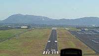 | |
| Towered general aviation airports | ||
| Non-towered general aviation airports | ||
| Military airports | ||