Bhadrawah
| Bhaderwah भद्रवाह भद्रकाशी | |
|---|---|
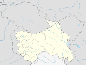 Bhaderwah  Bhaderwah Location in Jammu and Kashmir,India | |
| Coordinates: 32°59′N 75°43′E / 32.98°N 75.72°ECoordinates: 32°59′N 75°43′E / 32.98°N 75.72°E | |
| Country |
|
| State | Jammu and Kashmir |
| District | Doda |
| Elevation | 1,613 m (5,292 ft) |
| Population (2011) | |
| • Total | 11,084 |
| Demonym(s) | Bhadarwahi |
| Time zone | IST (UTC+5:30) |
| Website |
www |
Bhadarwah is a town and tehsil in the Doda district, in the State of Jammu and Kashmir. The town is governed by a Notified Area Council (city council).[1] The Bhadarwah valley is located in the foothills of the Himalayan mountains, 80 km from Batote.The town is endowed with natural beauty which lends to its nickname, mini Kashmir. Apart from the scenic beauty of its forests, the town contains many small streams flowing through its various parts.
History
Bhaderwah is also known as Nagon ki bhoomi, which means "land of snakes."[2] Bhaderwah Town (Nagar Bhaderwah) was known as "Hettary Nagar" and prior to that, there were two other towns namely "Donga Nagar" and "Udho Nagar." Both the Nagar was situated around villages Mondha which is about 3 km to the east of present Bhaderwah town. History tells us that at one point both the Nagars were flooded due to torrential floods from Himalayas, and the presence of the big boulders in abundance available in the present era reveal the story of disaster that occurred then. Later on, the people of Bhaderwah selected a place for their rehabilitation in Seeri (from word "seer" meaning a vast piece of land), now known as Seeri Bazar, a vast field belonging to a Zamindar (farmer) and reconstructed their dwellings around it. Bhaderwah constituency contains various places and villages like Halaran, of Tehsil Thathri of Doda district and all other villages of tehsil Bhaderwah.
Demographics
The town of Bhadarwah has a population 11084.
The religious composition of the tehsil is 74.99% Muslim and 24.71% Hindu.[3]
References
- ↑ Historical Origin Of District Doda Archived December 3, 2008, at the Wayback Machine.
- ↑ "History of Bhaderwah". Retrieved May 6, 2013.
- ↑ http://www.census2011.co.in