Berens River
| Berens River | |
| Country | Canada |
|---|---|
| Provinces | Manitoba, Ontario |
| Part of | Nelson River drainage basin |
| Tributaries | |
| - right | Whitefish River |
| Source | Unnamed lake |
| - location | Kenora District, Ontario |
| - elevation | 407 m (1,335 ft) |
| - coordinates | 51°28′03″N 92°38′18″W / 51.46750°N 92.63833°W |
| Mouth | Lake Winnipeg |
| - location | Census Division 19, Northern Region, Manitoba |
| - elevation | 217 m (712 ft) |
| - coordinates | 52°21′25″N 97°03′04″W / 52.35694°N 97.05111°WCoordinates: 52°21′25″N 97°03′04″W / 52.35694°N 97.05111°W |
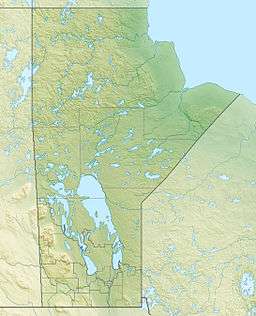 Location of the mouth of the Berens River in Manitoba.
| |
| [1][2] | |
The Berens River is a river in the Provinces of Manitoba and Ontario, Canada. It flows west from an unnamed lake in Kenora District, Ontario and discharges its waters into Lake Winnipeg near the village and First Nation of Berens River, Manitoba. The river has a number of lakes along its course, and many rapids.[1]
History
The river has been a First Nations traditional hunting and fishing area for thousands of years. It was first travelled by European explorers in 1767, who descended the river to Lake Winnipeg after having crossed over from the Severn River.[3] The river was named for Joseph Berens, then governor or the Hudson's Bay Company (HBC). Several HBC posts and one of the Northwest Company were established at the mouth, upriver, and even at the mouth of the Pigeon River further south, the first in 1814.[3] The river system became an HBC trade route.
Natural history
Berens River is one of the last remaining fresh water rivers in southern Canada with very little development, no major roads, and with woodland caribou habitat.
Transportation
The Ontario Government announced funding in 2009 for "…design, surveying, environmental assessments and other steps required before construction can begin" for a permanent bridge on the existing winter road between the all-weather road connecting to Ontario Highway 125 to the south and the Deer Lake First Nation, North Spirit Lake First Nation and Sandy Lake First Nation to the north.[4][5] The bridge would be located on the Berens River east and upstream of Berens Lake.[5]
Settlements
- Berens River, Manitoba
- Little Grand Rapids, Manitoba, on Family Lake about 115 kilometres (71 mi) southeast of the mouth of the river.
- Poplar Hill First Nation, Ontario
- Pikangikum First Nation, Ontario
Tributaries
- Keeper River (left)
- Crooked Mouth River (right)
- Pikangikum Lake
- Dowling River (left)
- Throat River (right)
- Windfall Creek (left)
- Owl Creek (left)
- Mamakwash River (left)
- Whitefish River (right)
- Serpent River (left)
See also
References
- 1 2 "Natural Resources Canada-Canadian Geographical Names (Berens River)". Retrieved 2014-08-29.
- ↑ "Atlas of Canada Toporama". Retrieved 2014-08-29.
- 1 2 Palmer, Gwen (Winter 1973). "Camperville and Duck Bay, Part 1 - Camperville, Berens River". Manitoba Pageant. Manitoba Historical Society. 18 (2). Retrieved 2010-08-19.
- ↑ "New Berens River Bridge Will Benefit First Nations". Ministry of Northern Development, Mines and Forestry. 2009-07-23. Retrieved 2010-08-19.
- 1 2 "District 1 - Kenora / Far West" (PDF). Northern Ontario Winter Roads Map. Ministry of Northern Development, Mines and Forestry]. 2010-07-22. Retrieved 2010-08-19.
- "Berens River". Geographical Names Data Base. Natural Resources Canada. Retrieved 2010-08-19.
- "Topographic Map sheets 52M9, 52M14, 52M15, 52M16, 52N7, 52N10, 52N11, 52N12, 52N13, 52N14, 52N15, 53D1, 53D2, 53D3, 53D4, 63A1, 63A2, 63A6, 63A7". Atlas of Canada. Natural Resources Canada. 2010-02-04. Archived from the original on 2010-08-03. Retrieved 2010-08-19.