Berens River, Manitoba
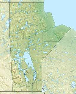
Berens River is located in Manitoba, Canada, along the eastern shore of Lake Winnipeg. This community is near the mouth of the Berens River, which flows west from the Ontario headwaters.
The community is accessible only by winter road, boat, or airplane. Recently a project has been announced to construct a dual-lane highway from Bloodvein, connecting Berens River to the continental road system.[1]
The First Nation and fur trade community there was officially started in the 19th century, but the spot was a traditional hunting and fishing area for thousands of years. The two communities create a population centre also called Berens River. Both are served by the Berens River Airport.
Demographics
In the 2011 Census, the Berens River designated place had a population of 111 living in 28 of its 31 total private dwellings.[2] According to the 2011 Canada Census, the bordering Berens River 13 reserve of the Berens River First Nation had a population of 1,028.[3]
Climate
Berens River experiences a humid continental climate (Dfb). The highest temperature ever recorded in Berens River was 40.0 °C (104 °F) on 11 July 1936.[4] The coldest temperature ever recorded was −47.2 °C (−53 °F) on 28 December 1933.[5]
| Climate data for Berens River, 1981−2010 normals, extremes 1905−present | |||||||||||||
|---|---|---|---|---|---|---|---|---|---|---|---|---|---|
| Month | Jan | Feb | Mar | Apr | May | Jun | Jul | Aug | Sep | Oct | Nov | Dec | Year |
| Record high °C (°F) | 7.1 (44.8) |
10.0 (50) |
21.9 (71.4) |
28.9 (84) |
32.2 (90) |
39.4 (102.9) |
40.0 (104) |
35.6 (96.1) |
32.2 (90) |
28.3 (82.9) |
20.6 (69.1) |
8.3 (46.9) |
40.0 (104) |
| Average high °C (°F) | −13.8 (7.2) |
−10.4 (13.3) |
−3.1 (26.4) |
7.0 (44.6) |
14.8 (58.6) |
20.8 (69.4) |
23.3 (73.9) |
22.1 (71.8) |
15.8 (60.4) |
7.4 (45.3) |
−2.5 (27.5) |
−10.3 (13.5) |
5.9 (42.6) |
| Daily mean °C (°F) | −18.9 (−2) |
−16.2 (2.8) |
−9.2 (15.4) |
1.1 (34) |
8.6 (47.5) |
14.9 (58.8) |
17.7 (63.9) |
16.5 (61.7) |
10.6 (51.1) |
3.2 (37.8) |
−6.5 (20.3) |
−15.0 (5) |
0.6 (33.1) |
| Average low °C (°F) | −23.9 (−11) |
−22.0 (−7.6) |
−15.3 (4.5) |
−4.8 (23.4) |
2.5 (36.5) |
8.9 (48) |
12.1 (53.8) |
10.8 (51.4) |
5.5 (41.9) |
−1.0 (30.2) |
−10.4 (13.3) |
−19.7 (−3.5) |
−4.8 (23.4) |
| Record low °C (°F) | −46.7 (−52.1) |
−45.0 (−49) |
−42.9 (−45.2) |
−34.4 (−29.9) |
−17.8 (0) |
−6.1 (21) |
−2.8 (27) |
−2.8 (27) |
−9.4 (15.1) |
−18.9 (−2) |
−36.8 (−34.2) |
−47.2 (−53) |
−47.2 (−53) |
| Average precipitation mm (inches) | 17.9 (0.705) |
12.3 (0.484) |
23.7 (0.933) |
23.4 (0.921) |
45.8 (1.803) |
60.4 (2.378) |
52.2 (2.055) |
72.2 (2.843) |
63.4 (2.496) |
47.3 (1.862) |
31.2 (1.228) |
19.9 (0.783) |
469.8 (18.496) |
| Average rainfall mm (inches) | 0.1 (0.004) |
0.9 (0.035) |
7.8 (0.307) |
17.0 (0.669) |
43.7 (1.72) |
60.4 (2.378) |
52.2 (2.055) |
72.2 (2.843) |
63.2 (2.488) |
35.4 (1.394) |
8.2 (0.323) |
0.3 (0.012) |
361.3 (14.224) |
| Average snowfall cm (inches) | 20.7 (8.15) |
13.3 (5.24) |
17.6 (6.93) |
6.7 (2.64) |
2.2 (0.87) |
0.0 (0) |
0.0 (0) |
0.0 (0) |
0.3 (0.12) |
13.0 (5.12) |
26.7 (10.51) |
22.7 (8.94) |
123.1 (48.46) |
| Average precipitation days (≥ 0.2 mm) | 10.3 | 9.3 | 9.1 | 11.2 | 11.5 | 11.2 | 9.7 | 8.6 | 5.9 | 7.3 | 12.6 | 12.1 | 118.8 |
| Mean monthly sunshine hours | 89.8 | 123.2 | 173.2 | 222.0 | 274.9 | 277.9 | 257.5 | 269.7 | 161.1 | 107.5 | 60.3 | 69.0 | 2,086.1 |
| Percent possible sunshine | 35.0 | 44.2 | 47.2 | 53.3 | 56.5 | 55.5 | 51.1 | 59.2 | 42.2 | 32.5 | 22.8 | 28.6 | 44.0 |
| Source: Environment Canada[6][7][8] | |||||||||||||
References
- ↑ "PROVINCE ANNOUNCES MAJOR INVESTMENT IN ALL-SEASON ROAD TO CONNECT EAST SIDE COMMUNITIES", East Side Road Authority, Retrieved 2010-06-17
- ↑ "Corrections and updates: Population and dwelling count amendments, 2011 Census". Statistics Canada. February 14, 2013. Retrieved February 16, 2013.
- ↑ "2011 Census Statistics Canada". Retrieved 2013-04-02.
- ↑ "Daily Data Report for July 1936". Environment Canada. Retrieved 17 November 2016.
- ↑ "Daily Data Report for December 1933". Environment Canada. Retrieved 17 November 2016.
- ↑ "Calculation Information for 1981 to 2010 Canadian Normals Data". Environment Canada. Retrieved October 24, 2014.
- ↑ "Berens River". Environment Canada. Retrieved 17 November 2016.
- ↑ "Berens River CS". Environment Canada. Retrieved 17 November 2016.
Coordinates: 52°21′50″N 97°01′37″W / 52.364°N 97.027°W