Benton Township, Franklin County, Illinois
| Benton Township | |
|---|---|
| Township | |
 Location in Franklin County | |
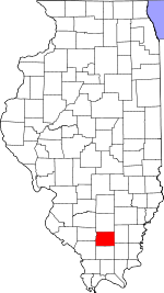 Franklin County's location in Illinois | |
| Coordinates: 37°59′44″N 88°52′09″W / 37.99556°N 88.86917°WCoordinates: 37°59′44″N 88°52′09″W / 37.99556°N 88.86917°W | |
| Country | United States |
| State | Illinois |
| County | Franklin |
| Established | November 4, 1884 |
| Area | |
| • Total | 36.72 sq mi (95.1 km2) |
| • Land | 36.12 sq mi (93.6 km2) |
| • Water | 0.59 sq mi (1.5 km2) 1.61% |
| Elevation | 387 ft (118 m) |
| Population (2010) | |
| • Total | 8,972 |
| • Density | 248.4/sq mi (95.9/km2) |
| Time zone | CST (UTC-6) |
| • Summer (DST) | CDT (UTC-5) |
| ZIP codes | 62812, 62890, 62896 |
| GNIS feature ID | 0428659 |
Benton Township is one of twelve townships in Franklin County, Illinois, USA. As of the 2010 census, its population was 8,972 and it contained 4,220 housing units.[1]
Geography
According to the 2010 census, the township has a total area of 36.72 square miles (95.1 km2), of which 36.12 square miles (93.6 km2) (or 98.37%) is land and 0.59 square miles (1.5 km2) (or 1.61%) is water.[1]
Cities, towns, villages
Unincorporated towns
Extinct towns
- Groat
- Logan
- Smothersville
Cemeteries
The township contains these nine cemeteries: Baxter, County Farm, Drummond, Franklin, Masonic-Oddfellow, Memorial Park, New Union, Rea and Swofford.
Major highways
Airports and landing strips
- Bessie RLA Airport
Lakes
- Vernons Lake
Political districts
- Illinois' 12th congressional district
- State House District 117
- State Senate District 59
Notes
- 1 2 "Population, Housing Units, Area, and Density: 2010 - County -- County Subdivision and Place -- 2010 Census Summary File 1". United States Census. Retrieved 2013-05-28.
Adjacent townships
- Ewing Township (north)
- Northern Township (northeast)
- Eastern Township (east)
- Cave Township (southeast)
- Frankfort Township (south)
- Denning Township (southwest)
- Browning Township (west)
- Browning Township (northwest)
References
- "Benton Township, Franklin County, Illinois". Geographic Names Information System. United States Geological Survey. Retrieved 2010-01-16.
- United States Census Bureau 2007 TIGER/Line Shapefiles
- United States National Atlas
External links
This article is issued from Wikipedia - version of the 10/31/2016. The text is available under the Creative Commons Attribution/Share Alike but additional terms may apply for the media files.