Belrose, New South Wales
| Belrose Sydney, New South Wales | |||||||||||||
|---|---|---|---|---|---|---|---|---|---|---|---|---|---|
 Austlink Business Park | |||||||||||||
| Population | 8,288 (2011 census)[1] | ||||||||||||
| Postcode(s) | 2085 | ||||||||||||
| Location | 19 km (12 mi) north-east of Sydney CBD | ||||||||||||
| LGA(s) | Northern Beaches Council | ||||||||||||
| |||||||||||||
Belrose is a suburb of the Northern Beaches, Sydney in the state of New South Wales, Australia 19 kilometres north-east of the Sydney central business district in the local government area of Northern Beaches Council. It is part of the Northern Beaches region. Belrose is also considered to be part of the Forest District, colloquially known as The Forest.
History
Belrose Post Office opened on 4 September 1923 and closed in 1986. Belrose West Post Office opened on 1 July 1969.[2]
The name 'Belrose' is said to be derived from the combination of two plant names the Christmas Bell and the bush rose which were predominant in the area.
Demographics
According to the 2011 census of Population, there were 8,288 residents in Belrose. 70.5% of residents were born in Australia. The most common other countries of birth were England 7.8%, South Africa 2.2% and New Zealand 1.7%. 83.6% of residents spoke only English at home. Other languages spoken at home included Armenian 3.3%, Cantonese 1.3% and Mandarin 1.0%. The most common responses for religious affiliation were Anglican 28.1%, Catholic 25.3% and No Religion 16.6%.[1]
Commercial area
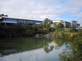
Belrose is primarily a residential area, but contains the Austlink Business Park, two shopping centres including Glenrose Village Shopping Centre (formerly Stockland Glenrose) and Belrose Village Shopping Centre. Belrose also has Glen St theatre,[3] and Belrose library.
There is also a Homemakers Supacenta with over 35 shops including established retailers such as Harvey Norman, Nick Scali Furniture, and JB Hi-Fi.[4]
Optus satellite communications facility is located in Belrose, where Optus manages its five satellites currently in orbit.[5]
Schools
Belrose is home to a number of schools:
- Belrose Public School
- Wakehurst Public School
- Covenant Christian School
- Kamaroi Rudolf Steiner School
- John Colet School
- Yanginanook School
Parks, sport and recreation
Garigal National Park and Ku-ring-gai Chase National Park are on the northern border.
Playing fields in Belrose include the Lionel Watts Oval, a sporting ground for children, and Frenchs Forest Showground, both on the border with Frenchs Forest.
BTH Raiders is the local soccer club, encompassing Belrose and Terrey Hills. The main oval is Wyatt Oval, but BTH also uses Terrey Hills ovals. More than 900 players are in the local club and it has a vibrant over-35 competition.
Belrose is home to at least two sets of Tennis courts including; The Belrose Tennis club [6] and Wyatt Reserve tennis courts.[7]
Belrose is also home to the Belrose Bowling club.[8]
Notable residents
- Paul Hogan, comedian and actor, star of movie "Crocodile Dundee" (former resident)
- INXS
- Jason King, rugby league player, Manly Warringah Sea Eagles prop.
- Lucas Neill, Socceroos Captain, played for the local club, Wakehurst in his youth
- Geoff Toovey, former rugby league player, Manly Warringah Sea Eagles legend & former head coach.
- Peter Lynch, head of Media Planet, a global media empire.
- Kieran Foran, professional rugby league footballer who currently plays for the Parramatta Eels.
References
- 1 2 Australian Bureau of Statistics (31 October 2012). "Belrose (State Suburb)". 2011 Census QuickStats. Retrieved 29 April 2013.
- ↑ Premier Postal History. "Post Office List". Premier Postal Auctions. Retrieved 12 June 2012.
- ↑ "Glen Street Theatre".
- ↑ "Supacenta Belrose".
- ↑ Taylor, Josh (13 July 2011). "Optus satellite facility tour: photos". ZDnet. Retrieved 13 July 2011.
- ↑ Belrose Tennis Club http://www.belrosetennisclub.com.au/
- ↑ http://www.warringah.nsw.gov.au/play/wyatt-reserve-tennis-club
- ↑ "Belrose Bowling Club".
Coordinates: 33°43′48″S 151°13′12″E / 33.730°S 151.220°E