Bellingen, Rhineland-Palatinate
| Bellingen | ||
|---|---|---|
| ||
 Bellingen | ||
Location of Bellingen within Westerwaldkreis district 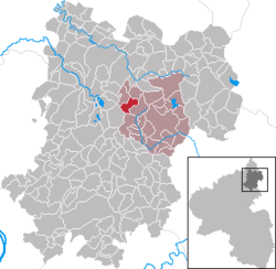 | ||
| Coordinates: 50°35′31″N 7°54′25″E / 50.59194°N 7.90694°ECoordinates: 50°35′31″N 7°54′25″E / 50.59194°N 7.90694°E | ||
| Country | Germany | |
| State | Rhineland-Palatinate | |
| District | Westerwaldkreis | |
| Municipal assoc. | Westerburg | |
| Government | ||
| • Mayor | Gerhard Kornab | |
| Area | ||
| • Total | 4.29 km2 (1.66 sq mi) | |
| Population (2015-12-31)[1] | ||
| • Total | 618 | |
| • Density | 140/km2 (370/sq mi) | |
| Time zone | CET/CEST (UTC+1/+2) | |
| Postal codes | 56459 | |
| Dialling codes | 02663 | |
| Vehicle registration | WW | |
| Website | www.bellingen.de | |
.svg.png)
Bellingen is an Ortsgemeinde – a community belonging to a Verbandsgemeinde – in the Westerwaldkreis in Rhineland-Palatinate, Germany.
Geography
Bellingen lies in a hollow northwest of Westerburg. Since 1972 it has belonged to what was then the newly founded Verbandsgemeinde of Westerburg, a kind of collective municipality.
Politics
Community council
The council is made up of 8 council members, including the extraofficial mayor (Bürgermeister), who were elected in a majority vote in a municipal election on 7 June 2009.
Economy and infrastructure
Transport
South of the community runs Bundesstraße 255, leading from Montabaur to Herborn. The nearest Autobahn interchange is Montabaur on the A 3. The nearest InterCityExpress stop is the railway station at Montabaur on the Cologne-Frankfurt high-speed rail line.
References
- ↑ "Gemeinden in Deutschland mit Bevölkerung am 31. Dezember 2015" (PDF). Statistisches Bundesamt (in German). 2016.
External links
This article is issued from Wikipedia - version of the 10/30/2016. The text is available under the Creative Commons Attribution/Share Alike but additional terms may apply for the media files.