Bayfield (town), Wisconsin
| Bayfield, Wisconsin | |
|---|---|
| Town | |
|
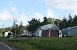
Town garage | |
| Coordinates: 46°50′21″N 90°55′23″W / 46.83917°N 90.92306°WCoordinates: 46°50′21″N 90°55′23″W / 46.83917°N 90.92306°W | |
| Country | United States |
| State | Wisconsin |
| County | Bayfield |
| Area | |
| • Total | 134.0 sq mi (347.0 km2) |
| • Land | 89.2 sq mi (230.9 km2) |
| • Water | 44.8 sq mi (116.1 km2) |
| Elevation[1] | 794 ft (242 m) |
| Population (2010) | |
| • Total | 680 |
| • Density | 8/sq mi (2.9/km2) |
| Time zone | Central (CST) (UTC-6) |
| • Summer (DST) | CDT (UTC-5) |
| Area code(s) | 715 & 534 |
| FIPS code | 55-05375[2] |
| GNIS feature ID | 1582765[1] |
| Website |
www |
Bayfield is a town in Bayfield County, Wisconsin, United States. The population was 680 at the 2010 census.[3] The unincorporated communities of Pureair and Salmo are located in the town, as are Eagle Island and Sand Island of the Apostle Islands.
Transportation
Wisconsin Highway 13 serves as a main arterial route in the community.
Geography
The town of Bayfield has the shape of a capital "L", extending north into the main body of Lake Superior and east into a channel of the lake between the mainland and Madeline Island. The city of Bayfield is located on the shore of Lake Superior and surrounded by the eastern leg of the town.
According to the United States Census Bureau, the town has a total area of 134.0 square miles (347.0 km2), of which 89.2 square miles (230.9 km2) is land and 44.8 square miles (116.1 km2), or 33.45%, is water.[3]
Demographics
As of the census[2] of 2000, there were 625 people, 261 households, and 194 families residing in the town. The population density was 7.0 people per square mile (2.7/km2). There were 491 housing units at an average density of 5.5 per square mile (2.1/km2). The racial makeup of the town was 79.52% White, 14.72% Native American, 0.16% Asian, 0.48% from other races, and 5.12% from two or more races. Hispanic or Latino of any race were 1.12% of the population.
There were 261 households out of which 26.4% had children under the age of 18 living with them, 60.5% were married couples living together, 8.0% had a female householder with no husband present, and 25.3% were non-families. 18.8% of all households were made up of individuals and 4.6% had someone living alone who was 65 years of age or older. The average household size was 2.38 and the average family size was 2.67.
In the town the population was spread out with 22.4% under the age of 18, 5.0% from 18 to 24, 23.7% from 25 to 44, 35.4% from 45 to 64, and 13.6% who were 65 years of age or older. The median age was 44 years. For every 100 females there were 107.0 males. For every 100 females age 18 and over, there were 108.2 males.
The median income for a household in the town was $39,342, and the median income for a family was $42,750. Males had a median income of $33,750 versus $25,179 for females. The per capita income for the town was $17,890. About 6.6% of families and 9.1% of the population were below the poverty line, including 4.0% of those under age 18 and 8.1% of those age 65 or over.
References
- 1 2 "US Board on Geographic Names". United States Geological Survey. 2007-10-25. Retrieved 2008-01-31.
- 1 2 "American FactFinder". United States Census Bureau. Archived from the original on 2013-09-11. Retrieved 2008-01-31.
- 1 2 "Geographic Identifiers: 2010 Demographic Profile Data (G001): Bayfield town, Bayfield County, Wisconsin". U.S. Census Bureau, American Factfinder. Retrieved 2014-05-08.
External links
| Communities |  | |
|---|---|---|
| Related Geographic Aspects | ||
| Local Native American Tribes | ||
Municipalities and communities of Bayfield County, Wisconsin, United States | ||
|---|---|---|
| Cities | 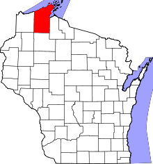 | |
| Village | ||
| Towns | ||
| CDPs | ||
| Unincorporated communities | ||
| Indian reservation | ||
| Footnotes | ‡This populated place also has portions in an adjacent county or counties | |