Baskin, Louisiana
| Baskin, Louisiana | |
| Village | |
 Baskin Veterans Memorial | |
| Country | United States |
|---|---|
| State | Louisiana |
| Parish | Franklin |
| Elevation | 72 ft (21.9 m) |
| Coordinates | 32°15′27″N 91°44′47″W / 32.25750°N 91.74639°WCoordinates: 32°15′27″N 91°44′47″W / 32.25750°N 91.74639°W |
| Area | 1.33 sq mi (3.44 km2) |
| - land | 1.33 sq mi (3 km2) |
| - water | 0.0 sq mi (0 km2), 0% |
| Population | 254 (2010) |
| Density | 191.0/sq mi (73.7/km2) |
| Timezone | CST (UTC-6) |
| - summer (DST) | CDT (UTC-5) |
| Area code | 318 |
 Location in Franklin Parish and the state of Louisiana.
| |
.svg.png) Location of Louisiana in the United States
| |
Baskin is a village in Franklin Parish, Louisiana, United States. The population was 254 at the 2010 census,[1] up from 188 at the 2000 census. Baskin is located north of the parish seat of Winnsboro.
History
Baskin was named in honor of Dr. Adolphus McDuffie Baskin, a pioneer settler.[2]
Baskin holds the dubious distinction of being the town in Louisiana which derives the most revenue from traffic fines and forfeitures, according to the Louisiana Legislative Auditor. Traffic fines and forfeitures account for 84% of the town's budget.[3]
Geography
Baskin is located in northwestern Franklin Parish at 32°15′27″N 91°44′47″W / 32.25750°N 91.74639°W (32.257544, -91.746378),[4] along U.S. Route 425, which leads south 7 miles (11 km) to Winnsboro and north 16 miles (26 km) to Rayville.
According to the United States Census Bureau, the village has a total area of 1.33 square miles (3.45 km2), all land.[1]
Demographics
| Historical population | |||
|---|---|---|---|
| Census | Pop. | %± | |
| 1920 | 654 | — | |
| 1930 | 416 | −36.4% | |
| 1940 | 330 | −20.7% | |
| 1950 | 117 | −64.5% | |
| 1960 | 238 | 103.4% | |
| 1970 | 177 | −25.6% | |
| 1980 | 286 | 61.6% | |
| 1990 | 243 | −15.0% | |
| 2000 | 188 | −22.6% | |
| 2010 | 254 | 35.1% | |
| Est. 2015 | 247 | [5] | −2.8% |
As of the census[7] of 2000, there were 188 people, 77 households, and 47 families residing in the village. The population density was 140.6 inhabitants per square mile (54.2/km²). There were 86 housing units at an average density of 64.3 per square mile (24.8/km²). The racial makeup of the village was 94.68% White, 2.66% African American, 0.53% Native American, and 2.13% from two or more races. Hispanic or Latino of any race were 0.53% of the population.
There were 77 households out of which 32.5% had children under the age of 18 living with them, 48.1% were married couples living together, 9.1% had a female householder with no husband present, and 37.7% were non-families. 33.8% of all households were made up of individuals and 26.0% had someone living alone who was 65 years of age or older. The average household size was 2.36 and the average family size was 3.04.
In the village, the population was spread out with 26.6% under the age of 18, 5.9% from 18 to 24, 25.0% from 25 to 44, 21.3% from 45 to 64, and 21.3% who were 65 years of age or older. The median age was 42 years. For every 100 females there were 77.4 males. For every 100 females age 18 and over, there were 72.5 males.
The median income for a household in the village was $18,000, and the median income for a family was $31,875. Males had a median income of $26,250 versus $12,321 for females. The per capita income for the village was $16,034. About 22.0% of families and 24.3% of the population were below the poverty line, including 22.2% of those under the age of eighteen and 31.7% of those sixty five or over.
Sports
The Baskin High School women's basketball team holds the record for longest winning streak in organized sports. The Lady Rams won 218 consecutive games from 1948 to 1953—a span of six years. Once the streak was broken, another 71 game streak continued. In the span of ten years, the Lady Rams led by Hall of Fame coach, Edna "Tiny" Tarbutton, would go 315 and 2 with 9 state titles and an average winning margin of more than 30 points. In 1993, Tarbutton was inducted into the Louisiana Sports Hall of Fame located in Natchitoches.
References
- 1 2 "Geographic Identifiers: 2010 Census Summary File 1 (G001), Baskin village, Louisiana". American FactFinder. U.S. Census Bureau. Retrieved May 26, 2016.
- ↑ Leeper, Clare D'Artois (19 October 2012). Louisiana Place Names: Popular, Unusual, and Forgotten Stories of Towns, Cities, Plantations, Bayous, and Even Some Cemeteries. LSU Press. p. 29. ISBN 978-0-8071-4740-5.
- ↑ Sentell, Will (Apr 22, 2008). "Bill to limit speed traps curbed (archived)". Advocate Capitol News Bureau. Archived from the original on May 22, 2011. Retrieved 17 August 2014.
- ↑ "US Gazetteer files: 2010, 2000, and 1990". United States Census Bureau. 2011-02-12. Retrieved 2011-04-23.
- ↑ "Annual Estimates of the Resident Population for Incorporated Places: April 1, 2010 to July 1, 2015". Retrieved July 2, 2016.
- ↑ "Census of Population and Housing". Census.gov. Archived from the original on May 11, 2015. Retrieved June 4, 2015.
- ↑ "American FactFinder". United States Census Bureau. Archived from the original on 2013-09-11. Retrieved 2008-01-31.
External links
- Baskin Progress Community Progress Site for Baskin, LA
Municipalities and communities of Franklin Parish, Louisiana, United States | ||
|---|---|---|
| City | 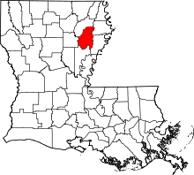 | |
| Town | ||
| Villages | ||
| Unincorporated communities | ||