Barton Stacey
| Barton Stacey | |
 Barton Stacey |
|
| Population | 892 (2001 Census) |
|---|---|
| OS grid reference | SU435415 |
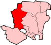
| District | Test Valley |
| Shire county | Hampshire |
| Region | South East |
| Country | England |
| Sovereign state | United Kingdom |
| Post town | Winchester |
| Postcode district | SO21 |
| Dialling code | 01962, 01264 |
| Police | Hampshire |
| Fire | Hampshire |
| Ambulance | South Central |
| EU Parliament | South East England |
| UK Parliament | Romsey |
Coordinates: 51°10′00″N 1°22′00″W / 51.166667°N 1.366667°W
Barton Stacey is a village and civil parish in the Test Valley district of Hampshire, England, situated about 7 miles (11 km) south-east of Andover. It is bounded by the A303 road some way to the north and the A30 to the south; both roads carrying traffic east-west between London and the West. At Bullington, to the east, the A34 road runs north-south from Southampton to The Midlands.
Civil parish
The total area of the civil parish is 5,027 acres (20,340,000 m2). It has a population of 892 living in 341 households.[1] The civil parish includes the village of Barton Stacey, and the hamlets of Cocum, Bransbury, Newton Stacey, and Drayton.
Geography
Barton Stacey itself lies in two parts. The original village comprises Kings Elms, Gravel Lane and The Street, situated around the church.
In 1943 the War Department (now MOD) purchased 2106.556 acres (852.5 hectares) to the North, East and South of the village for £24,000 for use as a military training area. Four army camps were developed at Drayton: 'A' 'B' & 'C' Camps to the north of the A303 and 'D' Camp to the south, east of the road from the village to Longparish. All of the original buildings are long gone, though many of the roadways and hard-standings remain visible and these areas are now vacant.
At either end of Roberts Road there are two pieces of woodland, both MOD property, but many villagers use the footpaths that have been made over the years to walk through these magnificent woodland areas. Much of the remainder of the MOD land is now rented to a local farmer.
Nearby to the north-east is a newer part, which lies along Roberts Road, East Road and West Road. This area was built in the 1950s by the MOD as married quarters for some of the troops that had been posted to the camps. From 1987 the MOD sold many of these houses privately, keeping some in West Road for military personnel. Since then only a few houses have been built in the area, all privately constructed. In 2006/2007 four flats were constructed on the edge of Roman Way, in Roberts Road. A plan exists to build some low-cost housing on land currently owned by the MOD.
The village has one primary school with around 96 students. It also has activity clubs that include a Choir, a Judo Club, a Football Club, two Drama Clubs and a Tuesday Club.
Cocum lies to the south, a farm and buildings, and incorporates a military small-arms firing range, situated to the north of the A30 road.
South of the A303 at Drayton is Barton Stacey Services, a Trunk Road Service Area accessible by westbound traffic only. This area was formerly known as Drayton Filling Station, having been developed from a parcel of MOD land in 1959.
Bransbury is to the west of Drayton, accessible by either turning south off the A303 or by taking a narrow lane westwards from the church, then a right turn. Here we find a 'mill' building alongside the river. On that narrow lane westwards from the church, but straight on from the junction, we find the hamlet of Newton Stacey.
Religious buildings
The All Saints Church in the village is situated to the west of the village opposite the start of Bullington Lane. The church is renowned to be one of the oldest in England, dating in part from the 11th century; it is mentioned in the Domesday Book.
Education
The local school, Barton Stacey C.E Primary, is also located at the end of The Green.
Sport
Recreation ground
The recreation ground is situated in the west of the village and contains two football pitches, a pavilion and a play park. There is a small car park in front of the village shop which is used as parking.
The Football Club
Barton Stacey Football Club was established in 1919 and plays and trains on the Barton Stacey recreational ground. The club currently field four youth teams at U8, U9, U13 and U15 and a senior side.
Economy
Local businesses
The Trunk Road Service Area 'Barton Stacey Services' comprises a Park Homes site of seven occupied units, a petrol filling station, a roadside restaurant and associated motel, together with a vehicle repair workshops business. The village once had two pubs: the Swan Inn and The Plough, which is now a private house.
References
- ↑ 2001 census
External links
| Wikimedia Commons has media related to Barton Stacey. |
- Barton Stacey community web site
- Barton Stacey Parish Council
- Photo of the old Plough Inn (Closed Pubs website)
- Barton [Stacey] in the Domesday Book