Upper Clatford

Coordinates: 51°11′35″N 1°29′45″W / 51.193118°N 1.495712°W
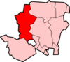
Upper Clatford is a village in Hampshire, England.[1] The village lies in the valley of the River Anton, several miles upstream of the point where it joins the River Test, just to the south of Andover. Clatford is an old English term meaning 'the ford where the burdock grows'. The local parish Church of All Saints was first built probably during the reign of Henry I (1100-1135) as its massive columns and round arches are typical of the first half of the 12th century. It was rebuilt in the 16th century and transformed into an 'auditory church' in the 17th century. Even so, a large proportion of the congregation still cannot see the altar. The Church rests between two arms of the Pillhill Brook; the village war memorial is also within its grounds.
The village historically had 4 manors: Norman Court, Sackville Court, Clatford Manor and Clatford Mills.
The village is within walking distance of Andover town centre and the most direct route is to follow the path of the old railway line which is now a public footpath. Along this route there is much evidence of the old railway line though little to be seen of the earlier canal that preceded the railway.[2] The canal and later railway were very important to the local economy in particular for the transport of raw materials from Southampton via Andover to Upper Clatford for Taskers of Andover whose premises were located in nearby Anna Valley. Pig Iron was shipped from Southampton via the canal to Taskers Wharf, originally located where the footpath now leaves Upper Clatford for Andover.
Local attractions are a number of traditionally thatched cottages and houses including the premises of the local public house The Crook & Shears. Following the road south out of the village leads to the twin village of Goodworth Clatford (formerly Lower Clatford).
References
- ↑ Ordnance Survey: Landranger map sheet 185 Winchester & Basingstoke (Andover & Romsey) (Map). Ordnance Survey. 2013. ISBN 9780319228845.
- ↑ "Andover's lost canal". www.andover.towncentral.co.uk. Retrieved 8 April 2016.
Taskers of Andover - A History
See also
External links
![]() Media related to Upper Clatford at Wikimedia Commons
Media related to Upper Clatford at Wikimedia Commons