Barton Knob
| Barton Knob | |
| Summit | |
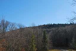 View looking south towards Barton Knob | |
| Country | United States |
|---|---|
| State | West Virginia |
| County | Randolph |
| Part of | Cheat Mountain |
| Elevation | 4,434 ft (1,351.5 m) [1] |
| Prominence | 574 ft (175.0 m) [1] |
| Coordinates | 38°37′01″N 79°55′47″W / 38.61694°N 79.92972°WCoordinates: 38°37′01″N 79°55′47″W / 38.61694°N 79.92972°W |
| Management | Monongahela National Forest |
| Owner | USDA Forest Service |
| Easiest access | hike from |
| Topo map | USGS Snyder Knob |
| Nearest city | Huttonsville, West Virginia |
 Location of Barton Knob in West Virginia
| |
Barton Knob is a mountain summit located on Cheat Mountain in southeastern Randolph County, West Virginia. Easily accessible during warm-weather months, Bickle Knob is also home to one of the few remaining fire towers in Monongahela National Forest.
Fire Tower

One of the most notable features is its fire tower, which has graced the top of the mountain since at least 1939.[2] While the tower is still As of September 2016, it has been abandoned and is no longer safe to climb. In June 2010, the U.S. Forest Service planned to remove the tower as part of a project to construct a radio repeater on Barton Knob.[3] The radio repeater was installed by May 2012 adjacent to the tower, which was not removed.[4]
Strip mining
The area surrounding Barton Knob is also notable for having been strip mined prior to its acquisition by Monongahela National Forest as part of the Mower Tract in 1986.[5] Today, MNF's Strip Mine Trail (Trail #350) traverses much of the area mined on the south side of Barton Knob and a ledge created continuing east along Cheat Mountain.
Rainbow Gathering
In 2005, the Rainbow Gathering considered using (and some may have used) strip-mined land near Barton Knob after being displaced from the original meeting site near Alpena.
Forest restoration
In late 2010, the Forest Service designated a 90-acre (36 ha) section of Barton Knob as the Barton Bench Ecological Restoration Site. After strip mining, the land had been replanted with non-native grasses to protect the soil. This also led to an arresting of ecological development as the grasses kept out any native growths. The Forest Service is conducting experiments on various ways to restart ecological succession on the site with an eye towards eventual reforestation with native red spruce and hardwood trees.[6]
See also
- Bickle Knob, an open Monongahela National Forest observation tower
- Olson Observation Tower, another Monongahela National Forest observation tower
- Cheat Mountain, on which Barton Knob sits
- Monongahela National Forest
References
- 1 2 "West Virginia Summits". PeakList.org. Archived from the original on November 30, 2008. Retrieved November 8, 2008.
- ↑ Monongahela National Forest visitor map (Map). USDA Forest Service. 1939.
- ↑ Ede, David (June 9, 2010). "Reply from David Ede of Monongahela National Forest to Andy FitzGibbon on plans for Barton Knob fire tower" (PDF). Retrieved November 2, 2016.
- ↑ Powell, Brian (May 11, 2012). "Barton Knob Fire Tower and Repeater". Wikimedia Commons. Retrieved November 2, 2016.
- ↑ de Hart, Allen (2006). Sundquist, Bruce, ed. Monongahela National Forest Hiking Guide (8th ed.). West Virginia Highlands Conservancy.
- ↑ Steelhammer, Rick (November 6, 2010). "Sprucing up the Monongahela". Charleston Gazette. Archived from the original on November 6, 2010. Retrieved November 6, 2010.