Elk River (West Virginia)
| Elk River | |
| River | |
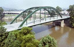 Elk River in Charleston, West Virginia. | |
| Country | United States |
|---|---|
| State | West Virginia |
| Counties | Pocahontas, Randolph, Webster, Braxton, Clay, Kanawha |
| Tributaries | |
| - left | Birch River |
| - right | Holly River |
| Source | Old Field Fork [1] |
| - location | Elk Mountain, Pocahontas County, WV |
| - elevation | 3,557 ft (1,084 m) [2] |
| - coordinates | 38°18′24″N 80°06′18″W / 38.30667°N 80.10500°W |
| Secondary source | Big Spring Fork [3] |
| - location | Pocahontas County, WV |
| - elevation | 3,655 ft (1,114 m) [4] |
| - coordinates | 38°22′32″N 80°00′34″W / 38.37556°N 80.00944°W |
| Source confluence | |
| - location | Slatyfork, WV |
| - elevation | 2,667 ft (813 m) [5] |
| - coordinates | 38°25′08″N 80°07′48″W / 38.41889°N 80.13000°W |
| Mouth | Kanawha River [6] |
| - location | Charleston, WV |
| - elevation | 574 ft (175 m) |
| - coordinates | 38°21′18″N 81°38′42″W / 38.35500°N 81.64500°WCoordinates: 38°21′18″N 81°38′42″W / 38.35500°N 81.64500°W |
| Length | 172 mi (277 km) [7] |
| Discharge | for Queen Shoals, WV |
| - average | 2,650 cu ft/s (75 m3/s) [8] |
| - max | 14,000 cu ft/s (396 m3/s) (1972) |
| - min | 271 cu ft/s (8 m3/s) (1976) |
 A map of the Elk River and its watershed. | |
The Elk River is a tributary of the Kanawha River, 172 miles (277 km) long,[7] in central West Virginia in the United States. Via the Kanawha and Ohio rivers, it is part of the watershed of the Mississippi River.
Course
The Elk is formed in the Allegheny Mountains in Pocahontas County by the confluence of two short streams, the Big Spring Fork and the Old Field Fork, which join near the community of Slatyfork. It flows above ground for several miles before it sinks into a network of caverns and flows underground for more than five miles. The old riverbed of solid rock, however, remains above ground in this section known as "The Dries." It follows a generally westward course across the unglaciated Allegheny Plateau, through Randolph, Webster, Braxton, Clay, and Kanawha Counties, past the towns of Webster Springs, Sutton, Gassaway, Clay, Clendenin, and Elkview before joining the Kanawha River at Charleston.
At Sutton, a U.S. Army Corps of Engineers concrete dam causes the Elk to form Sutton Lake.
The Elk's largest tributaries are the Holly River and the Birch River, both of which join it in Braxton County.
The upper portion of the river, above Sutton Lake, is a popular coldwater trout stream. Some reports of a 2013 Wake Forest University study of selenium contamination in Sutton Lake in North Carolina (allegedly due to coal ash from the Sutton power plant of Duke Energy). erroneously attributed this contamination to Sutton Lake in West Virginia.[9] Sutton Lake in North Carolina is on the Cape Fear River; whereas Sutton Lake in West Virginia is on the Elk River, an entirely different river drainage basin. [10] [11]
Below Sutton Lake, is a high-gradient warmwater fishery well known for its muskellunge, walleye and smallmouth bass fishing. The Elk River serves as the source of water for 1500 miles of pipeline that carry its water to customers in central and southwestern West Virginia.[12]
Name
The river's name most likely comes from the Native Americans of the area, who saw great numbers of elk near the stream.[13]
According to the Geographic Names Information System, the Elk River has also been known historically as:

- Pe-quo-ni
- Pe-quo-ni-cepe
- Pequoni
- Tis-chil-waugh
- Tiskelewah
- Tiskelwah
- To-que-man
- To-qui-min-cepe
History
Chemical spill
In January 2014 a spill of the chemical 4-methylcyclohexane methanol, a foaming agent used as a wash component in the coal-preparation process, required West Virginia authorities to supply water to as many as 300,000 people in nine of the state's counties.[14] The effect of the Elk River chemical spill to the critically endangered diamond darter fish, known only to live in the Elk River, is still unknown.[15]
See also
References
- ↑ "Old Field Fork". Geographic Names Information System. United States Geological Survey. Retrieved 2008-04-21.
- ↑ "USGS Elevation Query: Old Field Fork Source". U.S. Geological Survey. Retrieved 2008-04-22.
- ↑ "Big Spring Fork". Geographic Names Information System. United States Geological Survey. Retrieved 2008-04-22.
- ↑ "USGS Elevation Query: Big Spring Fork Source". U.S. Geological Survey. Retrieved 2008-04-22.
- ↑ "USGS Elevation Query: Elk River Source Confluence". U.S. Geological Survey. Retrieved 2008-04-22.
- ↑ "Elk River". Geographic Names Information System. United States Geological Survey. Retrieved 2008-04-22.
- 1 2 "Columbia Gazetteer of North America: Elk River". Columbia University Press. 2000. Retrieved 2008-04-23.
- ↑ "USGS 03197000 ELK RIVER AT QUEEN SHOALS, WV". U.S. Geological Survey. Retrieved 2008-04-22.
- ↑ Lemly, A.D., 2013, study for the Southern Environmental Law Center, pdf
- ↑ Charlotte Observer, "Duke’s coal ash kills, deforms fish, study says", 12/03/13 .
- ↑ Thinkprogress, 12/04/13 .
- ↑ CNN, "In parts of West Virginia, water is only for flushing": retrieved 10 January 2013
- ↑ Kenny, Hamill (1945). West Virginia Place Names: Their Origin and Meaning, Including the Nomenclature of the Streams and Mountains. Piedmont, WV: The Place Name Press. p. 229.
- ↑ Washington Post "Chemical spill into W.Va. river spurs closures, run on bottled water" 10 January 2014
- ↑ Stuart A. Welsh & Robert M. Wood (14 Jan 2008). "Crystallaria cincotta, a new species of darter (Teleostei: Percidae) from the Elk River of the Ohio River drainage, West Virginia". ZOOTAXA ISSN 1175-5334 (online edition) (Magnolia Press) (1680 (2008)): 62–68
Further reading
- DeLorme (1997). West Virginia Atlas & Gazetteer. Yarmouth, Maine: DeLorme. ISBN 0-89933-246-3.
External links
| Wikimedia Commons has media related to Elk River (West Virginia). |