Bartley Water

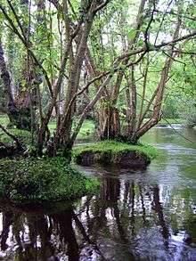
Bartley Water, west of Busketts Lawn Inclosure
Bartley Water is a stream and river going through the New Forest district of Hampshire, England.[1][2]
It runs from Bartley to Eling where it becomes tidal and flows out into Southampton Water which goes to the Solent.
The tidal part of the river (but not the natural low water flow) drives the working historic Eling Tide Mill at Eling, where a toll road crosses the river.
The river is also an important recreational and wildlife haven, especially at the tidal, Eling end of the river. Despite being shallow in many places the stream is home to brown and rainbow trout that average about 10 to 12 inches (25 to 30 cm) long.
References
- ↑ Ordnance Survey: Landranger map sheet 196 The Solent & Isle of Wight (Southampton & Portsmouth) (Map). Ordnance Survey. 2015. ISBN 9780319231425.
- ↑ "Ordnance Survey: 1:50,000 Scale Gazetteer" (csv (download)). www.ordnancesurvey.co.uk. Ordnance Survey. 1 January 2016. Retrieved 30 January 2016.
| Main rivers |
|  |
|---|---|---|
| Canals and Navigations | ||
| Ordinary watercourses |
| |
| Lakes, ponds and wetlands | ||
| Coast | ||
Categories: Rivers, Canals | ||
Coordinates: 50°54′42″N 1°28′49″W / 50.91167°N 1.48028°W
This article is issued from Wikipedia - version of the 4/24/2016. The text is available under the Creative Commons Attribution/Share Alike but additional terms may apply for the media files.