Banatski Karlovac
| Banatski Karlovac Банатски Карловац | |
|---|---|
| Town | |
|
The new Orthodox church | |
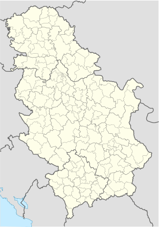 Banatski Karlovac Location of Banatski Karlovac within Serbia | |
| Coordinates: RS 45°03′N 21°01′E / 45.050°N 21.017°ECoordinates: RS 45°03′N 21°01′E / 45.050°N 21.017°E | |
| Country | Serbia |
| Province | Vojvodina |
| District | South Banat District |
| Municipality | Alibunar |
| Elevation | 99 m (325 ft) |
| Population (2002) | |
| • Total | 5,820 |
| Area code(s) | + 381(0)13 |
| Vehicle registration | PA |
| Website | banatskikarlovac.rs |

Banatski Karlovac (Serbian Cyrillic: Банатски Карловац) is a town located in the Alibunar municipality, in the South Banat District of Serbia. It is situated in the Autonomous Province of Vojvodina. The town has a Serb ethnic majority and its population numbers 5,820 people (2002 census). The nearby settlement of Devojački Bunar is also officially part of Banatski Karlovac.
Name

In Serbian, the town is known as Banatski Karlovac (Банатски Карловац), in German as Karlsdorf, and in Hungarian as Nagykárolyfalva. Adjective "Banatski" (i.e. "Banatian") was given to differentiate the town from the town Karlovac in Croatia.
History
This area was inhabited by humans during the bronze age, as well as in the 3rd and 4th century AD. During the Ottoman administration, settlement named Hoča or Oča existed at this location.[1] Settlement named Oča was also mentioned in 1764. During the 18th century, the settlement was populated by Serbs.[2]
Ethnic Germans settled in the settlement starting in 1803, and in the same year some Slavic Krašovani settlers from eastern Banat settled here as well. In 1921, name of the settlement was Karlovo Selo, and in 1926, it was officially named Banatski Karlovac. In the same year, the reading room was founded and monument dedicated to Serbs killed in 1848 revolution was built.
Before the end of World War II, most of the inhabitants of this town were ethnic Germans. After the war, their property was confiscated by the state and Germans were expelled or killed in concentration camps run by Yugoslav communist authorities. A German Lutheran church was razed off soon after the expulsion of Germans.
After the war, 615 (mostly Serb) families with 3,775 family members settled in the town. They originated from Central Serbia, Bosnia and Montenegro, mostly from area around Užice and Čačak. Some settlers were not satisfied with life conditions in the town, so about 80 families returned to their place of origin. In 1949, town was named Banatsko Rankovićevo, and this name was in use until 1956, when old name Banatski Karlovac was returned.
Historical population
| Historical population | ||
|---|---|---|
| Year | Pop. | ±% |
| 1961 | 6,025 | — |
| 1971 | 6,273 | +4.1% |
| 1981 | 6,319 | +0.7% |
| 1991 | 6,286 | −0.5% |
Notable citizens
Rock musician Nikola Čuturilo was born in Banatski Karlovac.
Climate
Climate in this area has mild differences between highs and lows, and there is adequate rainfall year round. The Köppen Climate Classification subtype for this climate is "Cfb" (Marine West Coast Climate/Oceanic climate).[3]
| Climate data for Banatski Karlovac | |||||||||||||
|---|---|---|---|---|---|---|---|---|---|---|---|---|---|
| Month | Jan | Feb | Mar | Apr | May | Jun | Jul | Aug | Sep | Oct | Nov | Dec | Year |
| Average high °C (°F) | 3 (38) |
4 (39) |
10 (50) |
17 (62) |
24 (75) |
26 (78) |
27 (81) |
29 (84) |
24 (75) |
17 (63) |
9 (48) |
1 (34) |
17 (62) |
| Average low °C (°F) | −3 (27) |
−4 (25) |
1 (33) |
7 (45) |
12 (53) |
15 (59) |
16 (61) |
18 (64) |
12 (53) |
8 (47) |
3 (37) |
−3 (26) |
8 (46) |
| Average precipitation days | 8 | 15 | 18 | 19 | 14 | 20 | 16 | 12 | 14 | 17 | 14 | 13 | 180 |
| Source: Weatherbase [4] | |||||||||||||
See also
References
- ↑ http://www.banatskikarlovac.rs/mz/sr/Grad/O-gradu/Istorija (Serbian)
- ↑ Dr Slobodan Ćurčić, Naselja Banata, geografske karakteristike, Novi Sad, 2004.
- ↑ Climate Summary Banatski Karlovac
- ↑ "Weatherbase.com". Weatherbase. 2013. Retrieved on July 14, 2013.
External links
- Official Website of Banatski Karlovac (not active)
- LEADER+BK Website
- Unofficial Website
- Municipality of Alibunar
| Wikimedia Commons has media related to Banatski Karlovac. |