Ivanovo, Pančevo
| Ivanovo Иваново Sándoregyháza | |
|---|---|
| Village | |
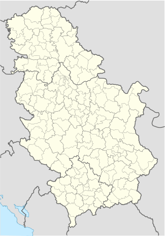 Ivanovo Location of Ivanovo within Serbia | |
| Coordinates: 44°44′11″N 20°42′03″E / 44.73639°N 20.70083°ECoordinates: 44°44′11″N 20°42′03″E / 44.73639°N 20.70083°E | |
| Country | Serbia |
| Province | Vojvodina |
| District | South Banat |
| Population (2011) | |
| • Ivanovo | 1,131 |
| Time zone | CET (UTC+1) |
| • Summer (DST) | CEST (UTC+2) |
| Postal code | 26223 |
| Area code(s) | +381(0)13 |
| Car plates | PA |
[[File:|300px|alt=|]]
Municipality
of Pančevo
●
of Pančevo
●
Ivanovo (Serbian: Иваново / Ivanovo; Hungarian: Sándoregyháza; Bulgarian: Ivanovo (Иваново); German: Alexanderkirchen or Iwanowo) is a village located in the Pančevo municipality, in the South Banat District of Serbia.
It is situated in the Autonomous Province of Vojvodina.
Geography
The closest bigger places are Pančevo (18 km), and Belgrade (35 km).
Population and major ethnic groups
| Year | Total | Hungarians | Bulgarians | Serbs | Yugoslavs | Slovaks | Undecided | Germans |
|---|---|---|---|---|---|---|---|---|
| 1869 | 824 | 0.0% | N/A% | 0.0% | 0.0% | 0.0% | 0.0% | N/A% |
| 1880 | 724 | 0.0% | N/A% | 0.0% | 0.0% | 0.0% | 0.0% | N/A% |
| 1890 | 2,129 | N/A% | N/A% | 0.0% | 0.0% | 0.0% | 0.0% | N/A% |
| 1991 | 1,439 | 46.14% | 27.44% | 10.42% | 11.60% | 0.76% | 0.13% | 0.0% |
| 2002 | 1,131 | 39.96% | 27.14% | 19.71% | 2.12% | 1.32% | 4.68% | 0.0% |
See also

The Saint Vendelin abbot Catholic Church
External links
- History of Ivanovo (Hungarian)
- Ivanovo in Serbia. Homepage
This article is issued from Wikipedia - version of the 6/10/2016. The text is available under the Creative Commons Attribution/Share Alike but additional terms may apply for the media files.