Babushkin (town)
| Babushkin (English) Бабушкин (Russian) | |
|---|---|
| - Town[1] - | |
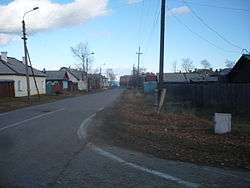 A street in Babushkin | |
.svg.png) Babushkin | |
|
| |
.png) | |
|
| |
| Administrative status (as of January 2013) | |
| Country | Russia |
| Federal subject | Republic of Buryatia[1] |
| Administrative district | Kabansky District[1] |
| Town | Babushkin[1] |
| Administrative center of | Town of Babushkin[1] |
| Municipal status (as of May 2013) | |
| Municipal district | Kabansky Municipal District[2] |
| Urban settlement | Babushkinskoye Urban Settlement[2] |
| Administrative center of | Babushkinskoye Urban Settlement[2] |
| Statistics | |
| Population (2010 Census) | 4,831 inhabitants[3] |
| Time zone | IRKT (UTC+08:00)[4] |
| Founded | 1892[5] |
| Town status since | 1902 |
| Previous names | Mysovaya (until 1941)[5] |
| Postal code(s)[6] | 30138 |
| Babushkin on Wikimedia Commons | |
Babushkin (Russian: Ба́бушкин), known as Mysovsk (Мысовск) before 1941, is a town in Kabansky District of the Republic of Buryatia, Russia, located on the southern shore of Lake Baikal on the Trans-Siberian Railway. Population: 4,831 (2010 Census);[3] 4,953 (2002 Census);[7] 7,298 (1989 Census);[8] 9,000 (1967).
History
It was founded in 1892 as a postal station Mysovaya (Мысовая),[5] its name derived from the Russian word Mys meaning "cape", referring to its location on the shores of Lake Baikal.
A few years later it was chosen as the eastern terminus for the train ferry across Lake Baikal, which was used as part of the Trans-Siberian Railway until the rail line around the southern shore was completed in 1905. It was granted town status under the name Mysovsk in 1902.
It was renamed Babushkin in 1942,[5] in honor of the revolutionary Ivan Babushkin, arrested and executed at Mysovaya station in 1906.
Administrative and municipal status
Within the framework of administrative divisions, it is, together with four rural localities, incorporated as the Town of Babushkin—an administrative division of Kabansky District.[1] As a municipal division, the territory of Babushkin, together with two rural localities, is incorporated within Kabansky Municipal District as Babushkinskoye Urban Settlement.[2] The remaining two rural localities are incorporated as Klyuyevskoye Rural Settlement of Kabansky Municipal District.[2]
Economy
Babushkin is a depot for wood transport on the Trans-Siberian Railway, as well as a tourist center for tours on southern Lake Baikal.
References
Notes
- 1 2 3 4 5 6 Resolution #43
- 1 2 3 4 5 Law #985-III
- 1 2 Russian Federal State Statistics Service (2011). "Всероссийская перепись населения 2010 года. Том 1" [2010 All-Russian Population Census, vol. 1]. Всероссийская перепись населения 2010 года (2010 All-Russia Population Census) (in Russian). Federal State Statistics Service. Retrieved June 29, 2012.
- ↑ Правительство Российской Федерации. Федеральный закон №107-ФЗ от 3 июня 2011 г. «Об исчислении времени», в ред. Федерального закона №271-ФЗ от 03 июля 2016 г. «О внесении изменений в Федеральный закон "Об исчислении времени"». Вступил в силу по истечении шестидесяти дней после дня официального опубликования (6 августа 2011 г.). Опубликован: "Российская газета", №120, 6 июня 2011 г. (Government of the Russian Federation. Federal Law #107-FZ of June 31, 2011 On Calculating Time, as amended by the Federal Law #271-FZ of July 03, 2016 On Amending Federal Law "On Calculating Time". Effective as of after sixty days following the day of the official publication.).
- 1 2 3 4 Энциклопедия Города России. Moscow: Большая Российская Энциклопедия. 2003. p. 32. ISBN 5-7107-7399-9.
- ↑ Почта России. Информационно-вычислительный центр ОАСУ РПО. (Russian Post). Поиск объектов почтовой связи (Postal Objects Search) (Russian)
- ↑ Russian Federal State Statistics Service (May 21, 2004). "Численность населения России, субъектов Российской Федерации в составе федеральных округов, районов, городских поселений, сельских населённых пунктов – районных центров и сельских населённых пунктов с населением 3 тысячи и более человек" [Population of Russia, Its Federal Districts, Federal Subjects, Districts, Urban Localities, Rural Localities—Administrative Centers, and Rural Localities with Population of Over 3,000] (XLS). Всероссийская перепись населения 2002 года [All-Russia Population Census of 2002] (in Russian). Retrieved August 9, 2014.
- ↑ Demoscope Weekly (1989). "Всесоюзная перепись населения 1989 г. Численность наличного населения союзных и автономных республик, автономных областей и округов, краёв, областей, районов, городских поселений и сёл-райцентров" [All Union Population Census of 1989: Present Population of Union and Autonomous Republics, Autonomous Oblasts and Okrugs, Krais, Oblasts, Districts, Urban Settlements, and Villages Serving as District Administrative Centers]. Всесоюзная перепись населения 1989 года [All-Union Population Census of 1989] (in Russian). Институт демографии Национального исследовательского университета: Высшая школа экономики [Institute of Demography at the National Research University: Higher School of Economics]. Retrieved August 9, 2014.
Sources
- Правительство Республики Бурятия. Постановление №431 от 18 ноября 2009 г. «О реестре административно-территориальных единиц и населённых пунктов Республики Бурятия», в ред. Постановления №573 от 13 ноября 2015 г. «О внесении изменений в Постановление Правительства Республики Бурятия от 18.11.2009 №431 "О реестре административно-территориальных единиц и населённых пунктов Республики Бурятия"». Вступил в силу 18 ноября 2009 г. Опубликован: "Бурятия", №216, Официальный вестник №120, 21 ноября 2009 г. (Government of the Republic of Buryatia. Resolution #431 of November 18, 2009 On the Registry of the Administrative-Territorial Units and the Inhabited Localities of the Republic of Buryatia, as amended by the Resolution #573 of November 13, 2015 On Amending Resolution #431 of November 18, 2009 of the Government of the Republic of Buryatia "On the Registry of the Administrative-Territorial Units and the Inhabited Localities of the Republic of Buryatia". Effective as of November 18, 2009.).
- Народный Хурал Республики Бурятия. Закон №985-III от 31 декабря 2004 г. «Об установлении границ, образовании и наделении статусом муниципальных образований в Республике Бурятия», в ред. Закона №1411-V от 14 октября 2015 г. «О внесении изменений в Закон Республики Бурятия "Об установлении границ, образовании и наделении статусом муниципальных образований в Республике Бурятия"». Вступил в силу со дня официального опубликования. Опубликован: "Бурятия", №1, Официальный вестник №1, 12 января 2005 г. (People's Khural of the Republic of Buryatia. Law #985-III of December 31, 2004 On Establishing the Borders, Creating, and Granting a Status to the Municipal Formations in the Republic of Buryatia, as amended by the Law #1411-V of October 14, 2015 On Amending the Law of the Republic of Buryatia "On Establishing the Borders, Creating, and Granting a Status to the Municipal Formations in the Republic of Buryatia". Effective as of the day of the official publication.).
Capital: Ulan-Ude | |||
| Districts | |||
| Cities and towns (all levels) | |||
| Urban-type settlements | |||