Bösel
| Bösel | ||
|---|---|---|
| ||
 Bösel | ||
Location of Bösel within Cloppenburg district 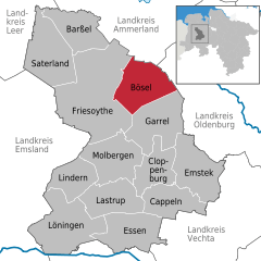
 | ||
| Coordinates: 53°0′21″N 7°57′15″E / 53.00583°N 7.95417°ECoordinates: 53°0′21″N 7°57′15″E / 53.00583°N 7.95417°E | ||
| Country | Germany | |
| State | Lower Saxony | |
| District | Cloppenburg | |
| Government | ||
| • Mayor | Hermann Block | |
| Area | ||
| • Total | 100.1 km2 (38.6 sq mi) | |
| Population (2015-12-31)[1] | ||
| • Total | 7,725 | |
| • Density | 77/km2 (200/sq mi) | |
| Time zone | CET/CEST (UTC+1/+2) | |
| Postal codes | 26219 | |
| Dialling codes | 0 44 94 | |
| Vehicle registration | CLP | |
| Website | www.boesel.de | |

Bösel is a municipality in the district of Cloppenburg, in Lower Saxony, Germany.
History
Bösel was first mentioned in 1080 under the name Borsla (= "Forest at a wavy bank") in a testimonial of the bishop of Osnabrück.
The first written document of a chapel in Bösel is dated with the year 1574, but Bösel was not separated from its mother church in Altenoythe and made an independent commune until 1876. Today Bösel consists of nine areas (Bösel-Ort, Edewechterdamm, Glaßdorf, Hülsberg, Osterloh, Ostland, Overlahe, Petersdorf und Westerloh).
Politics
- Mayor: Hermann Block
The municipal council of Bösel consists of the following seats:
- CDU: 14 seats
- SPD: 2 seats
- FDP: 3 seats
- UWB: 2 seats
Schools
- St.-Martin-Grundschule
- Haupt- und Realschule
- Grundschule Petersdorf
Places of interest
- Museum park „Am Pallert“ which contains:
- Heimathaus (traditional house)
- Landmaschinenmuseum (Museum of agricultural engines)
- Brotbackhaus (traditional bakery)
- Bauerngarten in der Parkanlage (traditional rural garden within the park)
Economy and Infrastructure
Bösel is member of the „Zweckverband Interkommunaler Industriepark Küstenkanal“ and takes places in the industrial area c-Port.
Events
- Schuetzenfest
- Euro-Musiktage
References
External links
- Official site (German),
- [[:de:B�sel|German Wikipedia]] (German)
Towns and municipalities in Cloppenburg (district) | ||
|---|---|---|
This article is issued from Wikipedia - version of the 6/21/2015. The text is available under the Creative Commons Attribution/Share Alike but additional terms may apply for the media files.