Atlin Volcanic Field
| Atlin Volcanic Field | |
|---|---|
 Atlin Volcanic Field | |
| Highest point | |
| Elevation | 1,880 m (6,170 ft) |
| Coordinates | 59°42′N 133°22′W / 59.700°N 133.367°WCoordinates: 59°42′N 133°22′W / 59.700°N 133.367°W |
| Geography | |
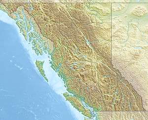
| Location | British Columbia, Canada |
| Parent range | Teslin Plateau (southern Yukon Plateau) |
| Geology | |
| Age of rock | Holocene |
| Mountain type | Cinder cones |
| Volcanic arc/belt | Northern Cordilleran Volcanic Province |
| Last eruption | Unknown, possible eruptions in 1898. |
The Atlin Volcanic Field, also called the Llangorse Volcanic Field and the Surprise Lake Volcanic Field, is a group of late-Pleistocene to Holocene cinder cones that lies on the Teslin Plateau east of Atlin Lake, Canada. The largest volcanic feature is the 1880-m-high Ruby Mountain which has been partially dissected by Pleistocene and post-Wisconsin glaciation. Two basaltic cinder cones at the heads of Cracker Creek and Volcanic Creek lie within glacially dissected U-shaped valleys and may be of postglacial age.
November 8, 1898 eruption
A Yukon newspaper reported in 1898 that an eruption was occurring near Atlin about 80 km south of Gladys Lake, near the end of the 19th century. Miners working in the area reportedly were able to work during the dark nights, due to the glow of the eruption. The article also reported that a group of people were going down from the Yukon to investigate the eruption, but no further reports were apparently made. Several recent studies, including a summary by Edwards et al. (2003) published by the Geological Survey of Canada, have determined that Ruby Mountain was definitely not the site of a historic eruption.[1] Nor were Cracker Creek or Volcanic Creek cones.
One possible explanation for the story is that placer miners found gold bearing gravels beneath an ancient lava flow at the base of Ruby Mountain, and were actively tunneling under the old lava flow to mine the gravels. As its name suggests, Ruby Mountain is ruby-colored due to the scoriaceous tephra that covers much of its summit. So, with miners working by the light of the summer sun shining off of the ruby-red flanks of the volcano, it's easy to see how such a rumor would have started. There have been no evidence of the eruption found in the region and the 19th century report is considered uncertain.[2]
Volcanoes
Volcanoes within the field include:
See also
- Northern Cordilleran Volcanic Province
- List of volcanoes in Canada
- Volcanism of Canada
- Volcanism of Western Canada
- Volcanic history of the Northern Cordilleran Volcanic Province
References
- ↑ Edwards, B. R.; Russell, J. K.; Anderson, R. G.; Harder, M. (2003). "Overview of Neogene to Recent volcanism in the Atlin volcanic district, Northern Cordilleran province, northwestern British Columbia". Geol. Surv. Canada, Current Res. 2003-A8: 1–6.
- ↑ "Atlin Volcanic Field". Global Volcanism Program. Smithsonian Institution.