Spectrum Range
| Spectrum Range | |
|---|---|
 Satellite photo of the Spectrum Range | |
| Highest point | |
| Peak | Yeda Peak |
| Elevation | 2,430 m (7,970 ft) |
| Coordinates | 57°26′0″N 130°41′0″W / 57.43333°N 130.68333°WCoordinates: 57°26′0″N 130°41′0″W / 57.43333°N 130.68333°W |
| Geography | |
 Spectrum Range | |
| Country | Canada |
| Province | British Columbia |
| Parent range | Tahltan Highland (southwestern Stikine Plateau) |
| Geology | |
| Orogeny | Volcanism |
| Age of rock | Pliocene-to-Holocene |
| Type of rock | Shield volcano |
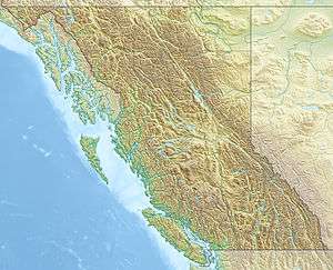
The Spectrum Range, formerly called the Spectrum Mountains and the Rainbow Mountains, is a subrange of the Tahltan Highland in the Stikine Country of northwestern British Columbia, 20 km west of the Stewart-Cassiar Highway, south of Mount Edziza and north of the Arctic Lake Plateau. The Spectrum Range falls within Mount Edziza Provincial Park. The range is lightly glaciated, as compared to the other ranges to the west.
Geology
Like the Rainbow and Itcha–Ilgachuz Ranges at the western end of the Chilcotin Plateau farther south, the range's name derives from the brilliant colours that are symptomatic from heavy mineralization comprising the material forming the range.
The Spectrum Range is one of four large stratovolcanoes that make up the Mount Edziza volcanic complex. A predominantly lava dome overlies a basal shield volcano. The range is Pliocene in age and on its southwestern flank contains Pleistocene subglacial and subaerial cones and its northwest and southwest sides contain Holocene pyroclastic cones and lava flows. The youngest feature in the volcanic complex could be The Ash Pit.
Volcanoes
The volcanoes that make up the Spectrum Range include:
- Nahta Cone
- The Ash Pit
- Mess Lake
- Outcast Hill
- Thaw Hill
- Source Hill
- Tadekho Hill
- Wetalth Ridge
- Exile Hill
- Spectrum Dome
- Little Iskut
- Yeda Peak
See also
- List of volcanoes in Canada
- List of Northern Cordilleran volcanoes
- List of mountain ranges
- Volcanism of Canada
- Volcanism of Western Canada
- Rainbow Range (Chilcotin Plateau) (aka Rainbow Mountains)
References
External links
 Spectrum Range colours from heavy mineralization
.JPG) Nahta Cone of the Spectrum Range
Nahta Cone of the Spectrum Range