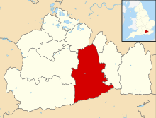
Ashtead Common
Ashtead Common (c. 200 ha) [1] is a wooded area to the north of the village of Ashtead in England which is open to the public. It is owned and managed by the City of London Corporation. 180.5 ha of the common are a National Nature Reserve.[1] Together with Epsom Common it forms part of a larger area of open countryside called Epsom and Ashtead Commons which is designated a Site of Special Scientific Interest.[2][3]
Background
Ashtead Common has been part of the Epsom and Ashtead Commons Site of Special Scientific Interest since 1955 because of its community of breeding birds. It has also been a National Nature Reserve since 1995 because of the wood of decaying ancient trees and the rare invertebrates that live in it. It contains a wooded common with over 2300 pollarded oaks[4] which are between 300 and 400 years old. These provide a habitat for many rare and endangered deadwood species. The area is of conservation interest in Britain and Europe. Also within the common are bracken, scrub grassland, semi-improved neutral grassland and various aquatic habitats.
Trials have been undertaken on how to deal with the invasion of Michaelmas daisies.[5] It was concluded that grazing by goats was the most successful management option.
There is a Roman villa on the common as well as tile works.[6] These are scheduled ancient monuments. There are also some earthworks.
When the Southern Railway planned to build a new line to connect Chessington South railway station with Leatherhead railway station in the 1930s, work was delayed by the outbreak of the second world war and afterwards the introduction of the "Green Belt" stopped development of the area. Part of the land reserved for the railway to the south of Ashtead Wood was subsequently used for the construction of the M25 motorway.
Access
Ashtead Common, together with Epsom Common, extends from the M25 Junction 9 near Leatherhead to the outskirts of Epsom. There are many entrances to the common for walkers, including in north Ashtead and Epsom.
The Thames Down Link long distance footpath, from Kingston upon Thames to Box Hill station, cuts across the western half of the common.[7]
References
- 1 2 R. Warnock; Superintendent of Ashtead Common; P. Ritchie; Senior Keeper (2005). "ASHTEAD COMMON NATIONAL NATURE RESERVE Site Management Plan 1st April 2005 – 31st March 2010" (PDF). Site Management Plan. Corporation of London Open Spaces Dapartment. Retrieved 25 March 2010.
- ↑ "Epsom And Ashtead Commons citation" (PDF). Sites of Special Scientific Interest. Natural England. Archived from the original (PDF) on 24 October 2012.
- ↑ "Map of Epsom And Ashtead Commons". Sites of Special Scientific Interest. Natural England.
- ↑ English Nature Archived 22 July 2005 at the Wayback Machine.
- ↑ Conservation evidence Archived 3 January 2009 at the Wayback Machine.
- ↑ Leatherhead local history
- ↑ "Thames Down Link" (PDF). Surrey County Council. Retrieved 6 January 2011.
External links
- Map
- Ashtead Common pages on the City of London Corporation website
|
|  | ||||||||||||||||||||||||||||||
|---|---|---|---|---|---|---|---|---|---|---|---|---|---|---|---|---|---|---|---|---|---|---|---|---|---|---|---|---|---|---|---|---|
| Parks | ||||||||||||||||||||||||||||||||
| Places of worship | ||||||||||||||||||||||||||||||||
| Education | ||||||||||||||||||||||||||||||||
| Transport |
| |||||||||||||||||||||||||||||||
Buildings and structures | ||||||||||||||||||||||||||||||||
| Sport |
| |||||||||||||||||||||||||||||||
Places listed are articles notable as settlements, arranged by post town The two principal towns are emboldened | ||||||||||||||||||||||||||||||||
Coordinates: 51°19′23″N 0°19′12″W / 51.323°N 0.320°W