Betchworth
| Betchworth | |
 Village Green (northern strand) The Street, Betchworth |
|
 St Michael's Church Grade I listed |
|
 Betchworth |
|
| Area | 9.91 km2 (3.83 sq mi) |
|---|---|
| Population | 1,052 (Civil Parish 2011)[1] |
| – density | 106/km2 (270/sq mi) |
| OS grid reference | TQ2150 |
| Civil parish | Betchworth |
| District | Mole Valley |
| Shire county | Surrey |
| Region | South East |
| Country | England |
| Sovereign state | United Kingdom |
| Post town | Betchworth |
| Postcode district | RH3, RH4 |
| Dialling code | 01737 |
| Police | Surrey |
| Fire | Surrey |
| Ambulance | South East Coast |
| EU Parliament | South East England |
| UK Parliament | Mole Valley |
Coordinates: 51°13′59″N 0°15′58″W / 51.233°N 0.266°W
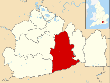
Betchworth is a village and civil parish in the Mole Valley district of Surrey, England. The village centre is on the north bank of the River Mole and south of the A25 road almost 3 miles (4.8 km) east of Dorking and 3 miles (4.8 km) west of Reigate. London is 19.5 miles (31.4 km) north of the village. Service sector occupations dominate Betchworth's economy[n 1]—its station and road links make it a part of the London commuter belt—combined with crop agriculture and services for a relatively large retired proportion of the population. A former lime quarry, rebuilt manor house and Grade I-listed church are within its boundaries.
History
Etymology
State records show the name as Becesworde, (11th century), Beceswrde, (12th century), Bechesworth, (13th century).[2]
Pre-Roman settlement
Bronze Age artefacts have been found at Betchworth only since 1944. No Roman villas, farms or camps have been found.[3][4]
Dark and Middle Ages
Betchworth lay within the Wotton hundred and appears in two entries[n 2] in the Domesday Book as Becesworde, held by Richard Fitz Gilbert, Richard de Tonebrige. On the Domesday survey in 1086 its Assets were: 27 villagers/smallholders, 15 slaves, two hides; one church, two mills worth £1 10 s, 12 ploughlands, 11 acres (4.5 ha) of meadow, pasture for five swine and woodland and herbage/woodland worth 81 hogs. To its overlords it rendered in total £7 10s [5][6] A distinct part named Thorncroft is mentioned in the first listing which was split by five overlords in 1066 before the conquest, Lewis (1848) and Malden (1911) say this relates to the formerly detached part in the west that is now between Brockham and Dorking.[6]
After a succession of lords, in the 13th century a reclassification of the hundred took place for the east main part to Reigate hundred – ownership of Betchworth Manor passed to Hamelin de Warenne, Earl of Surrey, who did villein service on Friday's Mead as Lord of (among others) Reigate and Betchworth in 1279.[7] Hamelin's grandson John de Warenne, 6th Earl of Surrey owned much land in Surrey and his widow left the land to his nephew the Earl of Arundel,[8] who eventually left the manor to Lord Abergavenny; the 9th Lord Abergavenny sold it in 1629 for £1,080 to Sir Ralph Freeman[n 3] in whose family's hands it remained until 1817 when it was sold to Henry Goulburn, later Chancellor then Under-Secretary of State for War and the Colonies.[2]
Two manors existed in today's village, Wonham (which still stands today) and Betchworth with the third, Brockham, becoming a village in the west.
Wonham Manor forms the eastern corner of the parish and is architecturally a grade II listed building and for centuries own Wonham Mill[2] at the foot of the Shag Brook which is a tributary on the boundary with Buckland and at the foot of the path Dungates Lane which leads up to the village of Buckland – it is close to both villages.[9][10]
Post-Reformation
A manorial system continued for a long period in this village; the great tithes were commuted for £295 15s 4d, and the vicarial (lesser tithes) for £20.[8]

Post-Industrial Revolution
A school was endowed with £20 per annum as at 1848[8] four other significant endowment charities existed then[8] and continued though were less significant due to inflation through to at least 1911 for the benefit of the poor.[2][8]
Betchworth lime quarries
To supply the cement for construction associated with required brick built housing, a rich seam of suitable chalk and limestone was identified in the North Downs. Broome Park estate, extending to the top of the hill, included some of these quarries and was integral to the Dorking Grey Stone and Lime Company and the North Downs Line's spur lines leading to these three pits. After an Act authorising the railway from Reading to Reigate was passed in 1847 and its construction, opening in 1849[2] the Betchworth Quarry Railways were built. To calcinate the lime from the stone, lime kilns were required. The six of the lime kilns along the Pilgrims' Way footpath in Betchworth are Scheduled Ancient Monuments, including Hoffman, Dietz and Six Flare kilns.[11] In 1911 A History of the County of Surrey by Malden which is also a county guide, records the earlier key dates in the industry and records that "the chalk furnishes the chief industry...There are also brickyards in the parish, which is, however, mostly agricultural and residential".[2]
Accomplished surgeon to George IV, William IV and Queen Victoria, Sir Benjamin Collins Brodie, lived and died at Broome Park [n 4] a nursing home since 1993 with 11 acres[12] at the top end of The Street.[13]
In 1924 a hydrator plant at Betchworth Limeworks was installed for slaking the lime.[14]

Landmarks
Betchworth Conservation Area contains 22 listed buildings – the highest ranked for architecture is the church of St Michael, the only Grade I building.[15]
Betchworth Castle
The ruins of Betchworth Castle in Betchworth Park are a couple of miles west of Betchworth in the west of Brockham civil parish.

Church interior
St Michael's Church
St Michael's Church, Betchworth is Church of England, immediately northwest of the village green and is Grade I listed. Most of the church on the Betchworth site now occupied by St Michael's dates to the early 13th century and in a pillar of the tower's south window, there remains a fragment of the stone Saxon church. The south aisle chapel became known as the Hope Chapel after Henry Thomas Hope bought the Manor in 1838.[16]
A tall war memorial is outside of the main west entrance of the building. A particular fine example of medieval Gothic architecture pointed arches is in this church throughout its long nave and forming the entrance to its alcoves.
It was used for the first scene of Richard Curtis's 'Four Weddings and a Funeral' (1994).
Betchworth House
Architecturally Grade II*-listed Betchworth House is the largest building in the village, excluding Hartsfield Manor Hotel on the opposite bank of the Sloughs brook, and was built by the lord of the manor in 1675. Erected by the Freeman local Lords of the Manor after Ralph Freeman, judge, auditor and tin trader bought the manor in 1629 which the House replaced, it was extended and re-faced in 1808.[17] The main materials are red brick cladding with stucco at the rear, tiled roof to the front, long slated roofs to the back forming eaves and features include sash windows.[17] Merstham stone (of the North Downs) forms its main entrance surround—a "Gibbs-style door surround with pulvinated frieze and rusticated, arched, surround".[17] Half-oval balconies are to the first floor windows. Marble columns are in the rear room.[17]
Separately listed are its stables in front of the house by the Street[17]
Local government
Surrey County Council elected every four years, has one representative, from Betchworth for Dorking Rural:
- Helyn Clack, (Con) who participates in these committees:
- Cabinet Member for Community Services and the 2012 Games decisions
- People, Performance and Development
- The Mole Valley local committee (obligatory)[18]
The second party forming the main local opposition in the 2013 election, was the Liberal Democrats gaining 1,527 votes versus the winning candidate's 1,810.[19]
2 councillors sit on Mole Valley borough council, who are:
| Election | Member[20][21] |
Ward | |
|---|---|---|---|
| 2011 | John Muggeridge | Brockham, Betchworth & Buckland | |
| 2010 | Paul Potter | Brockham, Betchworth & Buckland | |
Geography
Betchworth is 3 miles (4.8 km) east of Dorking and 3 miles (4.8 km) west of Reigate.[10] The village is 20 miles (32 km) south of London, in the outer London commuter belt.[10]
Betchworth is in the east of the Mole Valley Borough whose main town is Dorking; as it is mostly on the north bank the land slopes up towards the North Downs AONB. Below this range of hills the Mole flows briefly along the Vale of Holmesdale and the area around the tributary the Gadbrook is included in the village.
Betchworth is within Mole Valley. As part of Surrey, a third tier of local government is responsible for education, almost all built infrastructure and other services such as social care, Surrey County Council; Betchworth Parish Council provides certain local facilities and services.
There were 372 households and 12 vacant houses in 2001, as well as some local shops and outdoor businesses such as stone merchants and garden centres.[22]
 |
Westhumble | Box Hill and Headley | Walton-on-the-Hill | |
| Brockham | |
Buckland | ||
| ||||
| | ||||
| North Holmwood | Newdigate | Leigh |
Elevation
Elevations range between 216 m[10] at the water tower which marks the highest point of the parish on Box Hill, down to the River Mole which runs east-west through the village at 43 m[10] AOD. Between these extremes the landscape is mainly undulating, except for the steep (and where quarried for several hundred metres, sheer) chalk face of the North Downs.[23]
Geology and soil
Formation of the North Downs and the erosion that has taken place widely with repeated sea inundations and deposition is described in detail in the Geology of Surrey. Mammoth fossilised bone remains have been found below flint beds under considerable clay in the low hills by the bank of the River Mole in Betchworth.[24]
Most of the parish has free draining slightly acid loamy soil.[25] Soil of the area that forms the top of the Betchworth Hills[n 5] is "free draining, slightly acid but base-rich soil" rather than "shallow, lime-rich soil over chalk or limestone" which dominates the middle of Box Hill.[25] This is the natural spur to the trees that line the top as it producesextremely fertile pastures and deciduous woodland.[25] Surrey Wildlife Trust manages the rare flower meadows beneath the old quarry.
Demography and housing
In 2001, Betchworth had 919 residents, of whom 26.5% were aged over 65; 4.8% of the population were in full-time further education; 74.5% of all men were economically active whereas 2.5% were unemployed and 4.2% worked part-time; 56.1% of all women were economically active whereas 1.6% were unemployed and 35.1% worked part-time.[22]
As to ethnicity, 98.5% of the population identified themselves as white, 0.7% as mixed and 1.3% in one of the four other main categories (five including mixed).[22]
In terms of religion, 74.7% of the population responded as being Christian, 0.7% as Muslim, 1.4% other religions, 13.4% as atheist and 10.5% declined to answer.[22]
Betchworth's economy is predominantly a service sector economy reflected by the low concentration at one end of the official categorisation table of occupation given, compiled from the 2001 census:
| Category | Number of adults in category in 2001 | Percentage of those aged 16–74 |
|---|---|---|
| Lower supervisory and technical occupations | 19 | 2.9% |
| Semi-routine occupations | 42 | 6.5% |
| Routine occupations | 23 | 3.6%[22] |
Whereas 34.3% of the population worked in middle or higher professional occupations.
| Output area | Detached | Semi-detached | Terraced | Flats and apartments | Caravans/temporary/mobile homes | shared between households[1] |
|---|---|---|---|---|---|---|
| (Civil Parish) | 176 | 124 | 71 | 48 | 7 | 0 |
The average level of accommodation in the region composed of detached houses was 28%, the average that was apartments was 22.6%.
| Output area | Population | Households | % Owned outright | % Owned with a loan | hectares[1] |
|---|---|---|---|---|---|
| (Civil Parish) | 1,052 | 426 | 38.5% | 30.8% | 991 |
The proportion of households in the civil parish who owned their home outright compares to the regional average of 35.1%. The proportion who owned their home with a loan compares to the regional average of 32.5%. The remaining percent is made up of rented dwellings (plus a negligible percentage of households living rent-free).
Economy
Betchworth's economy is predominantly a service sector economy, with an emphasis on the service sector.,[22][26] with its station and road links it is part of the London commuter belt. Cleaning and gardening companies catering to a strong local market operate in the area.[27] Crop, chicken and pasture agriculture as well as a relatively large retired proportion of the population.[28] The former lime quarry is managed by workers from Surrey Wildlife Trust and English Heritage.
Great Brockhamhurst Farm is one of eleven farms in Betchworth and produces cereals and breeds horses.[29] Root Hill farm[30] is a farm and missionary camp. Local businesses include an air filters company.Yellow Pages: Westbury Filters, Betchworth and kennels.[31]
Hartsfield Manor Hotel is a major local employer with a long entrance drive off Sandy Lane has 16 acres (6.5 ha) of parkland containing a small gatehouse called Ye Olde Gatehouse and serves also as a Wedding and conference venue.[32]
Betchworth Park Golf Club holding in its grounds the ruined Betchworth castle is in Brockham though keeps the historic association with Betchworth.[33]
Culture and community
Betchworth parish council operates six full size allotments at the rear of The Walled Garden allocated at a nominal fee.[34] A post office with banking facilities is in the main street.
Village hall
Betchworth Memorial Hall has a large hall with a wooden floor, a high ceiling and a stage, making it suitable for self-nominated activities including badminton, lectures, receptions, and local operatics and drama, with seating for 150 people; leads to a smaller community room, the Geoffrey Browne Room, for 40/50 people available for hire separately. There is a 21st-century construction kitchen which can serve either hall, and all are available for hire.[34]
An Archives/Meeting Room, The Hamilton Room, suitable for meetings of 30/40 people, and small parties with adjoining kitchen and all amenities, is situated in conservation area Church Street in the centre of the village. It also has within it a room to house village archives, known as the Meg Ryan Room.[34]
Public house
The only public house in Betchworth is The Dolphin which is near the church and opposite the blacksmith. It has flagstone floors, log fires and a large rear garden.[35]
Village Green
Goulburn Green, the alternative name for the Village Green has stalls and maypole dancing in the children-costumed May bank holiday Medieval Fayre, hosts occasional summer celebrations and is the venue of the Harvest Lunch in alternate years.[36] James Hamilton donated the Green.
A popular local pastime is because of the Vale of Holmesdale and number of walks available, walking; the parish council has website editions of four walks.[34]
Transport

Railways
Half of the four passenger trains per hour serving the North Downs Line between the stations of Reading and Gatwick Airport call at Betchworth Station. Additional stations along this route include Guildford, Reigate and Redhill.
Roads
The A25 road that runs from the county of Kent to Guildford via Reigate and Dorking skirts the north of the village centre. From its roundabout on the A25, minor roads provide a cut through towards Walton-on-the-Hill a viable route towards Sutton, London, the M25's Reigate Hill junction or Leatherhead and minor routes to the south connect southern villages, including Leigh, Surrey. A-road intersections of the A25 are in Dorking and at the foot of Reigate Hill in Reigate.
Notable people
- Sir Ralph Freeman (about 1590–1650) see Notes.
Lord Coleraine:
- Henry Hare, 3rd Baron Coleraine (1693–1749)
- Chancellor of the Exchequer (1828)
- Slaveowner at his Jamaican estate, Amnity Hall
The Lords Hamilton:
- John Hamilton, 3rd Baron Hamilton
- Lord James Hamilton (1938–2006) a Lord-in-Waiting to the Queen.
Norton-Griffiths Baronets, Baronetcy of Wonham, (1922)
Education
North Downs Primary School is state-paid and has ones of its three sites in the village.
Religious sites
The only religious site is the Church of St Michael in Betchworth.
Notes and references
- Notes
- ↑ In 2001, 34.3% of the population worked in middle or higher professional occupations, see Economy
- ↑ Malden states it is uncertain if the part with Thorncroft Manor is still in the parish or is part of Dorking Parish[2]
- ↑ Sir Ralph Freeman was a relatively minor civil judge who married into exclusive tin rights and became Auditor of the Royal Mint and Auditor of Imprests
- ↑ Sir Benjamin Brodie "died on 21 October 1862 here"
- ↑ Betchworth Hills, likewise to the Brockham Hills, describe particular steep southern slopes of Box Hill[23]
- References
- 1 2 3 Key Statistics; Quick Statistics: Population Density United Kingdom Census 2011 Office for National Statistics Retrieved 21 November 2013
- 1 2 3 4 5 6 7 H.E. Malden (editor) (1911). "Parishes: Betchworth". A History of the County of Surrey: Volume 3. Institute of Historical Research. Retrieved 30 October 2012.
- ↑ Betchworth excavations at Franks' Sandpit, David Williams, 1996 Location: Library of the Surrey Archaeological Society, Castle Arch, Guildford see Catalogue
- ↑ Bronze Age Finds from Betchworth and Farnham 1944 Correspondence between W. Hooper, L. Chitty, S.S. Frere, J. Cumming(?) plus physical surveys of the above: Location: Location: Library of the Surrey Archaeological Society, Castle Arch, Guildford see Catalogue
- ↑ Surrey Domesday Book Archived 30 October 2007 at the Wayback Machine.
- 1 2 Domesday Map website – image of Betchworth's entry and transcription in summary retrieved 30 October 2012
- ↑ Assize Roll 877, manuscript 56.
- 1 2 3 4 5 Samuel Lewis (editor) (1848). "Besford – Beverley". A Topographical Dictionary of England. Institute of Historical Research. Retrieved 30 October 2012.
- ↑ Wonham Mill Historic England. "Details from listed building database (1190758)". National Heritage List for England.
- 1 2 3 4 5 Grid Reference Finder measurement tools
- ↑ Hoffman Kilns Historic England. "Details from listed building database (1028781)". National Heritage List for England.
Six Flare Historic England. "Details from listed building database (1028782)". National Heritage List for England.
Dietz Historic England. "Details from listed building database (1189697)". National Heritage List for England.
Unnamed remains of northern kilns Historic England. "Details from listed building database (1021346)". National Heritage List for England. - ↑ Broome Park Nursing Home
- ↑ Broome Park – Grade II 19th century mansion -Historic England. "Details from listed building database (1293763)". National Heritage List for England.
- ↑ Sowan, Paul W. (2003). The 1924 hydrator plant at Betchworth Limeworks, East Surrey. South Croydon: Croydon Natural Historyand Scientific Society. pp. 7 in total.
- ↑ Mole Valley Borough Council – Conservation Area
- ↑ St Michael's Church, Betchworth Historic England. "Details from listed building database (1378131)". National Heritage List for England.
- 1 2 3 4 5 Betchworth House Historic England. "Details from listed building database (1028786)". National Heritage List for England.
- ↑ Surrey Councillor details Surrey Councillor details
- ↑ Surrey County Council election, 2013
- ↑ Mole Valley Councillors. Retrieved 28 April 2012
- ↑ Mole Valley Results 2009–11
- 1 2 3 4 5 6 Surrey County Council collated figures from the 2001 census
- 1 2 Ordnance Survey Map courtesy of English Heritage
- ↑ Sir Roderick Impey Murchison (1851). "On the Distribution of the Flint Drift of the South-East of England on the flanks of the Weald and other the Surface of the South and North Downs". The Quarterly journal of the Geological Society of London. 7: 380.
- 1 2 3 Cranfield University National Soil Resources Institute
- ↑ In 2001, 34.3% of the population worked in middle or higher professional occupations.
- ↑ e.g. Betchworth Cleaning, Knight's Garden Centre
- ↑ In 2001, 26.5% of the population were aged over 65 per the collated statistics, above source.
- ↑ Great Brockhamhurst Farm
- ↑ Root Hill
- ↑ Crossways Kennels, cattery and animal hydrotherapy
- ↑ De Vere Venues – Hartsfield Manor Hotel
- ↑ Betchworth Park Golf Club. Est. 1911
- 1 2 3 4 Betchworth Parish Council
- ↑ "Public Houses". Betchworth Parish Council. Retrieved 6 February 2014.
- ↑ Betchworth Parish Council – Village Green Events
External links
![]() Media related to Betchworth at Wikimedia Commons
Media related to Betchworth at Wikimedia Commons
|
|  | ||||||||||||||||||||||||||||||
|---|---|---|---|---|---|---|---|---|---|---|---|---|---|---|---|---|---|---|---|---|---|---|---|---|---|---|---|---|---|---|---|---|
| Parks | ||||||||||||||||||||||||||||||||
| Places of worship | ||||||||||||||||||||||||||||||||
| Education | ||||||||||||||||||||||||||||||||
| Transport |
| |||||||||||||||||||||||||||||||
Buildings and structures | ||||||||||||||||||||||||||||||||
| Sport |
| |||||||||||||||||||||||||||||||
Places listed are articles notable as settlements, arranged by post town The two principal towns are emboldened | ||||||||||||||||||||||||||||||||