Arvier
| Arvier | ||
|---|---|---|
| Comune | ||
| Comune di Arvier Commune d'Arvier | ||
|
| ||
| ||
 Arvier Location of Arvier in Italy | ||
| Coordinates: 45°42′11″N 7°10′0″E / 45.70306°N 7.16667°ECoordinates: 45°42′11″N 7°10′0″E / 45.70306°N 7.16667°E | ||
| Country | Italy | |
| Region | Valle d'Aosta | |
| Province / Metropolitan city | none | |
| Frazioni | Baise-Pierre, Chamençon, Chamin, Chez les Fournier, Chez les Garin, Chez les Moget, Chez les Roset, Grand Haury, La Crête, La Ravoire, Léverogne, Mécosse, Petit Haury, Planaval, Rochefort, Verney | |
| Area | ||
| • Total | 33 km2 (13 sq mi) | |
| Elevation | 776 m (2,546 ft) | |
| Population (31 December 2006) | ||
| • Total | 858 | |
| • Density | 26/km2 (67/sq mi) | |
| Demonym(s) | Arvelains | |
| Time zone | CET (UTC+1) | |
| • Summer (DST) | CEST (UTC+2) | |
| Postal code | 11011 | |
| Dialing code | 0165 | |
| Patron saint | Saint Sulpice | |
| Saint day | 17 January | |
| Website | Official website | |
.svg.png)
Arvier is a town and comune in the Aosta Valley region of northwestern Italy.
Geography
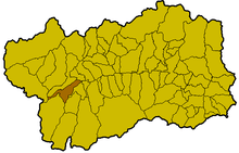
Location of the commune of Arvier within the Valle d'Aosta
Wine
The local wine, Enfer d'Arvier, had its own DOC designation before being subsumed into the Valle d'Aosta DOC. It is a blend made primarily from the Petit Rouge grape with lesser amounts of Dolcetto, Gamay, Neyret, Pinot noir, and/or Vien de Nus.[1]
People
Arvier was the birthplace of Maurice Garin, the winner of the original Tour de France in 1903. His family migrated to Northern France in 1885.
Notes and references
- ↑ T. Stevenson "The Sotheby's Wine Encyclopedia" pg 274 Dorling Kindersley 2005 ISBN 0-7566-1324-8
This article is issued from Wikipedia - version of the 9/22/2016. The text is available under the Creative Commons Attribution/Share Alike but additional terms may apply for the media files.