Artillery Park
For the ballpark in Pennsylvania, see Artillery Park (baseball).
|
Artillery Park | |
 | |
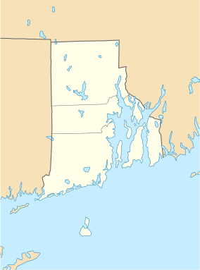  | |
| Location | Jamestown, Rhode Island |
|---|---|
| Coordinates | 41°29′47″N 71°22′29″W / 41.49639°N 71.37472°WCoordinates: 41°29′47″N 71°22′29″W / 41.49639°N 71.37472°W |
| Built | 1656 |
| NRHP Reference # | 73000054 [1] |
| Added to NRHP | March 7, 1973 |
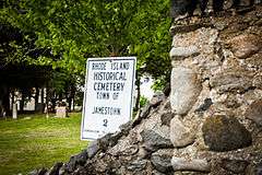
The Artillery Park (also known as the Churchyard Cemetery) is an historic cemetery at North Road and Narragansett Avenue in Jamestown, Rhode Island. It is located at a high point on the southern part of Conanicut Island. It was originally laid out in 1656 as a burying ground and militia training ground, but appears to have only been used as a burying ground since the 1740s. When British forces occupied the island in 1776, there was a brief skirmish there, and the British afterward used the area as a military staging ground.[2] The cemetery was listed on the National Register of Historic Places in 1973.[1]
-

Old section of the cemetery
-
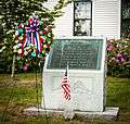
Memorial to veterans of Jamestown, RI
-
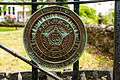
American Legion insignia on gate of cemetery
See also
References and external links
- 1 2 National Park Service (2007-01-23). "National Register Information System". National Register of Historic Places. National Park Service.
- ↑ "NRHP nomination for Artillery Park" (PDF). Rhode Island Preservation. Retrieved 2014-08-30.
| Topics | |
|---|---|
| Lists by states |
|
| Lists by insular areas | |
| Lists by associated states | |
| Other areas | |
| |
This article is issued from Wikipedia - version of the 11/26/2016. The text is available under the Creative Commons Attribution/Share Alike but additional terms may apply for the media files.