Arrondissement of Florac
| Florac | |
|---|---|
| Arrondissement of France | |
 | |
| Country | France |
| Region | Occitanie |
| Department | Lozère |
| Communes | 44 |
| Subprefecture | Florac-Trois-Rivières |
| Area¹ | |
| • Total | 1,687.5 km2 (651.5 sq mi) |
| Population (2013) | |
| • Total | 13,330 |
| • Density | 7.9/km2 (20/sq mi) |
| ¹ French Land Register data, which exclude lakes, ponds, and glaciers larger than 1 km² as well as the estuaries of rivers. | |
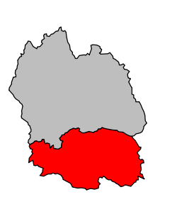
The arrondissement of Florac is an arrondissement of France in the Lozère department in the Occitanie région. Its INSEE code is 481 and its capital city is Florac-Trois-Rivières.
It is the smallest and southernmost of the two arrondissements of the department, with an area of 1,687.5 km2 (651.5 sq mi).[1] It has a population of 13,276 inhabitants and a density of 7.9 inhabitants/km².[2]
There is only a town with more than 1,000 inhabitants, and it is the subprefecture, Florac-Trois-Rivières, with 2,130 inhabitants.[2]
History
When the Lozère department was created on 17 February 1800, the arrondissement of Florac was part of that original department.[3]
Geography
The arrondissement of Florac is surrounded by the arrondissement of Mende to the north, by the Gard department to the east and south, and by the Aveyron department to the west.
Composition
Cantons
The cantons of the arrondissement of Florac are:
- La Canourgue (partly)
- Le Collet-de-Dèze
- Florac
- Saint-Étienne-du-Valdonnez (partly)
Communes
The arrondissement of Florac has 44 communes; they are (with their INSEE codes):
- Barre-des-Cévennes (48019)
- Bassurels (48020)
- Bédouès-Cocurès (48050)
- Les Bondons (48028)
- Cans-et-Cévennes (48166)
- Cassagnas (48036)
- Le Collet-de-Dèze (48051)
- Florac-Trois-Rivières (48061)
- Fraissinet-de-Fourques (48065)
- Gabriac (48067)
- Gatuzières (48069)
- Hures-la-Parade (48074)
- Ispagnac (48075)
- La Malène (48088)
- Mas-Saint-Chély (48141)
- Le Massegros (48094)
- Meyrueis (48096)
- Moissac-Vallée-Française (48097)
- Molezon (48098)
- Montbrun (48101)
- Le Pompidou (48115)
- Pont-de-Montvert-Sud-Mont-Lozère (48116)
- Quézac (48122)
- Le Recoux (48125)
- Rousses (48130)
- Le Rozier (48131)
- Saint-André-de-Lancize (48136)
- Sainte-Croix-Vallée-Française (48144)
- Sainte-Enimie (48146)
- Saint-Étienne-Vallée-Française (48148)
- Saint-Georges-de-Lévéjac (48154)
- Saint-Germain-de-Calberte (48155)
- Saint-Hilaire-de-Lavit (48158)
- Saint-Julien-des-Points (48163)
- Saint-Martin-de-Boubaux (48170)
- Saint-Martin-de-Lansuscle (48171)
- Saint-Michel-de-Dèze (48173)
- Saint-Pierre-des-Tripiers (48176)
- Saint-Privat-de-Vallongue (48178)
- Saint-Rome-de-Dolan (48180)
- Vebron (48193)
- Ventalon-en-Cévennes (48152)
- Vialas (48194)
- Les Vignes (48195)
References
- ↑ "Arrondissement de Florac (481) - Résumé statistique". Publications et statistiques pour la France ou les régions (in French). Institut national de la statistique et des études économiques - INSEE. Retrieved 19 August 2015.
- 1 2 "Populations lègales 2012 - 48-Lozère". Populations légales 2012 des départements et des collectivités d'outre-mer (in French). Institut national de la statistique et des études économiques - INSEE. Retrieved 19 August 2015.
- ↑ "Historique de la Lozère". Le SPLAF (in French). Retrieved 19 August 2015.
Coordinates: 44°19′29″N 3°35′34″E / 44.32472°N 3.59278°E