Ispagnac
| Ispagnac | ||
|---|---|---|
|
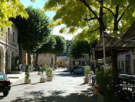
The centre of the village of Ispagnac | ||
| ||
 Ispagnac | ||
|
Location within Occitanie region  Ispagnac | ||
| Coordinates: 44°22′17″N 3°32′11″E / 44.3714°N 3.5364°ECoordinates: 44°22′17″N 3°32′11″E / 44.3714°N 3.5364°E | ||
| Country | France | |
| Region | Occitanie | |
| Department | Lozère | |
| Arrondissement | Florac | |
| Canton | Florac | |
| Intercommunality | Pays de Florac et du Haut Tarn | |
| Government | ||
| • Mayor (2008–2014) | Michel Vieilledent[1] | |
| Area1 | 53.71 km2 (20.74 sq mi) | |
| Population (1999)2 | 759 | |
| • Density | 14/km2 (37/sq mi) | |
| Time zone | CET (UTC+1) | |
| • Summer (DST) | CEST (UTC+2) | |
| INSEE/Postal code | 48075 / 48320 | |
| Elevation |
499–1,233 m (1,637–4,045 ft) (avg. 518 m or 1,699 ft) | |
|
1 French Land Register data, which excludes lakes, ponds, glaciers > 1 km² (0.386 sq mi or 247 acres) and river estuaries. 2 Population without double counting: residents of multiple communes (e.g., students and military personnel) only counted once. | ||

Ispagnac is a commune in the Lozère department in southern France.
See also
References
External links
| Wikimedia Commons has media related to Ispagnac. |
This article is issued from Wikipedia - version of the 1/3/2016. The text is available under the Creative Commons Attribution/Share Alike but additional terms may apply for the media files.