Armada, Michigan
| Armada, Michigan | |
|---|---|
| Village | |
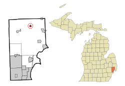 Location of Armada in Macomb County, Michigan | |
| Coordinates: 42°50′33″N 82°52′58″W / 42.84250°N 82.88278°WCoordinates: 42°50′33″N 82°52′58″W / 42.84250°N 82.88278°W | |
| Country | United States |
| State | Michigan |
| County | Macomb |
| Government | |
| • Type | Municipality [1] |
| • Village President | Devon LaHaie[1] |
| Area[2] | |
| • Total | 0.76 sq mi (1.97 km2) |
| • Land | 0.76 sq mi (1.97 km2) |
| • Water | 0 sq mi (0 km2) |
| Elevation | 748 ft (228 m) |
| Population (2010)[3] | |
| • Total | 1,730 |
| • Estimate (2012[4]) | 1,729 |
| • Density | 2,276.3/sq mi (878.9/km2) |
| Time zone | Eastern (EST) (UTC-5) |
| • Summer (DST) | EDT (UTC-4) |
| ZIP code | 48005 |
| Area code(s) | 586 |
| FIPS code | 26-03520[5] |
| GNIS feature ID | 2397987[6] |
Armada (pronounced ar-MAY-da) is a village in Macomb County in the U.S. state of Michigan. The population was 1,730 at the 2010 census. The 2008 Census Bureau Estimate places the population at 1,657. The village is located within Armada Township.
A country fair is held in the village each August.[7]
History
The first record of land purchased in the area that became Armada Township was made by John Proctor in 1825. Twenty-three more families had bought land in the area by 1832. Until 1832 the area was part of Ray Township. At that time a meeting was called to organize a separate township. The vote won by 2 and Armada Township was born. When the discussion of a name for the new township came up, legend says that "Hosea Northrup jumped up and shouted the name 'Armada'". The name was accepted. The meaning of the name is a mystery to this day. Scholars maintain the translation is lost.
The village, originally known as Burke's Corners, was founded by Elijah Burke in 1833. The village began to prosper when the old Indian trail, known today as Armada Ridge Road, was laid out as a roadway in the early 1830s. The road soon became part of the immigrant road network between Romeo and Port Huron.
Burke's Corners was briefly renamed Honeoye, for the New York hometown of several newly arrived residents. The village received its modern name of Armada when it was incorporated in the late 1860s. Armada by then had grown into a thriving village of 800 inhabitants.
The town at one time included a stagecoach stop, an opera house, a theater, seven grocery stores, three hotels, three hardware stores, a lumberyard, a grain mill, two implement dealers, a bakery, five doctors, several blacksmiths shops and a drug store.
The first school in Armada was a one-room schoolhouse at Selleck's Corners. Soon schools sprang up all around the township. These one room schools were consolidated during the 1940s and children were bused into town to attend the consolidated school district.
Armada's interest in education, literature and the arts was most evident when they persuaded Andrew Carnegie that they would support a library, if he would donate $8,000 towards the building of a permanent township library. The Armada Free Public Library was built in 1915 and is still being used to provide library service today.
A number of fraternal organizations, a literary club, a science club, and the Armada Cornet Band were among the social outlets for villagers and township residents.
A railroad, the Michigan Air-Line Railroad, connected Armada with the rest of the world. Passengers and freight were processed through the two-door depot at the foot of Church Street. A cartage company delivered the freight to uptown businesses by horse and wagon.
In recent history, the village has been shut down due to a murder investigation by State Police and the FBI.[8]
Geography
According to the United States Census Bureau, the village has a total area of 0.76 square miles (1.97 km2), all land.[2]
Demographics
| Historical population | |||
|---|---|---|---|
| Census | Pop. | %± | |
| 1870 | 494 | — | |
| 1880 | 556 | 12.6% | |
| 1890 | 638 | 14.7% | |
| 1900 | 863 | 35.3% | |
| 1910 | 748 | −13.3% | |
| 1920 | 711 | −4.9% | |
| 1930 | 840 | 18.1% | |
| 1940 | 865 | 3.0% | |
| 1950 | 961 | 11.1% | |
| 1960 | 1,111 | 15.6% | |
| 1970 | 1,352 | 21.7% | |
| 1980 | 1,392 | 3.0% | |
| 1990 | 1,548 | 11.2% | |
| 2000 | 1,573 | 1.6% | |
| 2010 | 1,730 | 10.0% | |
| Est. 2015 | 1,744 | [9] | 0.8% |
2010 census
As of the census[3] of 2010, there were 1,730 people, 607 households, and 425 families residing in the village. The population density was 2,276.3 inhabitants per square mile (878.9/km2). There were 656 housing units at an average density of 863.2 per square mile (333.3/km2). The racial makeup of the village was 98.0% White, 0.3% African American, 0.1% Native American, 0.1% Asian, 0.1% Pacific Islander, 0.4% from other races, and 0.9% from two or more races. Hispanic or Latino of any race were 2.6% of the population.
There were 607 households of which 40.2% had children under the age of 18 living with them, 55.7% were married couples living together, 10.7% had a female householder with no husband present, 3.6% had a male householder with no wife present, and 30.0% were non-families. 25.7% of all households were made up of individuals and 11.9% had someone living alone who was 65 years of age or older. The average household size was 2.73 and the average family size was 3.30.
The median age in the village was 38.6 years. 27.9% of residents were under the age of 18; 8.3% were between the ages of 18 and 24; 24% were from 25 to 44; 24.8% were from 45 to 64; and 15.1% were 65 years of age or older. The gender makeup of the village was 47.3% male and 52.7% female.
2000 census
As of the census[5] of 2000, there were 1,573 people, 540 households, and 408 families residing in the village. The population density was 2,221.8 per square mile (855.4/km²). There were 558 housing units at an average density of 788.2 per square mile (303.4/km²). The racial makeup of the village was 97.71% White, 0.19% African American, 0.57% Native American, 0.13% Asian, 0.06% Pacific Islander, 0.19% from other races, and 1.14% from two or more races. Hispanic or Latino of any race were 1.65% of the population.
There were 540 households out of which 42.2% had children under the age of 18 living with them, 63.3% were married couples living together, 8.0% had a female householder with no husband present, and 24.4% were non-families. 21.3% of all households were made up of individuals and 7.6% had someone living alone who was 65 years of age or older. The average household size was 2.81 and the average family size was 3.29.
In the village the population dispersal was 29.2% under the age of 18, 7.8% from 18 to 24, 30.8% from 25 to 44, 21.3% from 45 to 64, and 10.9% who were 65 years of age or older. The median age was 34 years. For every 100 females there were 90.0 males. For every 100 females age 18 and over, there were 90.4 males.
The median income for a household in the village was $61,700, and the median income for a family was $69,917. Males had a median income of $50,795 versus $32,330 for females. The per capita income for the village was $22,446. About 2.9% of families and 3.6% of the population were below the poverty line, including 3.8% of those under age 18 and 6.5% of those age 65 or over.
Notable people
- Dick Enberg, sports announcer; attended high school in Armada
- Martha Griffiths, 59th Lieutenant Governor of Michigan; lived and died in Armada
References
- 1 2 "Village of Armada". villageofarmada.org.
- 1 2 "US Gazetteer files 2010". United States Census Bureau. Archived from the original on 2012-01-24. Retrieved 2012-11-25.
- 1 2 "American FactFinder". United States Census Bureau. Retrieved 2012-11-25.
- ↑ "Population Estimates". United States Census Bureau. Archived from the original on 2013-06-17. Retrieved 2013-06-03.
- 1 2 "American FactFinder". United States Census Bureau. Archived from the original on 2013-09-11. Retrieved 2008-01-31.
- ↑ U.S. Geological Survey Geographic Names Information System: Armada, Michigan
- ↑ "Armada Agricultural Society in Armada, Mi". Armada Agricultural Society.
- ↑ Police, FBI stop people leaving, entering Armada | Detroit Free Press | freep.com
- ↑ "Annual Estimates of the Resident Population for Incorporated Places: April 1, 2010 to July 1, 2015". Retrieved July 2, 2016.
- ↑ "Census of Population and Housing". Census.gov. Archived from the original on May 11, 2015. Retrieved June 4, 2015.
External links
- Village of Armada Official Site
- Armada Fair website
- Armada Downtown Development Authority (DDA)
- NEMC-TV6: Armada Area Public-access television cable TV website
Municipalities and communities of Macomb County, Michigan, United States | ||
|---|---|---|
| Cities | 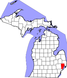 | |
| Villages | ||
| Charter townships | ||
| General law townships | ||
| Unincorporated community |
| |
| Footnotes | ‡This populated place also has portions in an adjacent county or counties | |