Arista, West Virginia
| Arista, West Virginia | |
|---|---|
| Unincorporated community | |
 Arista, West Virginia  Arista, West Virginia Location within the state of West Virginia | |
| Coordinates: 37°28′21″N 81°15′38″W / 37.47250°N 81.26056°WCoordinates: 37°28′21″N 81°15′38″W / 37.47250°N 81.26056°W | |
| Country | United States |
| State | West Virginia |
| County | Mercer |
| Elevation | 2,480 ft (760 m) |
| Time zone | Eastern (EST) (UTC-5) |
| • Summer (DST) | EDT (UTC-4) |
| Area code(s) | 304 & 681 |
| GNIS feature ID | 1553743[1] |
Arista is an unincorporated community and coal town in Mercer County, West Virginia, United States. Arista is located on West Virginia Route 10 4 miles (6.4 km) north of Matoaka.
Arista was named for a mining official's wife.[2]
References
- ↑ U.S. Geological Survey Geographic Names Information System: Arista, West Virginia
- ↑ Kenny, Hamill (1945). West Virginia Place Names: Their Origin and Meaning, Including the Nomenclature of the Streams and Mountains. Piedmont, WV: The Place Name Press. p. 84.
Municipalities and communities of Mercer County, West Virginia, United States | ||
|---|---|---|
| Cities | 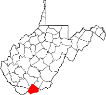 | |
| Towns | ||
| CDPs | ||
| Other communities |
| |
| Ghost town | ||
| Footnotes | ‡This populated place also has portions in an adjacent county or counties | |
This article is issued from Wikipedia - version of the 7/28/2016. The text is available under the Creative Commons Attribution/Share Alike but additional terms may apply for the media files.