Anton Chico, New Mexico
| Anton Chico, New Mexico | |
|---|---|
| Census-designated place | |
 Anton Chico, New Mexico | |
| Coordinates: 35°12′00″N 105°08′32″W / 35.20000°N 105.14222°WCoordinates: 35°12′00″N 105°08′32″W / 35.20000°N 105.14222°W | |
| Country | United States |
| State | New Mexico |
| County | Guadalupe |
| Area[1] | |
| • Total | 1.784 sq mi (4.62 km2) |
| • Land | 1.784 sq mi (4.62 km2) |
| • Water | 0 sq mi (0 km2) |
| Elevation | 5,253 ft (1,601 m) |
| Population (2010)[2] | |
| • Total | 188 |
| • Density | 110/sq mi (41/km2) |
| Time zone | Mountain (MST) (UTC-7) |
| • Summer (DST) | MDT (UTC-6) |
| ZIP code | 87711 |
| Area code(s) | 575 |
| GNIS feature ID | 903205[3] |
Anton Chico is a census-designated place in Guadalupe County, New Mexico, United States. Its population was 188 as of the 2010 census.[2] Anton Chico has a post office with ZIP code 87711.[4][5] New Mexico State Road 386 passes through the community.
Geography
Anton Chico is located at 35°11′42″N 105°08′38″W / 35.194866°N 105.143895°W. According to the U.S. Census Bureau, the community has an area of 1.784 square miles (4.62 km2), all of it land.[1]
References
- 1 2 "2010 Census Gazetteer Files: Places: New Mexico". U.S. Census Bureau. Retrieved July 11, 2014.
- 1 2 "American FactFinder". United States Census Bureau. Archived from the original on 2013-09-11. Retrieved 2011-05-14.
- ↑ "Anton Chico". Geographic Names Information System. United States Geological Survey.
- ↑ "Postmaster Finder - Post Offices by ZIP Code". United States Postal Service. Retrieved July 11, 2014.
- ↑ United States Postal Service (2012). "USPS - Look Up a ZIP Code". Retrieved 2012-02-15.
External links
A Brief History of the Anton Chico Land Grant by Severiano R. Sisneros Jr., Secretary/Treasurer @New Mexico Legislature
Municipalities and communities of Guadalupe County, New Mexico, United States | ||
|---|---|---|
| City | 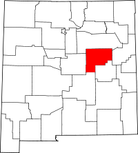 | |
| Town | ||
| CDPs |
| |
| Unincorporated community | ||
This article is issued from Wikipedia - version of the 10/15/2016. The text is available under the Creative Commons Attribution/Share Alike but additional terms may apply for the media files.