Wichian Buri District
| Wichian Buri วิเชียรบุรี | |
|---|---|
| Amphoe | |
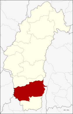 Amphoe location in Phetchabun Province | |
| Coordinates: 15°39′26″N 101°6′24″E / 15.65722°N 101.10667°ECoordinates: 15°39′26″N 101°6′24″E / 15.65722°N 101.10667°E | |
| Country |
|
| Province | Phetchabun |
| Seat | Tha Rong |
| Area | |
| • Total | 1,632.0 km2 (630.1 sq mi) |
| Population (2015) | |
| • Total | 132,490 |
| • Density | 79.2/km2 (205/sq mi) |
| Time zone | THA (UTC+7) |
| Postal code | 67130 |
| Geocode | 6705 |
Wichian Buri (Thai: วิเชียรบุรี) is a district (Amphoe) in southern part of Phetchabun Province, northern Thailand.
History
In the past the area of Wichian Buri was administrated by the Mueang Tha Rong. King Rama III upgraded status of Tha Rong city by gathering Bua Chum and Chai Badan and changed the city name to be Wichian Buri. When King Rama V created Monthon Phetchabun, Wichian Buri became a subordinate of Phetchabun in 1898. The name of the district was changed to be Tha Rong by the law on April 17, 1939,[1] but changed back to Wichian Buri in 1944.
Geography
Neighboring districts are (from the north clockwise) Bueng Sam Phan of Phetchabun Province, Phakdi Chumphon and Thep Sathit of Chaiyaphum Province, Si Thep of Phetchabun again, and Phaisali of Nakhon Sawan Province.
Climate
| Climate data for Wichian Buri (1981–2010) | |||||||||||||
|---|---|---|---|---|---|---|---|---|---|---|---|---|---|
| Month | Jan | Feb | Mar | Apr | May | Jun | Jul | Aug | Sep | Oct | Nov | Dec | Year |
| Record high °C (°F) | 37.5 (99.5) |
39.2 (102.6) |
41.0 (105.8) |
42.1 (107.8) |
41.5 (106.7) |
39.0 (102.2) |
38.2 (100.8) |
38.0 (100.4) |
39.1 (102.4) |
36.5 (97.7) |
37.4 (99.3) |
36.4 (97.5) |
42.1 (107.8) |
| Average high °C (°F) | 32.5 (90.5) |
34.8 (94.6) |
36.6 (97.9) |
37.2 (99) |
35.3 (95.5) |
34.3 (93.7) |
33.5 (92.3) |
32.9 (91.2) |
32.5 (90.5) |
32.5 (90.5) |
32.2 (90) |
31.4 (88.5) |
33.8 (92.8) |
| Daily mean °C (°F) | 25.3 (77.5) |
27.5 (81.5) |
29.5 (85.1) |
30.4 (86.7) |
29.4 (84.9) |
29.1 (84.4) |
28.6 (83.5) |
28.1 (82.6) |
27.9 (82.2) |
27.7 (81.9) |
26.3 (79.3) |
24.8 (76.6) |
27.9 (82.2) |
| Average low °C (°F) | 18.1 (64.6) |
20.9 (69.6) |
23.2 (73.8) |
24.9 (76.8) |
25.1 (77.2) |
24.9 (76.8) |
24.6 (76.3) |
24.5 (76.1) |
24.4 (75.9) |
23.7 (74.7) |
21.0 (69.8) |
17.9 (64.2) |
22.8 (73) |
| Record low °C (°F) | 9.7 (49.5) |
11.8 (53.2) |
11.2 (52.2) |
20.0 (68) |
20.0 (68) |
21.6 (70.9) |
20.5 (68.9) |
21.7 (71.1) |
21.5 (70.7) |
15.2 (59.4) |
9.6 (49.3) |
7.2 (45) |
7.2 (45) |
| Average rainfall mm (inches) | 7.7 (0.303) |
12.6 (0.496) |
50.6 (1.992) |
89.9 (3.539) |
158.1 (6.224) |
144.3 (5.681) |
145.9 (5.744) |
209.2 (8.236) |
246.1 (9.689) |
131.6 (5.181) |
20.3 (0.799) |
4.3 (0.169) |
1,220.6 (48.055) |
| Average rainy days | 1.0 | 1.3 | 3.8 | 7.4 | 14.4 | 13.8 | 14.9 | 17.6 | 17.9 | 11.1 | 2.6 | 0.7 | 106.5 |
| Average relative humidity (%) | 64 | 61 | 62 | 66 | 74 | 76 | 77 | 80 | 82 | 78 | 70 | 65 | 71 |
| Mean monthly sunshine hours | 260.4 | 245.8 | 238.7 | 204.0 | 158.1 | 117.0 | 120.9 | 58.9 | 108.0 | 179.8 | 219.0 | 260.4 | 2,171 |
| Mean daily sunshine hours | 8.4 | 8.7 | 7.7 | 6.8 | 5.1 | 3.9 | 3.9 | 1.9 | 3.6 | 5.8 | 7.3 | 8.4 | 6.0 |
| Source #1: Thai Meteorological Department[2] | |||||||||||||
| Source #2: Office of Water Management and Hydrology, Royal Irrigation Department (sun and humidity)[3] | |||||||||||||
Administration
Central administration
The district Wichian Buri is subdivided into 14 subdistricts (Tambon), which are further subdivided into 192 administrative villages (Muban).
| No. | Name | Thai | Villages | Pop.[4] |
|---|---|---|---|---|
| 1. | Tha Rong | ท่าโรง | 18 | 26,106 |
| 2. | Sa Pradu | สระประดู่ | 12 | 6,614 |
| 3. | Sam Yaek | สามแยก | 10 | 5,399 |
| 4. | Khok Prong | โคกปรง | 17 | 9,956 |
| 5. | Nam Ron | น้ำร้อน | 12 | 8,559 |
| 6. | Bo Rang | บ่อรัง | 22 | 15,282 |
| 7. | Phu Toei | พุเตย | 14 | 12,189 |
| 8. | Phu Kham | พุขาม | 10 | 8,386 |
| 9. | Phu Nam Yot | ภูน้ำหยด | 16 | 7,355 |
| 10. | Sap Sombun | ซับสมบูรณ์ | 10 | 5,021 |
| 11. | Bueng Krachap | บึงกระจับ | 10 | 6,411 |
| 12. | Wang Yai | วังใหญ่ | 10 | 5,586 |
| 13. | Yang Sao | ยางสาว | 17 | 9,338 |
| 14. | Sap Noi | ซับน้อย | 14 | 6,288 |
Local administration
There is one town (Thesaban Mueang) in the district:
- Wichian Buri (Thai: เทศบาลเมืองวิเชียรบุรี) consisting of parts of the subdistricts Tha Rong, Sa Pradu.
There is one subdistrict municipality (Thesaban Tambon) in the district:
- Phu Toei (Thai: เทศบาลตำบลพุเตย) consisting of parts of the subdistrict Phu Toei.
There are 14 subdistrict administrative organizations (SAO) in the district:
- Tha Rong (Thai: องค์การบริหารส่วนตำบลท่าโรง) consisting of parts of the subdistrict Tha Rong.
- Sa Pradu (Thai: องค์การบริหารส่วนตำบลสระประดู่) consisting of parts of the subdistrict Sa Pradu.
- Sam Yaek (Thai: องค์การบริหารส่วนตำบลสามแยก) consisting of the complete subdistrict Sam Yaek.
- Khok Prong (Thai: องค์การบริหารส่วนตำบลโคกปรง) consisting of the complete subdistrict Khok Prong.
- Nam Ron (Thai: องค์การบริหารส่วนตำบลน้ำร้อน) consisting of the complete subdistrict Nam Ron.
- Bo Rang (Thai: องค์การบริหารส่วนตำบลบ่อรัง) consisting of the complete subdistrict Bo Rang.
- Phu Toei (Thai: องค์การบริหารส่วนตำบลพุเตย) consisting of parts of the subdistrict Phu Toei.
- Phu Kham (Thai: องค์การบริหารส่วนตำบลพุขาม) consisting of the complete subdistrict Phu Kham.
- Phu Nam Yot (Thai: องค์การบริหารส่วนตำบลภูน้ำหยด) consisting of the complete subdistrict Phu Nam Yot.
- Sap Sombun (Thai: องค์การบริหารส่วนตำบลซับสมบูรณ์) consisting of the complete subdistrict Sap Sombun.
- Bueng Krachap (Thai: องค์การบริหารส่วนตำบลบึงกระจับ) consisting of the complete subdistrict Bueng Krachap.
- Wang Yai (Thai: องค์การบริหารส่วนตำบลวังใหญ่) consisting of the complete subdistrict Wang Yai.
- Yang Sao (Thai: องค์การบริหารส่วนตำบลยางสาว) consisting of the complete subdistrict Yang Sao.
- Sap Noi (Thai: องค์การบริหารส่วนตำบลซับน้อย) consisting of the complete subdistrict Sap Noi.
References
- ↑ พระราชกฤษฎีกาเปลี่ยนนามอำเภอ กิ่งอำเภอ และตำบลบางแห่ง พุทธศักราช ๒๔๘๒ (PDF). Royal Gazette (in Thai). 56 (0 ก): 354–364. April 17, 1939.
- ↑ "Climatological Data for the Period 1981–2010". Thai Meteorological Department. p. 7–8. Retrieved 1 August 2016.
- ↑ "ปริมาณการใช้น้ำของพืชอ้างอิงโดยวิธีของ Penman Monteith (Reference Crop Evapotranspiration by Penman Monteith)" (PDF) (in Thai). Office of Water Management and Hydrology, Royal Irrigation Department. p. 35. Retrieved 1 August 2016.
- ↑ "Population statistics 2015" (in Thai). Department of Provincial Administration. Retrieved 2016-03-25.