Lom Kao District
| Lom Kao หล่มเก่า | |
|---|---|
| Amphoe | |
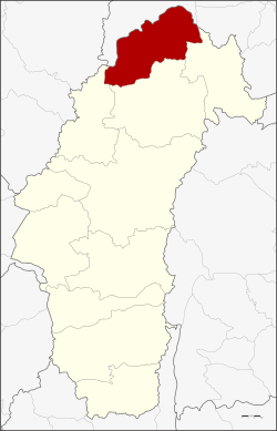 Amphoe location in Phetchabun Province | |
| Coordinates: 16°53′8″N 101°13′46″E / 16.88556°N 101.22944°ECoordinates: 16°53′8″N 101°13′46″E / 16.88556°N 101.22944°E | |
| Country | Thailand |
| Province | Phetchabun |
| Area | |
| • Total | 927.1 km2 (358.0 sq mi) |
| Population (2015) | |
| • Total | 67,101 |
| • Density | 65.0/km2 (168/sq mi) |
| Time zone | ICT |
| Postal code | 67120 |
| Geocode | 6704 |
Lom Kao (Thai: หล่มเก่า) is the northernmost district (amphoe) of Phetchabun Province, northern Thailand.
History
The first record of Mueang Lom is found in Ram Khamhaeng the Great's stone pillar. In the Rattanakosin era, the area was populated by a large community of Lao people from Vientiane. The population grew due to further immigration from Luang Phrabang and Vientiane, so the governor led some people to establish a new town near the Pa Sak River, now in the Lom Sak District.
Geography
Neighboring districts are (from the north clockwise) Dan Sai and Phu Ruea of Loei Province and Nam Nao, Lom Sak, and Khao Kho of Phetchabun Province.
Administration
Central administration
The Lom Kao District is divided into nine sub-districts (tambon), which are further subdivided into 99 administrative villages (muban).
| No. | Name | Thai | Villages | Pop.[1] |
|---|---|---|---|---|
| 1. | Lom Kao | หล่มเก่า | 13 | 11,959 |
| 2. | Na Sam | นาซำ | 10 | 7,345 |
| 3. | Hin Hao | หินฮาว | 13 | 7,506 |
| 4. | Ban Noen | บ้านเนิน | 8 | 5,254 |
| 5. | Sila | ศิลา | 16 | 10,066 |
| 6. | Na Saeng | นาแซง | 7 | 3,921 |
| 7. | Wang Ban | วังบาล | 17 | 11,649 |
| 8. | Na Ko | นาเกาะ | 6 | 2,642 |
| 9. | Tat Kloi | ตาดกลอย | 9 | 6,759 |
Local administration
There is one sub-district municipality (thesaban tambon) in the district:
- Lom Kao (Thai: เทศบาลตำบลหล่มเก่า) consisting of parts of the sub-district Lom Kao.
There are nine sub-district administrative organizations (SAO) in the district:
- Lom Kao (Thai: องค์การบริหารส่วนตำบลหล่มเก่า) consisting of parts of the sub-district, Lom Kao.
- Na Sam (Thai: องค์การบริหารส่วนตำบลนาซำ) consisting of the entire sub-district, Na Sam.
- Hin Hao (Thai: องค์การบริหารส่วนตำบลหินฮาว) consisting of the entire sub-district, Hin Hao.
- Ban Noen (Thai: องค์การบริหารส่วนตำบลบ้านเนิน) consisting of the entire sub-district, Ban Noen.
- Sila (Thai: องค์การบริหารส่วนตำบลศิลา) consisting of the entire sub-district, Sila.
- Na Saeng (Thai: องค์การบริหารส่วนตำบลนาแซง) consisting of the entire sub-district, Na Saeng.
- Wang Ban (Thai: องค์การบริหารส่วนตำบลวังบาล) consisting of the entire sub-district, Wang Ban.
- Na Ko (Thai: องค์การบริหารส่วนตำบลนาเกาะ) consisting of the entire sub-district, Na Ko.
- Tat Kloi (Thai: องค์การบริหารส่วนตำบลตาดกลอย) consisting of the entire sub-district, Tat Kloi.
References
- ↑ "Population statistics 2015" (in Thai). Department of Provincial Administration. Retrieved 2016-03-25.
External links
- amphoe.com (Thai)